
-
 10054 Hits
-
 79.04% Score
-
 11 Votes
|
|
Mountain/Rock |
|---|---|
|
|
42.93500°N / 110.78656°W |
|
|
Lincoln |
|
|
Hiking |
|
|
Summer |
|
|
10141 ft / 3091 m |
|
|
Overview
 Greys River Road view of Virginia Peak
 Virginia Peak from Visser Peak
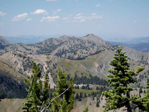 Virginia Peak from Cabin Creek Peak
No trailheads are close to it from the Grey's side, making it a long hike from that direction. I only recently thought to go from the western side from the Strawberry Creek side as a means of access.
The name Virginia has been on the old maps for a long time. Nobody knows who it was named after, but the name was given a long time before. It was probably first ascended many years before, but it receives very little traffic today. It is photographed a lot, being visible for many miles on the Grey's road. The valleys and cirques around the peak are very wild and pristine looking. To the east of the peak, are many signs of sheep usage, and lots of ATV trails. The western side of the peak is connected to the ridges above Strawberry Creek, and some lovely terrain.
Getting There
 Greys River Road view at dusk of Virginia Peak
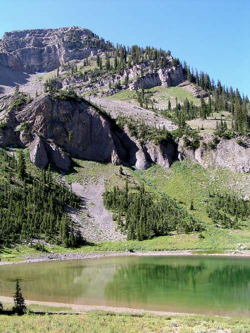 Lovely Strawberry Lake
First you must get to the Strawberry Creek trailhead. South of Thayne, Wyoming is the turnoff for Bedford and Strawberry Creek. Follow the road for a few miles past houses and the small settlement of Bedford. You reach the end of the pavement when you pass the residence of the caretaker of the hydroelectric station. You will see a large pipe containing a lot of the creeks flow being used for power, on your right as you ascend the canyon. Past the house the road starts to narrow and get a little rocky. Follow the road a couple of miles past many nice campsites and views of the creek. You go up one steep loose section that might be difficult for some low clearance cars. Soon you traverse a rocky hillside and you see the dam and small reservoir on your right. Shortly past the reservoir the road ends at a small parking area.
Take the obvious trail up the canyon on the left side of the lovely spring fed creek. A little less then a mile up canyon, you cross the small creek coming in from the north fork. A short ways past you see a trail going left, near a white diamond on a tree. Take this trail up the north fork, a very beautiful hike with amazing views of Haystack above you. After a couple of miles and some steep sections you curve around to your right and you finally reach the lovely little lake. The lake has no official name, but Strawberry Lake seems fitting. From here I will describe the way on the route page.
Red Tape
 wild rock formations above Strawberry Lake
Camping
 The southwest sub-summit of Virginia Peak