
-
 3369 Hits
-
 82.48% Score
-
 15 Votes
|
|
Mountain/Rock |
|---|---|
|
|
37.30220°N / 118.52331°W |
|
|
Inyo |
|
|
Trad Climbing, Sport Climbing |
|
|
Spring, Summer, Fall |
|
|
6800 ft / 2073 m |
|
|
Overview

Lambada Dome is a rock formation in The Little Egypt area of the Eastern Sierras.

After crossing Bishop Creek and hiking up the initial steep hill, the approach becomes much more pleasant and interesting. Since your destination is Lambada Dome, you continue past the left side of Frontier. Soon after reaching the top of an obvious ridge, the whole back country open up before you. There are mini domes and rocks in all directions to wet any one’s appetite.
Lambada Dome is west facing and in the shade for a good part of the day. That, combined with the fact that it’s at an elevation of over 6800 feet, makes it an ideal formation for climbing during warmer seasons. The approach to the base is made via a short hill on the right. The base is sandy and for the most part flat or on a gentle slope. There are large trees to provide shade from the sun and great for taking lunch break. The area, however, lacks running creeks. Carry plenty of water during the warm seasons. Don’t be surprised to see bald eagles in this area. If you run into birds of prey nests, try to avoid them the best you can. We want these beautiful birds to continue making Little Egypt their home.
 |
 |
 |
 |
|---|
Routes of Lambada Dome
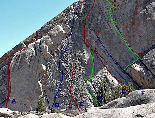

According to the guide book, however, there are three more routes on a smaller rock in the far right hand side of Lambada Dome. Unfortunately, I missed those three climbs and cannot show any photos, or make a comment on them. If you make your way to the back side of Lambada Dome, you can see a beautiful straight up crack high up on the upper part of the east face. I wonder if this crack has ever been climbed, or if it has the same grainy quality that repels most climbers. If you have any information on that crack, please feel free to attach the details to this page.
Lambada Dome | |
| A | Route In Exile, 5.8, 3 pitches, standard rack |
| B | Slab Hymen, 10b, bolts and standard rack |
| C | Do Not Take the German People Lightly, 11b, bolts |
| D | Forbidden Dance, 11d, bolts |
| E | Wall of Separation, 5.9, two pitches, bolts |
| F | Busy Child, 10c, standard rack |
| G | Little Fluffy Clouds, 10c, three pitches, bolts and standard rack |
Camping
 White Mountains seen across Owens Valley
There are many campgrounds along Bishop Creek. There are also many places in The Buttermilks are that are close to a creek that are suitable for camping. Please do not camp in The Buttermilks bouldering area. That area is very crowded and is suffering from the impact unregulated camping has caused.
The following links should help finding a good campsite
Horton Creek Campground
Rock Creek Canyon
Inyo National Forest
Bishop Creek and vicinity camping
Getting there
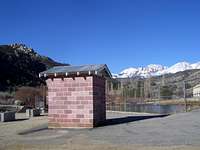
 Bridge over Bishop Creek