On this summer day Altyn Peak was different, standing out from the rugged norm in a manner quite memorable. Perhaps it was the GNP weather, a special served up warm and sunny, or maybe the green so bright it hurt your eyes did the trick. Or the flowers, forest, and meadows (and soaking one's feet in Natahki Lake certainly didn't hurt!), or possibly the fact that following all the days of summer's steepness and length, Altyn just seemed to be reaching out—an encompassing welcome of the best kind. So here is a page of pleasant and gentle memory. Of course there is drama, that in the nearness of Mount Henkel, and (of course) there are the forever-in-GNP summit views, thrilling even through too much smoke. But mostly it was a relaxing mountain day engendering fond warmth of memory, the sort of thing holding up well through those long dark months looming (all too frequently) on the horizon, when Glacier is more imagined than experienced.
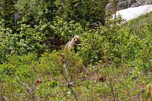
Royalty, surveying his domain....
[Take the time to fill the screen with this!]
It was not quite a walk in the park, but on this day there were similarities to such...and they were present in abundance.
[Images will enlarge if clicked.]
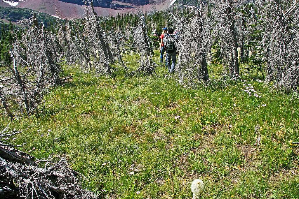
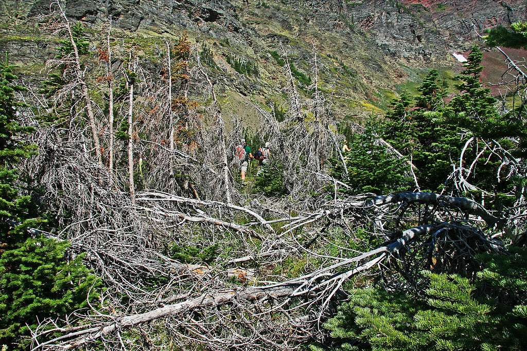
As we move through, the Dead Forest seems quite alive....
TO CLIMB AN EMBRACING MOUNTAIN
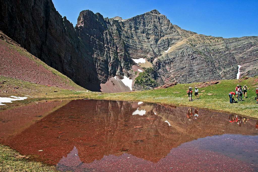
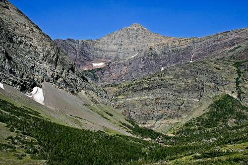
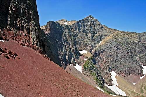
Well on the way: Mount Henkel reflected in tarn (Altyn is almost directly at my back).
Trailhead
There is a quite unusual characteristic to Altyn Peak, which if so chosen (and it is an option—more below*) makes this climb something along the lines of distant cousin to "a stroll in the park," an outing on which to relax, smell the flowers...a climb, unusual, I think, not just in this part of the mountaineering world, but everywhere. A climb to savor. This mountain is by no means a difficult undertaking, in all probability being one of Glacier's easier offerings, and can be done by the mountain goat contingent in something along the lines of four hours, or it can be pleasurably drawn out to a quite lackadaisical, enjoyable seven or eight.
Climbing into the first basin
It is a friendly thing, and within its slightly more than 3,000' of relatively steady and moderate elevation gain rising along a bit more than
Not far before leaving the trail
4 miles from trailhead to summit, encompasses the likes of Apikuni Falls, meadows, forest, flowers, and easily surmounted cliffs (really!—in all honesty, nothing to fret over). Then, topping it all off is Natahki lake, which, with its grass-lined shore comes across as neither more nor less than an alpine park by which to lounge, have a picnic, soak your feet, and gaze at both the summit—now not much more than an hour away—and the impressive, not often seen east face of Mount Henkel (most definitely substantially closer and more intimidating and interesting than Altyn's gentle high point). Yes, this is a mountain which can be done quickly, but...if blazing through the wild is your thing, there are better choices easily located; the climbing of Altyn Peak is through a place tailor-made to enjoy the easy, gentler side of the mountain world.
Parking Area
The route starts southeast of the peak, wrapping around as it climbs, enough so that ascending the ridge for the final push to the summit actually comes from the north, with the last 600 feet elevation gain up the ridge being almost directly from the west. The trailhead is well marked, although—since it is typical of GNP that nothing but goat and game trails (if that) guide the way up these mountains—not with the
To Apikuni Falls
words "Altyn Peak." Steering you in the right direction is a sign about 2 miles from the Swiftcurrent Campground and village area, readily seen on the road's north side, with the designation "Poia Lake." There is a small parking area, and signs directing the way not only to the aforementioned Poia Lake, but also to other destinations. One of these signs is badly worn [at least it was this way when we were there, July, 2009], but has barely-readable wording (see picture) showing the way to Apikuni Falls. With the jaunt to those nice falls you are on your way.
(*Not to worry: the "...quite unusual characteristic..." defining this outing awaits. But the summit comes first.)
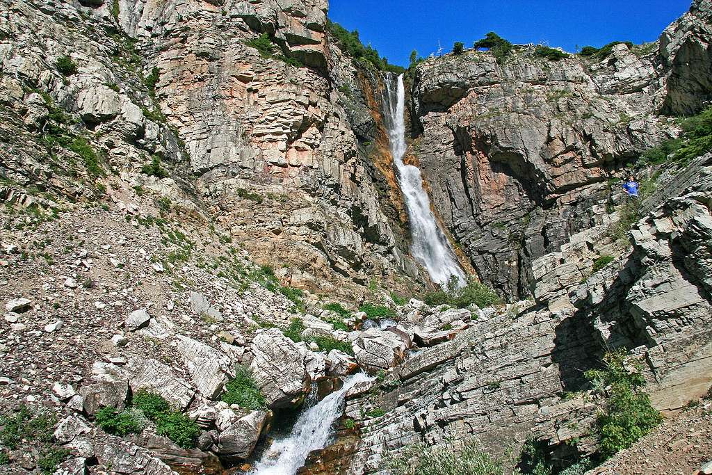
Apikuni Falls
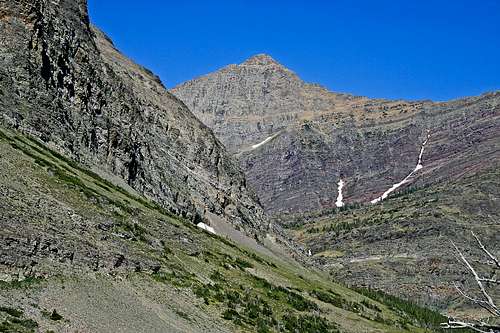
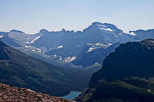
Altyn Peak, from Apikuni Mountain
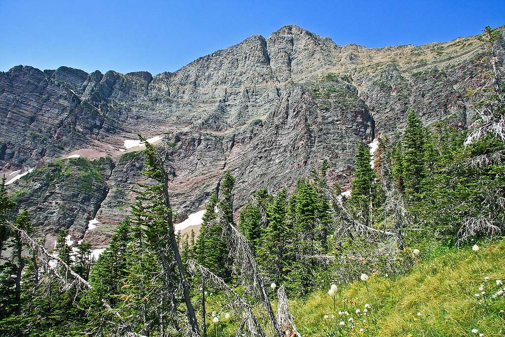
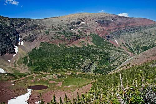
Distance to the falls is a short mile; it is perhaps a hundred yards off the main trail, and easily worth the short side jaunt. These mountains are filled with assorted waterfalls of varying sizes and shapes; the Apikuni Falls are merely one among many, providing easy visual substantiation of a land, which, if no longer being actively carved by glaciers, still remains a fluid, always-changing landscape, and this particular cause, when pouring down the slopes, is a nice thing to see. So enjoy this small bit of creation-on-the-move, then return to the nearby trail and continue perhaps another half mile until entering a basin of flowery meadow (although note that our outing was the end of July; flowers will vary with the calendar, as well as year to year) and patches of forest, with as an interesting contrast, some of that forest being dead, and bleached a stark grayish white. On the basin's north and east, Apikuni Mountain's large rounded shoulders dominate; to the west the sheer wall of Mount Henkel is becoming more and more a dominant factor, making one wish for an actual summit sighting, and now, as though seeking to get the jump on its higher (and admittedly more impressive) neighbor, beginning to at least partially show itself is Altyn Peak proper—the lure of its summit finally no longer hidden from view.
Working our way through the forest
And now...for visually dramatic purposes, a brief digression...
HENKEL INTERLUDE
A VISIT WITH ALTYN'S CLOSEST NEIGHBOR
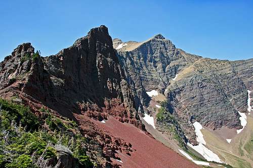
There is nothing difficult or dramatic in the climbing of Altyn Peak (well, on a nice day, anyway—which just coincidentally was presented to us in abundance), and the summit itself is mostly a geologically unimpressive rounded dome. And yet, memories belie there was nothing to this day outside a gentle mountain climbing experience, topped off (naturally) with stunning vistas from the summit. There was indeed drama. Visual drama, the likes from which it is difficult to veer, the kind supplied in abundance by a growing nearness of something along the lines of 2000 feet of near-vertical carved upthrust. Visual stimulation supplied by the east face of joined-at-the-hip neighbor Mount Henkel. This day's outing was one of the summer's more memorable, and I'd recommend Altyn Peak to anyone.
Still...I came away with more photos of Henkel than Altyn:
Henkel's east face impresses as we cross the first basin
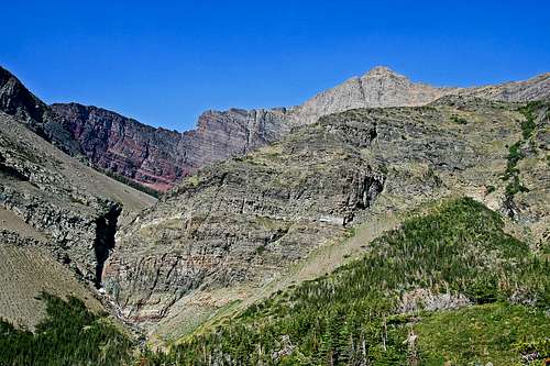
Climbing between basins brings a growing awareness of grandeur
Two similar views of Henkel from the saddle below Altyn's summit
(Okay, enough of Henkel-drama. Back to the Altyn Peak narrative....)
THE CLIMB CONTINUES....
Overview of lake and saddle
The route does not yet head directly to the mountain, but at this point makes a left turn off the trail to head west across the basin, all the while moving towards
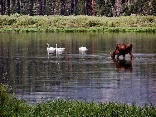
Very nice on a warm day!
low-lying cliffs which are now directly ahead. After leaving the trail, both route and climb become relatively and easily intuitive; the cliffs must be surmounted—not difficult—after which the natural lay of the land leads the way up a grassy ridge. At the top of this ridge, angle for the saddle west of Altyn's summit—by now quite obvious—descending through a mix of forest and meadow (this is a nice area!) into a small basin, and head directly to Natahki Lake, which is a great place to stop and, in general, just relax.
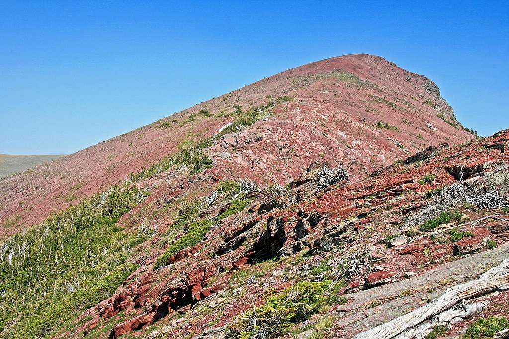
Altyn Peak is now perhaps only a bit more than an hour away as it dominates the view south of the lake, with the easy climb to the saddle quite obvious, and the equally easy, and visible, final 600 feet up the summit ridge providing, if any be needed, the impetus to successfully end
Route goes this way
the climb. Reaching the saddle will involve crossing a couple snow fields, but they are not steep enough to require any kind of gear, and at least by late July may normally be skirted if desired (but do note that conditions always vary greatly from year to year; earlier in the summer, or following a heavy winter/late spring, the character and size of these snow crossings are substantially different). From lake to saddle to summit is an easy jaunt, with
Snowfield, saddle, summit
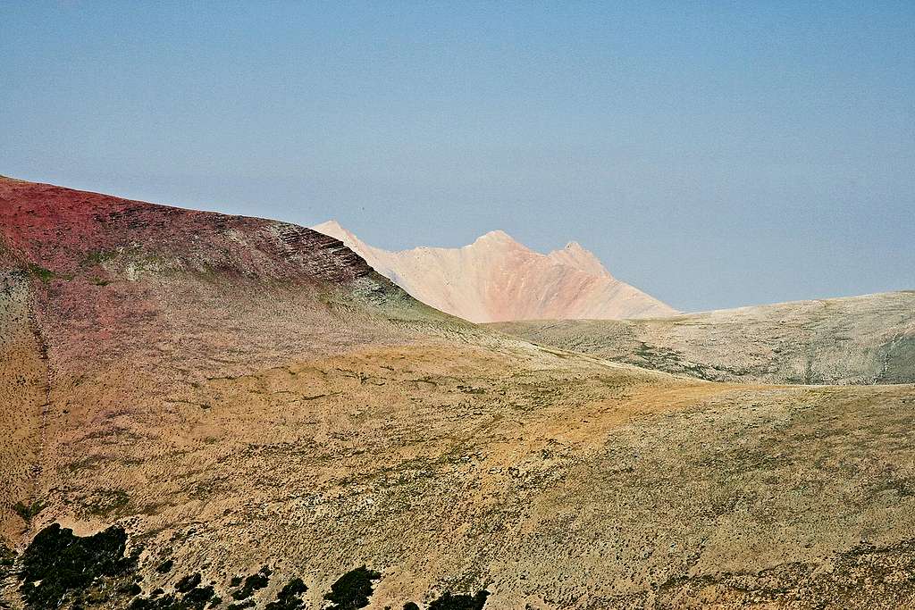
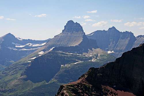
ever-expanding views; the true summit of Mount Henkel finally becomes visible to the west, as do the always thrilling Mount Wilbur, Iceberg Peak, B-7 Pillar, Swiftcurrent Mountain, and Mount Grinnell, and to give a sense of perspective, upon reaching Altyn's summit the entire Many Glacier valley lies 3000' below, with such as Mounts Wynn and Gould, and Allen Mountain across the way. To the north is the large bulk of Apikuni Mountain, with one of the more intriguing and weird GNP peaks, Yellow Mountain, making its yellowish presence known as it rises above the Apikuni ridge line. And finally, upon reaching the summit, as a quite dramatic and unanticipated counterpoint to the ridge crest running north of Henkel, the top couple hundred feet of Crowfeet Mountain's 2000'+ sheer east face unexpectedly pops into view. A climb to savor, indeed!
First hint of things west, from the saddle
But of course, part of any climb is the descent, and this is where Altyn Peak takes a nice climb and makes it special. Rather than turning around and retracing the way back to the by now mentally distant Poia Lake sign, this mountain offers the opportunity of an absolutely wonderful scree descent into the Many Glacier Valley, which is 2500' below the saddle. It is relatively moderate in descent angle, making it just right to "ski" with your feet—and there are no usage restrictions in effect as a result of erosion. (Only one other time have I encountered its like, and that on a climb about twenty years ago of Colorado's Handies Peak—an equally wonderful descent which, if memory serves correctly, has been closed in the intervening years due to excessive foot traffic and erosion.) Getting off this peak is a marvel! Simply head down from the saddle (not the summit) until running out of scree, at which
The summit awaits—only 600 more feet elevation gain to go....
point traverse right (west) a short distance (there is a trail) until coming upon more scree; continue blazing down until that scree ends. Traverse right again until...more scree. Eventually, you'll run out of scree—but by then you are most of the way down—and continue traversing west (there's not always a trail for the traversing on the lower flanks, but—really!—it is not necessary; just keep heading west), descending whenever a trail shows itself until that trail peters out, then walk west again. Soon you'll encounter the Mount Henkel trail, which is followed a short distance until encountering the Iceberg Lake trail, at which point the Swiftcurrent Store and Campground is less than a half mile away. Where if you used foresight, there is a vehicle waiting for the return trip the 2 miles to the Poia Lake trailhead. The 2500' descent took us an hour!
VIEW FROM THE UPPER REACHES
The weird, wonderful, and intriguing Yellow Mountain
Swiftcurrent Mountain, Mount Wilbur, Iceberg Peak (L); Mount Gould (R)
Swiftcurrent Valley
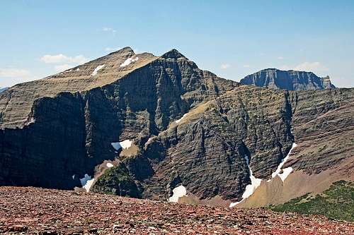
Apikuni Mountain (L); Henkel & Crowfeet (R)
Overview—Grinnell and Swiftcurrent Valleys
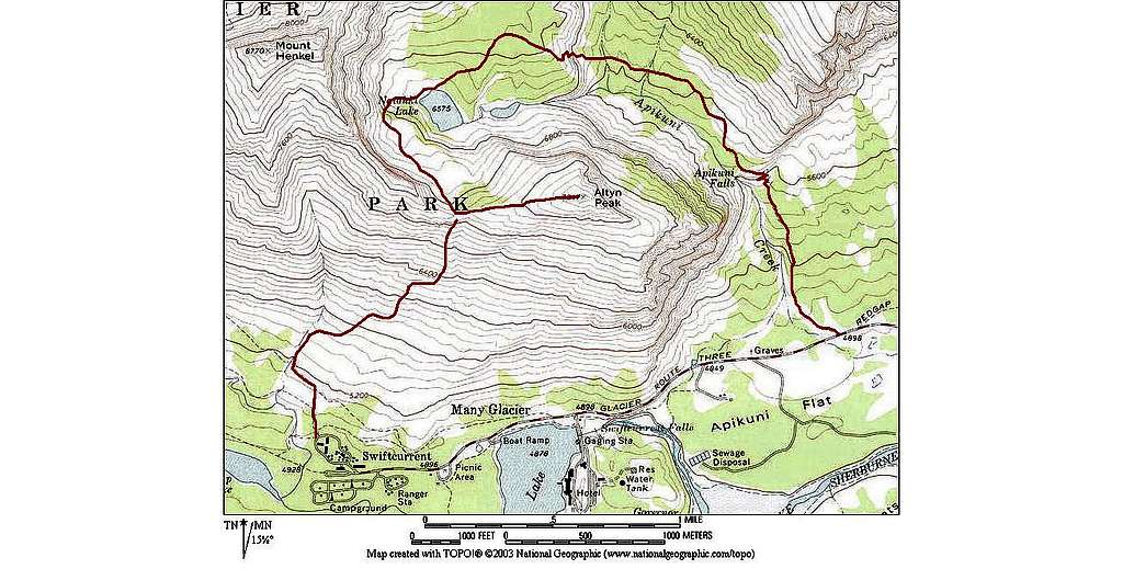
Route Map and Link
Route starts at right, on the Apikuni Falls Trail.
[Click to enlarge.]
Also note that I've attached this route by Glacierscrambler to the page. It contains good Google Earth photos of the route to Natahki Lake, which is really the far extent to which any kind of map is needed. The rest is quite visible, and easily done.
The Red Tape, Wildlife, & Cautions Section
In case you need it: A couple reminders that this GNP/Northern Rockies area has a LOT of wildlife.
No permits required, but you must pay a park entry fee, which is $25 for one week, or $35 for an annual pass. Registration for day climbs in Glacier National Park is recommended, but not mandatory. Probably anyone prone to climbing in this part of the country already knows this, but the Northern Rockies are full of wildlife. Always be aware, and don't do anything stupid, like—for example—feed the bears, think that a mountain lion is even remotely related to your pet cat, or run up to a moose (moose are quite unpredictable, irritable, and very dangerous). And never, ever, EVER forget you're in grizzly country; they insist on being left alone—disagreement on that point is not an argument you'll win! Bear spray and noise should be part of every GNP foray you make into the back country. Black bears will be found in the forests, grizzlies commonly venture onto the above-timberline tundra, sometimes, when in pursuit of such delicacies as ladybugs or cutworm moth larva, even to the summits! Also note that improperly stored food in park campgrounds (i.e., scraps left around the table or campfire, or edibles in your tent rather than your car) will subject you to a $50 fine. If you wander off, leaving your pack unattended, and there is food in it which attracts the attention of, for example, a bear, it is also a fine. Folks, the Park Service is serious about not providing human food access to the critters!
GNP Road Information
Standard Precautionary Note: All GNP roads are closed in winter, with Going-to-the-Sun Road (the major route through the park; its eastern terminus is at Saint Mary) sometimes not opening until July (average opening is second week in June; earliest opening ever is May 16, 1987, with the second earliest being May 22, 2005). Don't head out early in the year (i.e., June/early July) without checking the status of these roads—it is not unusual to have repeated, sometimes lengthy, road closures due to storms, avalanches, rock slides, or all three! The same holds true for late in the year; weather changes dramatically in Glacier, beginning usually around the end of August, with road closures normally becoming more and more frequent throughout the month of September (although don't shy away from going, there can also be very nice—albeit cool or cold—days of Indian Summer throughout this time frame; plus the park is relatively free of people after Labor Day). The following links are relatively self-explanatory, and provide all sorts of useful information:
And finally, click here for current information, as well as easy access to some interesting photos showing the Plowing of Going-to-the-Sun Road.
When to Climb, & Climbing Considerations
From late June/early July (during this time frame expect LOTS of snow in the high elevations) to early fall, depending on snow conditions. Traditional climbing season in the Northern Rockies is July, August, and September—with September weather becoming progressively colder and more unstable (sometimes dramatically so: PAY ATTENTION!) as the month progresses—but does of course vary from year to year. There are occasional winter climbs in the park, but not often, and then only by well-equipped, area-wise, extremely competent individuals. Basically, most of GNP is inaccessable through the winter, and avalanche danger, to put it mildly, is extreme almost everywhere.
CLIMBING CONSIDERATIONS
Because of the nature of the rock, there are special considerations regarding climbing in Glacier National Park, and grading systems unique to the Park have been developed by both J. Gordon Edwards and the Glacier Mountaineering Society. Anyone doing more than just "trail" hiking in this part of the Rockies should read the excellent and important information put together by Fred and Moni Spicker. Much—if not most—of the rock in GNP is sedimentary and rotten, and you need to know about it: Glacier National Park Rock & Grading Systems.
Camping
There are numerous campgrounds available within Glacier National Park, of which only Fish Creek and Saint Mary take reservations (not required, but probably a good idea during the peak summer tourist period, especially on weekends). There are also many campgrounds as well as motels just outside the park on both the west and east sides. Lodging, whether camping or indoors, should be no problem. Specifically, Altyn Peak is in the Many Glacier area, and very close to the Swiftcurrent Campground, which, it should be noted, is one of the more popular such in the park, and fills quite frequently. Cost is $20 per night. See link below for current campground information throughout the park, including fees. There is also a good restaurant and convenience store in this area, plus, of course, both the Swiftcurrent Inn and Many Glacier Hotel.
The communities of East Glacier Park, Browning, Saint Mary, and Babb, are all on the Blackfeet Indian Reservation, where there a great many additional services available.
Also, for those so inclined...GNP does have Backcountry Campsites throughout the park. Some of these sites can be reserved; others are on a first come basis. Anyone doing extensive, multi-day, remote hiking/climbing would be well advised to check this out.
Current Conditions/Web Cams
Weather page—an overview, plus current conditions and forecast
Glacier National Park Chat—a great source for friendly conversation and information concerning all things GNP related!
In Tribute
On March 1, 2011, Vernon Garner, Saintgrizzly, left us after losing a bold, inspiring fight against pancreatic cancer. Or maybe he won, for he is at last free of his pain and has "shuffle[d] off this mortal coil."
Vernon was an important contributor on SummitPost, but beyond merely making good, informative pages, he actually inspired many who read his work. No one put more work into his or her pages than Vernon did, and many of those pages, especially those related to Glacier National Park, the place he loved above all others, are works of art in both the writing and layout. More than one person has wanted to visit Glacier or go back to Glacier largely due to what he shared about that magnificent place.
Many people on SP counted Vernon among their friends, and many more saw him as one of the best, one of those who exemplified the spirit of this site. He was one of the best of us, he will be missed, and he will not be forgotten.
As a tribute to him, Vernon's pages will remain in his name. Any member who sees a need for an addition or correction should please contact site management via the "Send PM to the Elves" feature.
Children refers to the set of objects that logically fall under a given object. For example, the
Aconcagua mountain page is a child of the 'Aconcagua Group' and the 'Seven Summits.' The
Aconcagua mountain itself has many routes, photos, and trip reports as children.
Parents refers to a larger category under which an object falls. For example, theAconcagua mountain page has the 'Aconcagua Group' and the 'Seven Summits' asparents and is a parent itself to many routes, photos, and Trip Reports.

 19092 Hits
 88.19% Score
 26 Votes
 Trailhead
 Climbing into the first basin
 Not far before leaving the trail
 Parking Area
 To Apikuni Falls
 Altyn Peak, from Apikuni Mountain
 Overview of lake and saddle
 Very nice on a warm day!
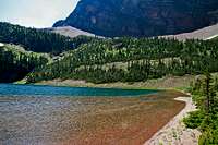 Route goes this way
 Snowfield, saddle, summit
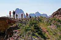 First hint of things west, from the saddle
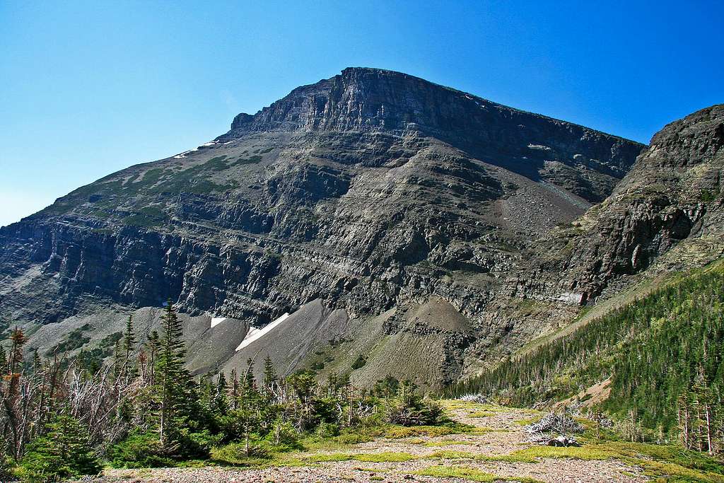


