
-
 7256 Hits
-
 84.82% Score
-
 19 Votes
|
|
Mountain/Rock |
|---|---|
|
|
44.62860°N / 108.1636°W |
|
|
Big Horn |
|
|
Hiking, Scrambling |
|
|
Spring, Summer, Fall, Winter |
|
|
5087 ft / 1551 m |
|
|
Overview
 Sheep Mountain
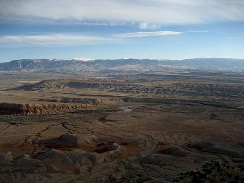
The Sheep Mountain Anticline is situated between the towns of Lovell and Greybull in the northwest part of Wyoming; its long, narrow, and perfectly straight crest is an easily recognizable sight from many areas around the Big Horn Basin. An anticline is a geologic formation where the strata slope downward on either side of a crest, and this particular mountain is one of the more famous examples of this kind of formation. Running northwest to southeast for about 15 miles, the formation is dissected in the middle by the Big Horn River, which runs through the 1,000-foot deep Sheep Mountain Canyon (also known as the Black Canyon). There are three ranked summits along the ridge, one north of the canyon (Sheep Mountain North), and two south of it (Peak 4970 & Sheep Mountain South).
Sheep Mountain North is a fun summit to reach and has outstanding views of the interesting geologic formations that cover the area surrounding the base on both sides of the peak, and the close views of the northern part of the Big Horn Range are very nice as well. On a clear day, all of the major peaks of the Absaroka Range are visible to the west in a long chain that stretches from the Montana border down towards central Wyoming. The Spence Oil Field is also visible at the east base of the anticline.
 Hills in Ribbon Canyon
Getting There and Climbing Information
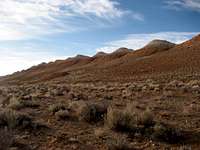 Ribbon Canyon
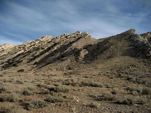
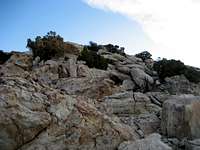 Sheep Mountain terrain
From Lovell, Wyoming, take Highway 310 south for 15 miles past the spot where it splits with 14A and turn left on a dirt road that takes you through some strip mining areas. Keep straight at the first fork at about 2.5 miles, and keep right immediately after this point, continuing to follow the main road. When I was there, I turned left 8.0 miles from the highway and followed this nice dirt road back north to a point parallel to the summit and started hiking west. However, if you stay on the main dirt road for another mile, you can turn left on Ribbon Canyon Road, which is a red dirt road that takes you directly beneath Sheep Mountain North. However, I cannot attest to the state of this road except that the section of it that I crossed to reach the peak looked a little rougher than the road that I chose.
If you end up driving on Ribbon Canyon Road, the easiest way to the top would be to hike (or drive as far as you can) up the gentle ridge that starts about 1.75 miles from the main dirt road. However, for a shorter and much more interesting hike/scramble, drive along the base of the peak until you see the two prominent V-shaped notches. Both notches follow drainages and/or ridges that will get you there, but don't take the leftmost drainage of the left notch, as it doesn't lead to the summit, at least not directly. If you hike from the other road, you will have to cross a few steep hills and descend some steep but easy terrain on the gentle hills on the west side of Ribbon Canyon.
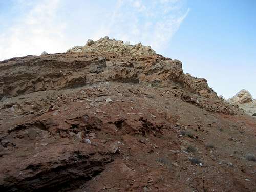
 Rock outcrop
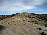 Approaching the summit
Once inside one of the notches, you will have to do some scrambling over and up about 600-800 vertical feet of mostly solid talus or some easy slabs to gain the ridge. Head north to the summit on a trail after reaching the ridge; the highest point is just a few feet south of the Spence Benchmark. The angle of the slopes down to the east and west of the anticline are similar, and the views are greatly enhanced by being on such a narrow ridge.
The total round trip for climbing Sheep Mountain North varies depending on your starting point, but expect a total of about 2-3 miles and between 800-1000 feet of elevation gain on Class 2 terrain.
 Summit view towards the Big Horns
 Summit view west
Red Tape and Camping
Visit the BLM site for all rules and regulations regarding use of public lands. There are no fees involved with hiking in this area. Be sure to pay attention to signs posted detailing the active mining sites.As with all of the badlands areas in NW Wyoming, be very aware of approaching storms, as these areas are prone to flash-flooding, and even a little rain can quickly make these roads impassable. Rattlesnakes and mountain lions are found here, to take appropriate precautions to avoid these animals and know what to do if you encounter one.
For rules about camping on BLM land, visit this page.
 Sunrise in Ribbon Canyon
External Links
Information about the Sheep Mountain area:Sheep Mountain Anticline
Geology
 Rock layers of the anticline