
|
|
Mountain/Rock |
|---|---|
|
|
35.76797°N / 52.21277°E |
|
|
Mountaineering |
|
|
Summer |
|
|
13278 ft / 4047 m |
|
|
Overview
The elevation used here is per my GPS measurements. The Iranian 1:50 000 Map gives an elevation of 4025 m for Angemar I Peak.Click to see a Map of the Dobrar Ridgeline.
Dobrar Ridgeline:
 Angemar I
Dobrar (Ghareh Dagh) Ridgeline is an impressive 52 Km long mountain chain that forms a continuous wall in the southeastern portion of the Central Alborz Mountains of northern Iran. This ridgeline gives rise to more than 20 named peaks and many other unnamed high points. The elevations of 5 of these peaks exceed 4000 m. The highest of these peaks is the 4072 m summit of the West Dobrar Peak. The ridgeline starts near the Emamzadeh Hashem Pass on Haraz (Tehran-Amol) Road and heads east to end near the village of Seh Band on Firooz Kooh (Tehran-Sari) Road.
 Dobrar Ridgeline
Angemar I Peak:
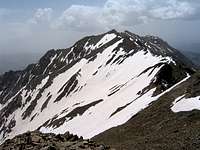
 West Face
Angemar I is a rugged peak that rises on the crest of the Dobrar Ridgeline. To the west, Angemar I is connected to the 4020 m Angemar II Peak and to the east it connects to the 4072 m West Dobrar Peak. The northern slopes of Angemar I go down to reach the village of Lasem (2550 m) at the bottom of the Lasem River Valley. Its southern slopes drop very steeply into the Tar River Valley near Tar Lake (2900 m). Just below its summit, the southern slopes of Angemar create small walls.
Angemar I can be climbed via its northern slopes starting in the village of Lasem (2550 m). Most climbers, however, reach Angemar I as a part of a multi-day traverse of the Dobrar Ridgeline.
 Angemar I in the middle, north face
Wilderness Skiing:
The northern slopes of Angemar I & II have become a popular destination for wilderness skiers. The best time to ski the area is in late March and early April. You can ski from the top of Point 4010 m (on Angemar II) down to the 2550 m village of Lasem. The best ski route follows the valley that goes between Point 4010 m and Angemar I Peak. In June of 2009 (a year with better than average spring snow cover), we found continuous ski-able snow down to an elevation of 3150 m. From the village of Lasem, skiers hike up the steep slopes of the mentioned valley to reach Point 4010 m.
Route:
This route describes a traverse of the Dobrar Ridgeline from the top of Point 4010 m (on Angemar II Peak) to the summit of Angemar I. Hiking distance is 1.25 Km (per my GPS)
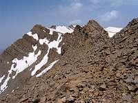
From the top of Point 4010 m, head east and follow the ridgetop down past a few small high points to reach near the 3930 m saddle between Point 4010 m & Angemar I. Before reaching the saddle, you will run into a series of gendarmes that block your progress.
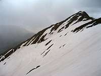
 The west face of Angemar I & the gendarmes
Descend a short distance on the south side of the ridgetop and find your way east over the very steep scree covered slopes.
 |  |  |
 |  | 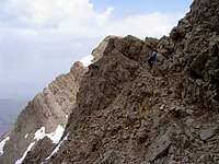 |
You will then reach the base of the Angemar I Peak.

Looking back (west) at Point 4010 m (of Angemar II).
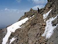
 Point 4010 m & Gendarmes
The summit of Angemar I creates walls on its south side. Go to the north side and climb up the scree slopes to the top.
 Summit
Views from the summit of Angemar I:
 Dobrar Peaks Dobrar Peaks | 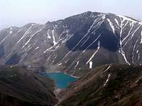 Tar Lake & Zarrin Kooh Tar Lake & Zarrin Kooh |  Angemar II Peaks Angemar II Peaks |  Lasem Village Lasem Village |
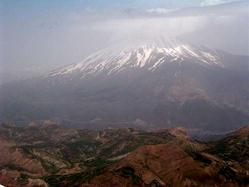 Mt. Damavand from the summit of Angemar I
Ski descent to the village of Lasem:
Hiking distance from the 3930 m saddle between Angemar I & II to the village of Lasem is 5.0 Km
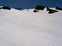
In June of 2009, there was skiable snow down to an elevation of 3150 m
Pictures of the slopes above 3150 m (June 2009):
 |  |  |
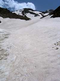 | 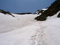 | 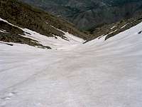 |
Pictures of the slopes below 3150 m (June 2009):
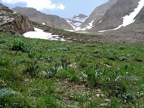
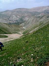 Lasem Village Lasem Village | 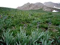 |  |  |
 |  |  | 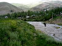 Village of Lasem Village of Lasem |
Getting There
Click here for directions to the trailhead for Bazm Chal Peak, the usual access point to the top of the Dobrar Ridgeline.Directions to the village of Lasem (direct access to the northern slopes of Angemar II):
From eastern Tehran, drive the Haraz Road roughly 55 Km to reach the 2700 m Emamzadeh Hashem Pass. Continue north roughly 15 Km down into the Haraz River Valley past the town of Poloor until you see a side road on the right. Turn right and follow the road 17 Km uphill to reach the village of Lasem.