
|
|
Mountain/Rock |
|---|---|
|
|
41.17171°N / 117.76692°W |
|
|
Humboldt |
|
|
Hiking, Scrambling |
|
|
Spring, Summer, Fall, Winter |
|
|
7923 ft / 2415 m |
|
|
Bloody Run
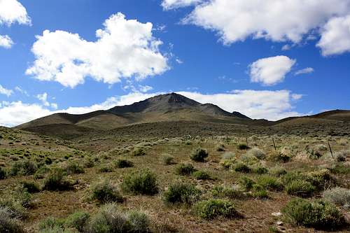
Bloody Run Peak is the highest point in the Bloody Run Hills, a subrange of the Santa Rosa Range. Steep faced on all sides, Bloody Run offers a half day scramble with incredible views of Northern Nevada Ranges from the Ruby Mountains in the southeast to the Pine Forest Range in the northwest. #63 on the Nevada P2K list, Bloody Run has 3013 feet of prominence and makes a good candidate to combine with other nearby prominence peaks for a multi-summit day. Granite Peak the northern highpoint of the Santa Rosa Range is one such peak with a similarly short route and nearby proximity. Within clear site of the summit is Winnemucca, the nearest town with a population just under 10k residents. Winnemucca can be found a mere 10 miles to the south of Bloody Run Peak and being located on a freeway offers all the amenities of a small city.
Deer and antelope can be found in the Bloody Run Hills along with raptors that cruise currents above the highest peaks. There is very little forest cover, only small stands of aspen, cottonwood, and willow in a few of the deeper canyons. You will find none of the coniferous trees that can be found further north in the Santa Rosa Range proper, or across the valley in the Sonoma Range. Sagebrush and bunchgrass dominate the mountain slopes, and views southwest reveal a broad valley buried beneath the sand dunes of a one time inland sea that occupied the Silver State Valley.
Getting There
 Upper Slopes
10 miles north of Winnemucca on US95 is Sand Pass Road, a gravel two lane road that travels west into the Silver State Valley via a gap in the Bloody Hills known as Sand Pass. Turn west onto Sand Pass Road and drive 2.5 miles to a 4x4 road that follows a natural gas line. Turn north (right) onto this 4x4 road and follow it to a suitable starting point. About 1 mile down the natural gas road another 4x4 road to the NW (left) can be taken to the southeast base of the mountain, a good starting point for the scramble up Bloody Run's steep south face.
Route:
A ridgeline extends from the summit southeast to an improvised parking area at the base of the peak. Follow the ridgeline 2 miles and 2600 feet in gain up to the mountaintop. The first mile and a half climbs gradual slopes to a knob at 6800 feet, the last half mile climbs the final 1100 feet up a much steeper boulder field. Keep left of the prominent rib dropping from the summit. Expect some 3rd class scrambling the last 100 feet to the summit with some exposure off the SE and NW faces.
When to Hike - Red Tape
Springtime makes for moderate temperatures and is a great time to hike in this desert region at mid-elevations. Expect a short hike within site of a major highway, however be aware thunderstorms or blizzards may strike unexpectedly throughout the year. Most routes on Bloody Run are steep, and no trail to the summit exists. Expect this hike to take 3-4 hours roundtrip.This is BLM land open to the public. Some fences exist on and around the peak, but I did not see any "no trespassing" signs. Always close gates behind you when passing through barbed wire fences.

Camping
This is a good peak to combine with nearby Sonoma or Granite Peaks where better camping can be found.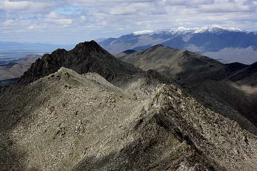 The Santa Rosa Range across the horizon
Weather

Santa Rosa Pages
No page exists at this time for the Santa Rosa Mountain Range; here are links to the other peaks in the range.Granite Peak
Santa Rosa Peak
Buckskin Mountain
 Nearby Sonoma Range