The White Tauern Queen Seen from the E, where the ascent from Villacher Hütte goes.
Nov 26th, 2022: Interactive map embedded, more description.
Jan 14th, 2019: Design corrections.
May 26th, 2011: The first ascent info updated.
Jan 11th, 2006: The Wiews from the distance chapter added, pictures re-attached.
Nov 29th, 2004: A little redesign made, pictures linked and attached/detached.
Aug 6th, 2004: Links to two ice-climbs inserted.
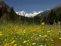
Hochalmspithe is the highest mountain in Ankogel group, and most certainly the most beautiful glacier summit east of Grossglockner. From whereever in the east you look on the high Central Alps range of Hohe Tauern, you will see its glaciers shining above green forehills.
Overview
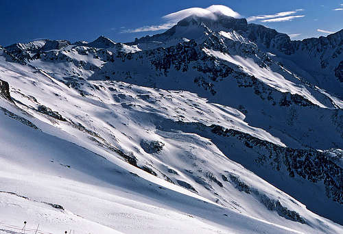
Hochalmspitze from the West On the right is Lassacher Winkel-Scharte.
Detmolder Grat
Steinerne Maennln
Hochalmspitze Group
As almost the entire Hohe Tauern range also Hochalmspitze is built of solid granite. Therefore on its ridges and walls, you will see many wild rock forms and on lower parts of the mountain, glacier waters stay in many lakes.
The summit of Hochalmspitze sends many long ridges in all directions. Actually close to the main summit in these ridges there are some nearby lower summits, forming the narrow Hochalmspitze group: Preiml-Spitze on the NE, Grosselend-Kopf on the N, Schneewinkel-Spitze on the SWand others.
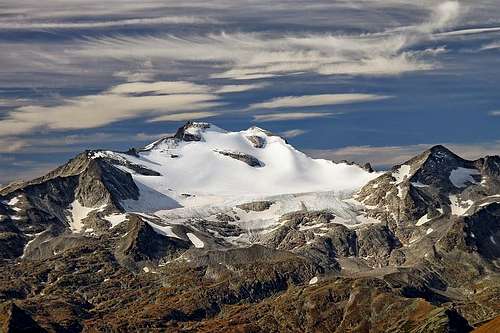
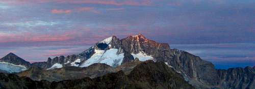
Hochalmspitze from the E
The first ascent history
It is quite interesting. In 1855 four men from Gmuend, guided by a hunter from Malta ascended the eastern part of Hochalmkees. A big crevasse stopped them. Later, they climbed again, reached Steinerne Maennln, but did not proceed, although it was a calm, sunny day. On the same month Martin Krall with companions came, but in a dense fog they climbed the nearby Grosselendkopf instead of the main summit. In August 1859Anton fon Ruthner reached the foresummit, the 3346 m high Schneeige Hochalmspitze (Snow-peak), but he and his guide didn't dare to climb the exposed ridge to the main summit (only 5-10 minutes). So a few days later, on August 15th, the famous Paul Grohmann came and took the victory. But did he really? This was the official story until 2010 when Hans Jungmeier found a few more than 150-year-old letters that were kept in Martin Krall's archives. On August 30th, 1855, the highest summit of Hochalmspitze were reached by Josef Moritz from Eisentratten with the local guide Andreas Pucher from Grosshattenberg in Liesertal and Jakob Haman. They did not however raise on the top the usual ciarn, so the first-ascent history turned into a mini mountaineering "crimi".
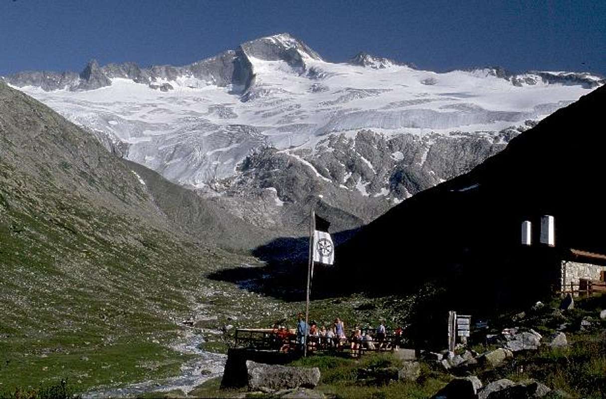
Above the Hochalmkees
Why to climb it?
The mountain is mostly visited by mountaineers and skiers. Although being surrounded by many huts, Hochalmspitze is not an easy mountain. In the close neighborhood there are no mass sports centers and no cable car penetrates its slopes. To earn its wide panorama a mountaineer must be able of some easy climbing, glacier crossing, few approaches are also steep and exposed. Still, reaching the summit of Hochalmspitze is one of the most desirable goals in this region.
While the main Hohe Tauern range goes north of it, a long ridge, heading in the NW-SE direction, is connecting Ankogel with the Hochalmspitze group. Großelendscharte, 2675 m is the saddle, separating the two groups. Now let's see the main structure of the Hochalmspitze Group:
The SW Ridge
From the main summit a strong ridge (Detmoldergrat) goes in the SW direction towards the Saeuleck. In it the following peaks are rising: Winkelspitz, 3121 m, 3119 m, Schneewinkel-Spitze, 3015 m and Gussenbauer-Spitze, 2981 m. Between the summits of Winkelspitz and Schneewinkelspitze there's the Lassacher Winkelscharte, 2856 m, which can be reached either from the NW (from the Seebachtal), either from the SE (from the Goßkar plateau).
The E-SE Ridge
The second important ridge goes from the summit of Hochalmspitze towards the E-SE. By the upper part of it one of normal ascent routes goes. It comes up from the south on the notch near the granite towers, called Steinerne Maennln. From there further down the ridge the first summit is Zsygmondykopf, 3152 m, named by the famous brothers. Then the long ridge lowers gradually down into the valley of Malta. It contains many summits which are less important and rarely climbed: Kordonspitz, 3102 m, Kleiner Hochalmer, 2910 m, Tullnock, 2780 m, Schmiednock, 2616 m, Draxelnock, 2443 m and Höhennock, 2124 m.
Between the upper parts of the SW ridge and the E-SE ridge there's the S face of Hochalmspitze. It's rocky, too steep for hikers and not enough attractive for climbers. Below it lies the rapidly melting Trippkees (glacier). Some climbers touch only its W part when ascending the Winkelscharte.
The W-NW Ridge
From the main summit, towards the N-NW a short high ridge runs on the nearby Großelendkopf, 3317 m. There the third and the fourth cardinal ridge of the Hochalmspitze group start descending. Towards the W-NW a strong ridge descends all the way down to the Großelendscarte. No marked route goes by it. The first summit W of Großelendkopf is Jochspitze, 3179 m, then a long ridge descends all the way down to Karlspitz, 2936 m, where it branches. The long main branch goes in a long arc towards the W, then NW, finally lowering on the Großelendscarte.
Between this W-NW ridge and the SW ridge (Detmolder Grat) the Winkelkees (glacier) lies. The steep W wall of Hochalmspitze is one of the most beautiful features of the massif. The wall is cut by a few steep couloirs which were in the past very popular with climbers.
From the Grosselendkopf also the strong fourth ridge descendrs - first towards the NE, then towards the N. Due to the high Malta valley road, its summits are quite popular and are ascended in summer and winter. From the Grosselendkopf, the ridge first lowers to the high Preimlscharte, 2950 m. It's an important notch, over which the northern route on the Hochalmspitze goes. Immediately NE of the notch the steep Preimlspitze, 3133 m rises. There the main ridge turns in the N direction, lowers to the popular Oberlercherspitze, 3107 m, and further over several summits down to the big Kölnbrein reservoir.
Between the W-NW ridge and the NE ridge the broad glacier expands, very reach with ice. In its upper regions Großelendkees reaches almost both ridges. So, the view on the Hochalmspitze from the N is very beautiful. But the main summit is from the valley N of the glacier not seen. We see only the Grosselendkopf.
Hochalmkees
Between the E-SE ridge and the Preiml ridge the broad Hochalmkees (glacier) lies. In some parts it is rich with crevasses but in winter it also enables a long but comfortable ski ascent. Despite possible crevasses, the eastern side of Hochalmspitze is flat enough, so there go the easiest ascent routes - in summer and winter. But they are all long, overcoming big altitude differences.
The southern, eastern and northern approach all start in the beautiful Malta valley, being guarded by the picturesque town of Gmuend, lying already on the Salzburg - Villach highway.
The southern approach
1. Southern approach. Driving by car into Malta valley you can deter in Malta village to the left, drive by a narrow, but good mountain road through the Goessgraben and reach the parking place below the Gosskar lake dam (1670 m). From there, you can reach the Giessener Huette (2215 m) by a steep, for public traffic closed road, appropriate for a mountain bike.
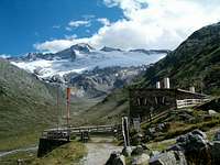
2. Eastern approach. After passing the Malta village you stop in the Maltatal by the Gmuender Huette, 1186 m. There a steep forrest road deters left, closed for public traffic. After it finishes (at the altitude of cca 1900 m) a marked path brings you to the Villacher Huette, 2194 m. This hut is not regularly serviced.
3. Northern approach. The road through the main Malta valley is soon after the Gmuender Huette closed and to continue to the huge Koelnbreinsperre (dam) you must pay toll. This road is opened from the end of May till first snow, so it can be used for late spring ski tours and for summer ascents. From the big parking place by the dam (1950 m) you continue a 2 hours walk by the lake and reach Osnabrucker Huette (2026 m).
4. The approach from the West starts in Mallnitz, a small tourist town, which can be reached either by the road from south (from Moelltal) or by train, coming through the main Hohe Tauern ridge by the tunnel from Badgastein. The train can also carry your car. From Mallnitz you go by Seetal (valley) eastwards, reach the station of Ankogel cable car which brings you up to Hannover Haus (2719 m). Reaching Hochalmspitze from this hut is still a long, tiresome endeavor. The other possibility is to go from Mallnitz into the Doesenertal (possible by car to the altitude of 1400 m), walk to Arthur-Schmid-Haus (2272 m), and from there take a long hard ascent to Hochalmspitze over the Saeuleck summit. You can see a detailed map on: http://www.austrianmap.at/, but the above interactive map is useful (and detailed enough) too.
Routes overview
Normal approaches
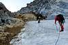
1. From Giessener Huette, 2215 m. The Hut - Steinerne Maennln - E-SE ridge - summit. The hut is reached by a mountain road, closed for public trafiic. Above it we have broad, quite flat grassy and rubble slopes, Then below the E-SE ridge a steep snow field and a short, very steep rock wall above it. The passage over it is secured with cables. The route further by the ridge has some more steep, ferrata sections and some easy not protected climb sections. Overall, the route is graded PD-, II/I. 3 h 30 min.
2. From Villacher Huette, 2194 m. The hut can be reached from the Malta valley by a forest road and a well beaten marked path. Then we continue towards the W, by a not steep grassy and rocky terrain to the glacier, and over it towards Steinerne Maennln (eventually demanding passage from tghe glacier on the ridge) or directly towards the summit (take care of crevasses) or towards the Preiml Scharte and then left. Then from the fore-summit on the main summit. Glacier ascent. 3 h 30 min.
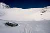
3. From Osnabrucker Huette, 2026 m. The hut can be reached from the last parking place of Malta valley by a flat road - either by bikes or on foot. From the hut we continue over morraines on the Großelendkees and from the glacier by a very steep couloir on the Preiml Scharte. From there the traverse towards the main summit follows. Glacier, steep ascent through the couloir under Preiml Scharte. 4 h.
Preiml Scharte
Summit slopes
4. Detmolder Grat (ridge). Saeuleck (3085 m, to this summit 2 h 30 min from Arthur Schmid-Haus) - SW (Detmolder) ridge - summit. Medium difficult ferrata (C) and combined (easy climb) ascent, graded AD, II/I. From Saeuleck 6 h. The ridge can be also gained from the Gießener Hütte on Lassacher Winkel-Scharte, 2862 m. This shortens the ascent. Very popular (but demanding) is this ascent in combination with the descent, described in #1 (in total 8-10 hours).
5. From Hannover Haus, 2719 m. It's a long route, but this hut can be reched by cable car. To the Hochalmspitze we have the following options:
By the Cellar Weg. This marked path traverses all the slopes above the Seebachtal and its end the Winkelbach Tal. Then we climb steeply up on the SW ridge of Hochalmspitze, which we reach on the Lassacher Winkelscharte, 2856 m. From there by the demanding Detmolder Grat on the highest point.
We can traverse first to the Grosselend Scharte, 2674 m (cca 2 hours) and from there down to the Osnabrucker Hütte. From there by the route #3 on Hochalmspitze.
From Hannover Haus
Harder climbs
On Hochalmspitze's NW face there are also some harder (ice) climbs. Conditions for ice-climbing is best in early summer.
Here I'm posting just some basic information about some summits of the Hochalmspitze Group which will not likely get their own SP pages soon.
Großelendkopf, 3317 m. The ridge connection with the nearby Hochalmspitze is fairly easy and goes over firn and around boulders. Over the W and SW face runs the Arnoldweg which requires climbing of UIAA II degree (snow, rock).
Zsigmondykopf, 3152 m. This summit in the E-SE ridge offers great views around, but it's not reachable via the nearby Steinerne Mandln notch. The normal ascent goes by the E ridge which requires scrambling and is not too demanding. More tricky is due to glacier with crevasses the approach below the notch in the E ridge.
Preimlspitz, 3133 m. It rises in the NE ridge, where it turns into the northern direction. This sharp summit can be reached by three not too demanding climbs, but none of them goes up directly from the frequented nearby Preimlscharte (notch). The N ridge notch requires climbing of UIAA I+ degree, of pretty much the same difficulty is the route over the S face, while the route over the SE ridge is even slightly less demanding.
Oberlercherspitze, 3107 m. This summit rises close to the Preimlspitz and is situated in the ridhe north of it. It's well known among the tour skiers, the north-oriented ski tour goes up just from the dam of the Kölnbreinspeicher.
Winterleiten, 2518 m. This summit rises just above the Gießener Hütte and can be best reached by a marked hiking route which has only one short secured with cable section. Nice views around.
Brunnkarkopf, 2401 m. This hiking summit rises just east above the Osnabrucker Hütte and offers nice views around, especially on the nearby artificial lake. Nature is nice there and many hikers continue the ascent towards the nearby Brunnkarsee, 2509 m.
The mountain lies in the Hohe Tauern national park, so you are obliged to strictly obey the rules of protecting nature. For the road to Koelnbreinsperre you need to pay a toll.
When To Climb
The best months to climb Hochalmspitze are in summer - from the start of July when the weather starts to stabilize - till autumn. In spring there are good conditions for tour skiing, but for the whole ascent from Malta valley snow must lie also on the altitude of 1200 meters, while for late spring tours the road to Koelnbreinsperre is closed till the second half of May and the road to Gosskar lake opens only with July 1st. In summer the summit can be reached in one day, while for a ski tour you will need two days. See also conditions on the mountain with this live web camera.
Camping
Climbing Hochalmspitze you can use the following mountain huts:
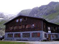
Giessener Huette
Giessener Huette, 2215 m. It is standing on the southern side of the mountain, above the Goessgraben valley. It can be reached from the parking place at Gosskar lake (1670 m) in 1 h 30 min. (You can use a mountain bike too). Opened: from July 1st till end of September. Tel.: 04733/336.
Villacher Huette, 2194 m. It's a self-catering hut, standing under the moraine of the Hochalm glacier. It can be reached from the parking place just below Gmuender Huette (1186 m) in 3 hours. Tel.: 04242/431053.
Osnabruecker huette
Osnabrucker Huette, 2026 m. It is standing above the upper end of Koelnbrein lake. It can be reached from the parking place at the dam (toll road till there, 1950 m) in 2 h. From the dam you can use a bike too. Opened: from mid-June till end of September. Tel.: 04783/211139159.
Arnoldshöhe chapel
Hannover Haus, 2719 m. It is standing far away from Hochalmspitze, by the upper station of Ankogel cable car. Opened: from July 1st till end of September. Tel.: 0664/1619367.
Celler Huette, 2240 m. It stands west of Hochalmspitze. It can be reached from Hannoverhaus in 3-4 h or directly from Mallnitz in 5 h. The hut is a self-service hut and can be used from end of June to the beginning of October. The hut gives the western approach to Lassacher Winkelscharte pass and Detmolder Grat, and it is a basis for the difficult ice climbing routes of the NW face. Link: Celler Huette.
In the yearly book of the german/austrian alpine clubs for 2010 there is an interesting article by Heinz Jungmaier: he has found some - more than 150 years old - letters that include a report about the really frist ascent: That has been done on August 30th 1855, by Josef Moritz from Eisentratten with local guides Andreas Pucher and Jakob Haman.
Children refers to the set of objects that logically fall under a given object. For example, the
Aconcagua mountain page is a child of the 'Aconcagua Group' and the 'Seven Summits.' The
Aconcagua mountain itself has many routes, photos, and trip reports as children.
Parents refers to a larger category under which an object falls. For example, theAconcagua mountain page has the 'Aconcagua Group' and the 'Seven Summits' asparents and is a parent itself to many routes, photos, and Trip Reports.

 48264 Hits
 94.02% Score
 45 Votes
 Hochalmspitze from the West
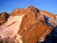 Detmolder Grat
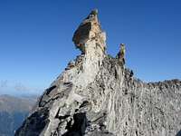 Steinerne Maennln
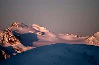 Hochalmspitze from the E
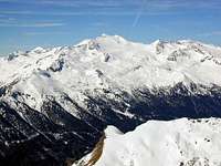 Above the Hochalmkees
 from the N
 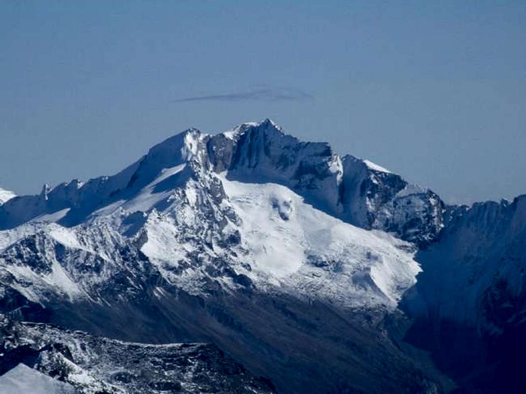 from the W
 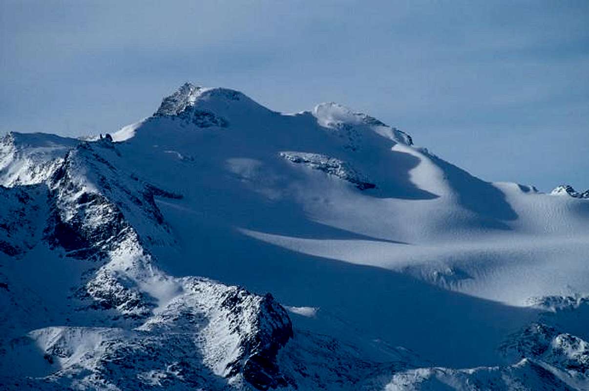 from the E
 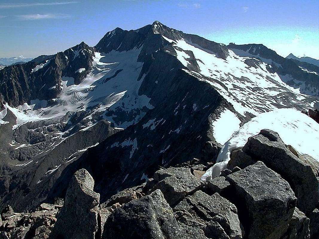 from the SW
 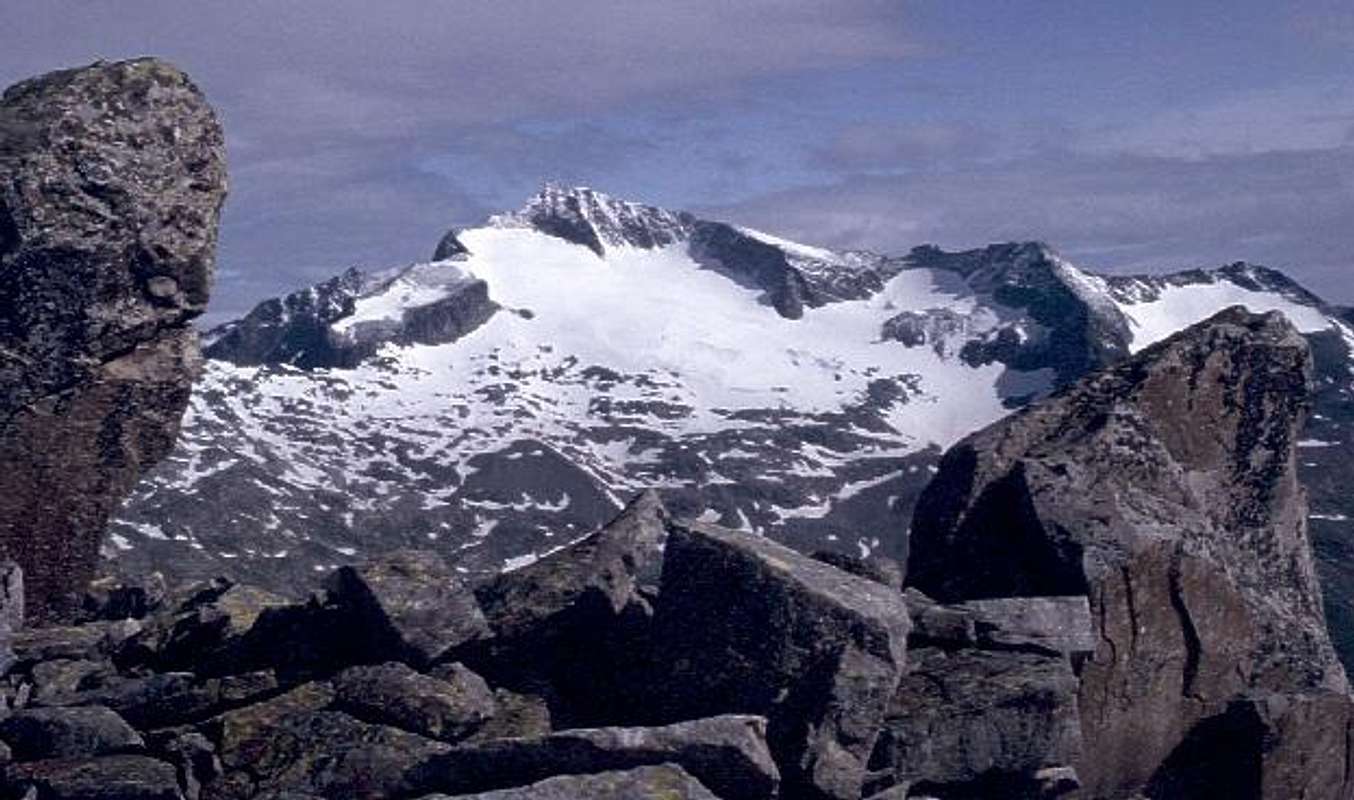 from the S
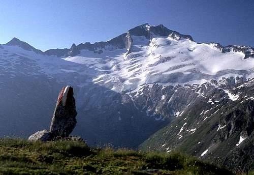


 The southern approach


 Preiml Scharte
 Summit slopes
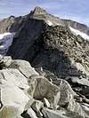
 From Hannover Haus
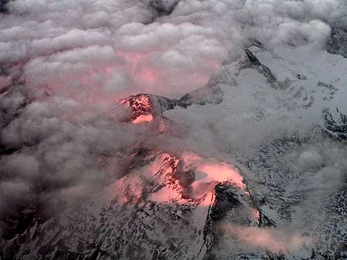 wuedesau - From an airplane


Mathias Zehring - May 15, 2010 3:29 am - Voted 10/10
first ascentIn the yearly book of the german/austrian alpine clubs for 2010 there is an interesting article by Heinz Jungmaier: he has found some - more than 150 years old - letters that include a report about the really frist ascent: That has been done on August 30th 1855, by Josef Moritz from Eisentratten with local guides Andreas Pucher and Jakob Haman.
Vid Pogachnik - May 15, 2010 4:14 am - Hasn't voted
Re: first ascentInteresting news! I will immediately have a look - I hope that's on the web, I usually find them. Thanks a lot! Vid
Vid Pogachnik - May 15, 2010 4:22 am - Hasn't voted
Re: first ascentAha. It's Jungmeier. There are other articles as well...