
|
|
Mountain/Rock |
|---|---|
|
|
39.02940°N / 106.4725°W |
|
|
14336 ft / 4370 m |
|
|
La Plata Peak Overview
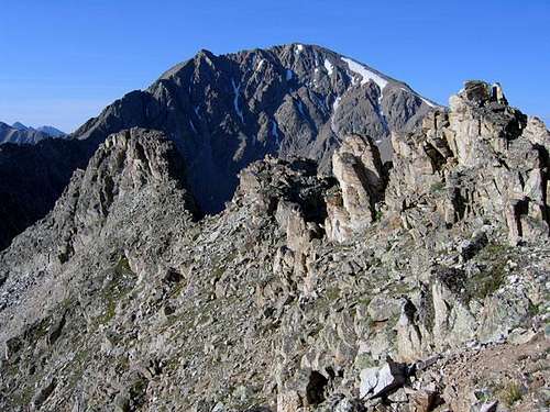
La Plata Peak (14,336 ft.) is another big and bulky Sawatch mountain, similar in configuration to Colorado's highest two mountains Mt. Elbert and Mt Massive. The Hayden Survey Team first climbed the peak on July 26th, 1873, then naming the peak La Plata, which means "silver" in Spanish. (Source-Historian Walter R. Borneman) Staying with the typical Sawatch mountaineering theme, La Plata has steep surrounding slopes and gentle, broad ridges leading to its large summit plateau. In contrast to other Sawatch fourteeners, La Plata Peak has an unequaled personality of its own. Colorado's 5th highest mountain harbors a classic technical route, a route that is reserved for only the true mountaineer, the rugged and spectacular Ellingwood Ridge. This sensational 2 mile long ridge is the true redeeming quality that separates La Plata Peak from its neighboring fourteeners.
Ellingwood Ridge
Update- Ellingwood Ridge by SP member Brad Snider. Standing on Colorado's highest summit, the view of Ellingwood Ridge from Mt. Elbert is spectacular. The ridge is 2 miles of sweeping ridge, loaded with rock pinnacles. it is a major undertaking. It's obvious that this would be a bad place to get caught in one of Colorado's fast moving lightning storms.
Current conditions & Satillite Image
Click image to enlarge

Lake Creek TH- Standard Northwest Ridge Route
La Plata Peak is one of only a few Colorado fourteeners that you can reach the trailhead via a paved road! If approaching from the east, go 14.5 mile west on Colorado 82 from the junction of U.S. 24-Colorado 82. If approaching from the west, go 8.8 miles east on 82 from the summit of Independence Pass. There is a turn-off here and plenty of parking available. This parking area tends to fill up quickly on the weekends. For additional parking and camping, turn south onto South Fork Lake Creek Road (FS 391) and continue up the rough road. You will need a high clearance vehicle for FS 391.CAMPING-Click here for complete information on campgrounds in the Leadville Ranger District. Camping along 82 is very popular in the summer and fall, you might be better off camping up South Fork Lake (FS 391) road since it requires a high clearance vehicle and this should eliminate the moterhomes traffic. Sites available on a first come first serve basis. (distance statistics per Gerry Roach)
West Winfield TH-Alternate Southwest Ridge Route
- Go south 4.3 miles from the US 24 and Co. 82 junction and turn west (right) onto Chaffee County 390. Go 11.8 miles on the graded dirt road to the historical mining town of Winfield. Winfield has preserved several buildings and restored them to original condition. Many buildings remain private and visitors are encouraged to avoid trespassing where posted. From Winfield, go right for 60 yards and then left on a rough road for a half-mile to the Winfield Cemetery. Continue another 100 yards and park on the left side. The West Winfield TH starts here. CAMPING- Click here for complete information on campgrounds in the Leadville Ranger District. (distance statistics per Gerry Roach.)
- - Winfield Trail Head
Author: Bryan W(N310bh)
Date: Sept 25, 2002 11:03 PM
Take U.S. 24 to Chaffee County 390, this is a dirt road and is the second road when entering Chaffee County coming south from Leadville. It is about 4.5 south of the U.S. 24/Colorado 82 junction near Twin Lakes. Follow the dirt road for almost 12 miles to the ghost town of Winfield. You will know when you are there, but do not expect and old west type of ghost town. When you are passing the cabins in Winfield, Chaffee County 390 will turn left, however you want to stay straight. You are now on the 4WD road and it will turn to the right and head into the trees almost right away. You can drive the first part in almost any kind of vehicle and you will find a parking area only about .5 miles in. There will be a sign that clearly states "High Clearence Vehicles Only." From there an SUV, Jeep, or the alike is recommended. Continue along the road, there are only a few spots that are not wide enough for two SUVs to pass. About 2.2 miles from Winfield, you will see the road split. You can go straight, but you need to make the right turn and go up the steep part of the road. This is the toughest part, but only goes for about .1 miles. No need to drive all the way to the register, as there is only parking for one or two vehicles and it is much easier to park just below the register. There will be a small section that flattens out and this is where you want to park (on the westside of the road). Gear up and hike the road for 50 yards and you turn right and there is the register. The trail is just to the left of the register. Don't get confused and think that you are supposed to take the trail to the right of the register that has a gate. This is obviously a private road or a U.S. Ranger access road.
Sawatch Overview
La Plata Peak rests within the backbone of the Colorado Continental Divide, the Sawatch Range. This complex range stretches nearly 100 miles north and south, starting at Tennessee Pass and ending at the Marshall Pass area. The Sawatch is home to 15 fourteeners and 14 centennial thirteeners; no other Colorado mountain range contains as many peaks above 13,800 ft. When hiking this range, there are a few things you can count on, long approaches, plenty of vertical, and endless class 2 hiking. SP mountain pages within a 20 mile vicinity of La Plata Peak. - Rinker/Twin Peaks
- Grizzly Peak
- Mount Hope
- Mount Oklahoma
- Casco Peak
- Mount Belford
- Mount Elbert
- Mount Harvard
- Mount Massive
- Mount Oxford
- Missouri Mountain
- Huron Peak
Credits
- La Plata Peak page previosly maintained by rfbolton
- George Bell and Warren Teissier
- Statistics per Gerry Roach
- mtntrail2
External Links
- 14 Fourteeners in 60 Hours
- climb of unnamed couloir on north face
- 14ers.com - The Home of Colorado's Highest Peaks Fourteener Photos, Route Descriptions, Forum, and more...
johnmcys - Oct 12, 2003 10:07 pm - Hasn't voted
Untitled CommentThe trail that goes through the gate to the right of the start of the La Plata trail leads to the Tasmania Mine, one of the more prolific mines of the Winfield District.