Page Type Page Type: Mountain/Rock
Location Lat/Lon: 40.51700°N / 9.57980°E
Additional Information Elevation: 3467 ft / 1057 m
Sign the Climber's Log

Overview


Punta Ferulargiu photo_id=101028

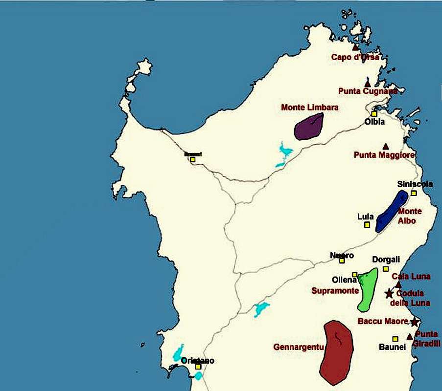
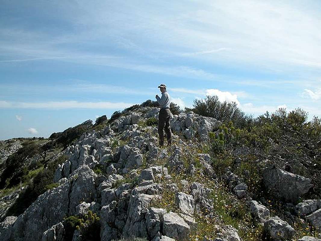
The Monte Albo Chain in Sardinia / Sardegna stretches for about 20 - 25 km between the towns of Lula to its southwest and Siniscola to its northeast. It is famous for its long vertical north face stretching between Monte Turuddo and Punta Cupetti. This north face is composed of numerous summits which all are separated by deep gullies and ravines which are deeply cut into the limestone rock. Monte Albo means "Pale Mountain" or “White Mountain” and it is the bleached limestone which gave the range its name.

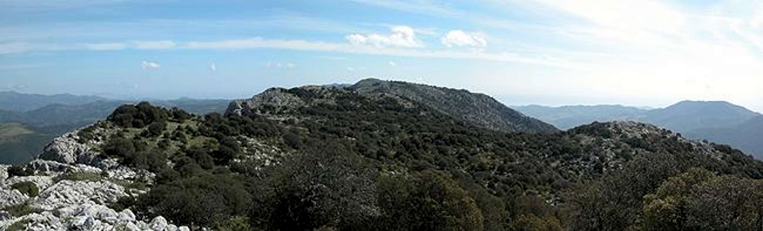
Punta Ferulargiu is located almost at the centre of the northern ridge of Monte Albo and together with Punta Romasinu it almost forms a twin peak. The two mountains are divided by a deep ravine which drops down to the road pass Janna Portellitos 500m below. It is this ravine which is the most impressive feature of the mountain, its southern and eastern slopes being very smooth and easy to ascend.

Though definitely one of the finest hikes on Sardinia the ascend to Punta Ferulargiu is far from easy. The first stretch follows Sentiero Italia to the Monte Albo Plateau but from there on it is trail less scrambling along sharp and spiky rocks. The best way to reach Ferulargiu is to follow the northern ridge of Monte Albo. There you have certainly the finest views into the plains and valleys below and you don't have to fight against the macchia undergrowth. There are no bushes or trees along the ridge, only flowers -but of these you'll see millions. Scrambling along the ridge means that you will have to pass Punta sae Mussinu and Punta Romasinu on the way.

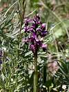
Having spoken of flowers - you will see from the pictures on this page (and from the ones on the other Monte Albo pages) that this mountain not only offers you great rock formations. There is one picture which I particularly like - the large one in the "Getting there" section. It shows you the "trail" with its spiky stones and also that every nook is inhabited by blossoming flowers. You turn into a flower lover up there ;-)

Monte TuruddoPunta CatirinaPunta sae MussinuPunta RomasinuPunta FerulargiuPunta Cupetti

Interactive overview map of the Monte Albo mountain range. The summits which have been posted to SP are marked in red.
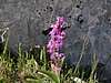
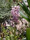
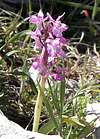
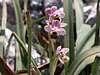
Orchids !


Punta Ferulargiu photo_id=101047

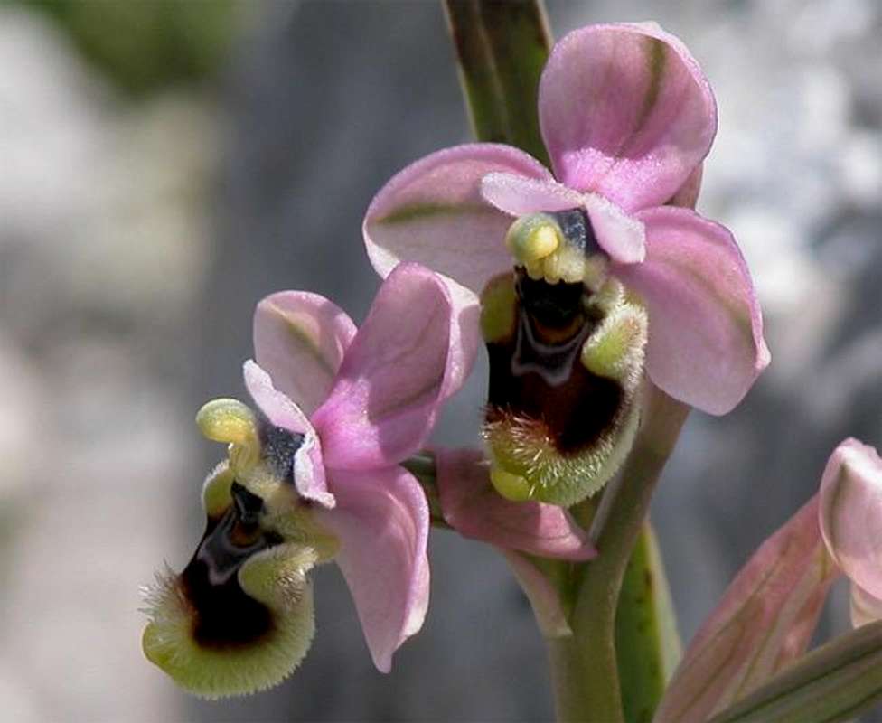
There is no such place for orchids as Monte Albo! Ever since my late dad (a biology professor) took me on an orchid hunting trip in the vicinity of his university as an adolescent - I have been fascinated by these beautiful flowers. I have never had the chance to see so many different varieties as on this mountain.

Punta Ferulargiu photo_id=89866Punta Ferulargiu photo_id=90357Punta Ferulargiu photo_id=89864Punta Ferulargiu photo_id=90066Punta Ferulargiu photo_id=90354Punta Ferulargiu photo_id=97100Punta Ferulargiu photo_id=101035
Punta Ferulargiu photo_id=90353Punta Ferulargiu photo_id=90355Punta Ferulargiu photo_id=92627Punta Ferulargiu photo_id=90356Punta Ferulargiu photo_id=92628Punta Ferulargiu photo_id=93752Punta Ferulargiu photo_id=98455

Getting There


Punta Ferulargiu photo_id=101031

Sardinia can be reached either by plane or by ferry. The main ports are Porto Torres and Olbia in the north and Arbatax and Cagliari in the south. Airports are at Alghero and Olbia in the north as well as (again) Arbatax and Cagliari in the south. For exploring the northeastern part of the island where most of the mountains are the best entry point is Olbia, which is where most flights go anyway.

Approaching the mountain from Olbia airport
Get on motorway SS 131 south in the direction of Siniscola / Nuoro. At the exit Lula / Dorgali get off and turn on SP38 north (again direction Lula). Here turn to SP3 east (direction Passo Santa Anna). 6km after the town on the right hand side first a dirt road (route to Monte Turuddo), a little later a marked trail (Sentiero Italia) turn off. Park the car at either of the trailheads, wherever you find room enough. The ascent starts where Sentiero Italia leaves the road to climb the mountain.

Capo d'OrsaPunta CugnanaMonte LimbaraPunta MaggioreCala LunaPunta GiradiliMonte AlboSupramonteGennargentuCodula della LunaBaccu Maore

Interactive map of Sardinia and its mountain regions. Click on the regions, red triangles (mountains) or stars (gorges).

Red Tape


There is no red tape whatsoever. You should park your car so that it doesn't clog the field and forest roads but that's about the only "restriction". The orchids however are protected all over Europe and you have to leave them in their place. I don't know about Sardinia but in many places you have to pay heavy fines if you are caught red handed.

When To Climb


Punta Ferulargiu is pretty much an all-year mountain. The weather on Sardinia does not get too cold anyway and only in the Gennargentu mountain range, Sardinia's highest by far, you have to take snow int o account. In winter the mediterranean weather can get quite dismal, however, with lots of rain. I would recommend spring and autumn - May was just about perfect. The summers tend to get pretty hot inlands - I doubt that you will want to quit the coast.

Accommodation


Accommodation...
...is rather easy to find. Since all the interesting mountaineous regions are on the north and east coast - which is where the largest beaches are - you can book hotel rooms and appartments from any tourist office. The region around the towns of Siniscola or Lula should be the best staying places for exploring Monte Albo.

You can also take advantage of "agriturismo", apartments and rooms, let by farmers. This is also possible for camping since many of the agriturismo farms will let you stay on their grounds for small fees.

Camping...
... is also easy to find in the vicinity of the beaches. Look for locations, using www.sardegna.com. Free camping is frowned upon, better ask the farmers whether you can stay on their grounds.

Weather Conditions


Go for the following link, which is in Italian but with ALL the information you might want to have on weather on the island:

www.sar.sardegna.it.

Head for the "Bollettino dettagliato".

Maps 'n' Books


As for Maps I used only a road map scale 1:200000 since the guidebook I used has maps and is really quite good. Don't be fooled by the durations they state, you'll be much faster but the "getting there's" and "route description's" are very good.

The book is:
Sardinia (Sardegna / Sardinien)
M. Omidvar
Rother Verlag
ISBN: 3-7633-4800-X (English)
ISBN: 3-7633-4143-9 (Italian)
ISBN: 3-7633-4023-8 (German)


Children

Children

Children refers to the set of objects that logically fall under a given object. For example, the Aconcagua mountain page is a child of the 'Aconcagua Group' and the 'Seven Summits.' The Aconcagua mountain itself has many routes, photos, and trip reports as children.

Parents 

Parents

Parents refers to a larger category under which an object falls. For example, theAconcagua mountain page has the 'Aconcagua Group' and the 'Seven Summits' asparents and is a parent itself to many routes, photos, and Trip Reports.

Monte AlboMountains & Rocks