Toggle navigation
Mountains
Routes
Images
Trip Reports
Forum
What's New
People
Areas & Ranges
Articles
Trailheads
Canyons
Huts & Campgrounds
Albums
Logistical Centers
Fact Sheets
Lists
Custom Objects
Gear
Plans & Partners
WELCOME TO SUMMITPOST
SIGN IN
REGISTER
Mt. Timpanogos (UT)
Additional Parents
SW Face via Dry Canyon-Couloir Variation
Image
Timpanogos from the west in...
View High-Resolution Image
Timpanogos from the west in...
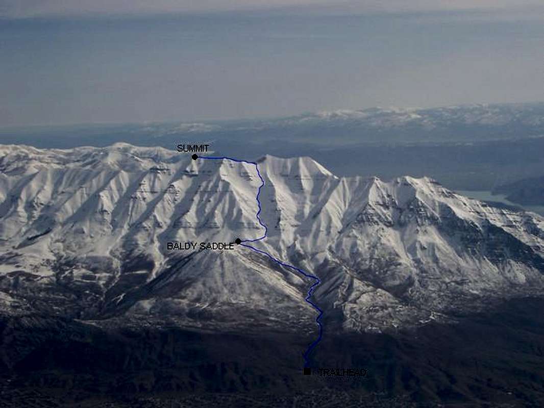
Timpanogos from the west in April 2005 (Denver-SLC flight). Route diagram of the
Dry Creek Route-Couloir Variation
. From the trailhead to the summit is approximately 6600 feet elevation gain.
« PREV
NEXT »
Scott
on
Jun 20, 2005 8:19 pm
Comments & voting
Other parents
Lat/Lon:
40.38460°N / 111.636°W
Image ID:
111093
4023 Hits
75.81
% Score
6
Votes
Log in to vote
Comments
No comments posted yet.
to post!
Don't have an account?
Mt. Timpanogos (UT)
(Mountain/Rock)
« PREV
Viewing
#262 of 668
GALLERY
NEXT »
Scott's Image Gallery
« PREV
Viewing
#1172 of 8090
GALLERY
NEXT »
SW Face via Dry Canyon-Couloir Variation
(Route)
Loading....
×
You need to login in order to vote!
User Name
Password
Remember me
Forgot your password?
Log me out when I close my browser.
Keep me logged in all the time.
sign in as a user
Don't have an account?
Register now for FREE
Rating available
Suggested routes for you
People who climb the same things as you
Comments Available
Create Albums
Register Here


