


Todd Caudle - Sep 10, 2005 4:26 pm - Hasn't voted
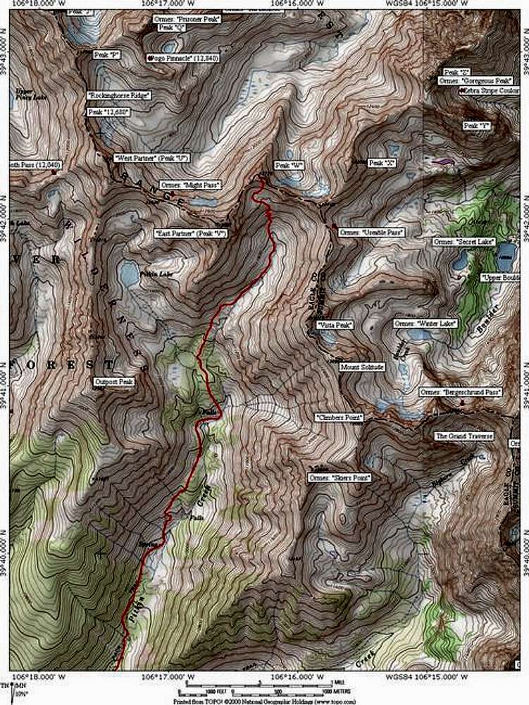
Bigger map?Sure wouldn't mind a link to a much larger version of this. There are soooo many Gore peaks that aren't named on the USGS quads, the expertise of you guys who spend time there would be a huge benefit to those of us who aspire to go there.

JonBradford - Sep 12, 2005 6:16 pm - Hasn't voted
Re: Bigger map?Todd,
First off thanks for the comment. I always forget to do the custom zoom when saving maps in Topo! which is why everything is so small. I'll submitt a closer view tonight. However if you have the National Geographic Topo program you can get a topo data file from the Theron Welch site. Go to his site on the Gore Range and scroll down looking for map data on the menu on the left. Save that data into your Topo data directory and choose "Gores" instead of "colorado" when you open Topo! I could also email you this file if you can't find it. Hope this helps.
Jon Bradford


Comments
Post a Comment