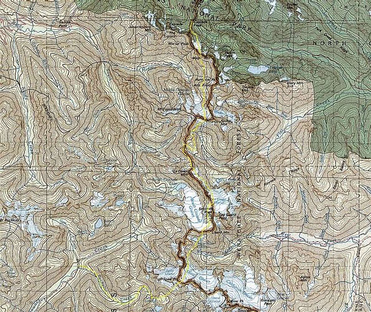
The crest of the North Cascades. The yellow line traces the Ptarmigan Traverse from Cascade Pass in the north to the Downey Creek Trail at the SW end. It does not include the 4.5 miles of trail up to Cascade Pass from the Cascade River road, nor the 6.5 miles of trail down Downey Creek to the Suiattle River road. The dark red line is the line between Skagit and Chelan Counties -- the divide between Eastern and Western Washington State. The faint black squares are survey sections: 1 square mile.
I've divided the route into five stages, each a reasonable day's travel if you don't take time out to climb any peaks. Each stage has a SummitPost "Route" page with a more detailed map.
Map derived from TOPO! cdrom www.topo.com


