
-
 7518 Hits
-
 74.01% Score
-
 4 Votes
|
|
Route |
|---|---|
|
|
39.36830°N / 106.1492°W |
|
|
Hike, limited scrambling |
|
|
Most of a day |
|
|
Class 2 |
|
|
Approach
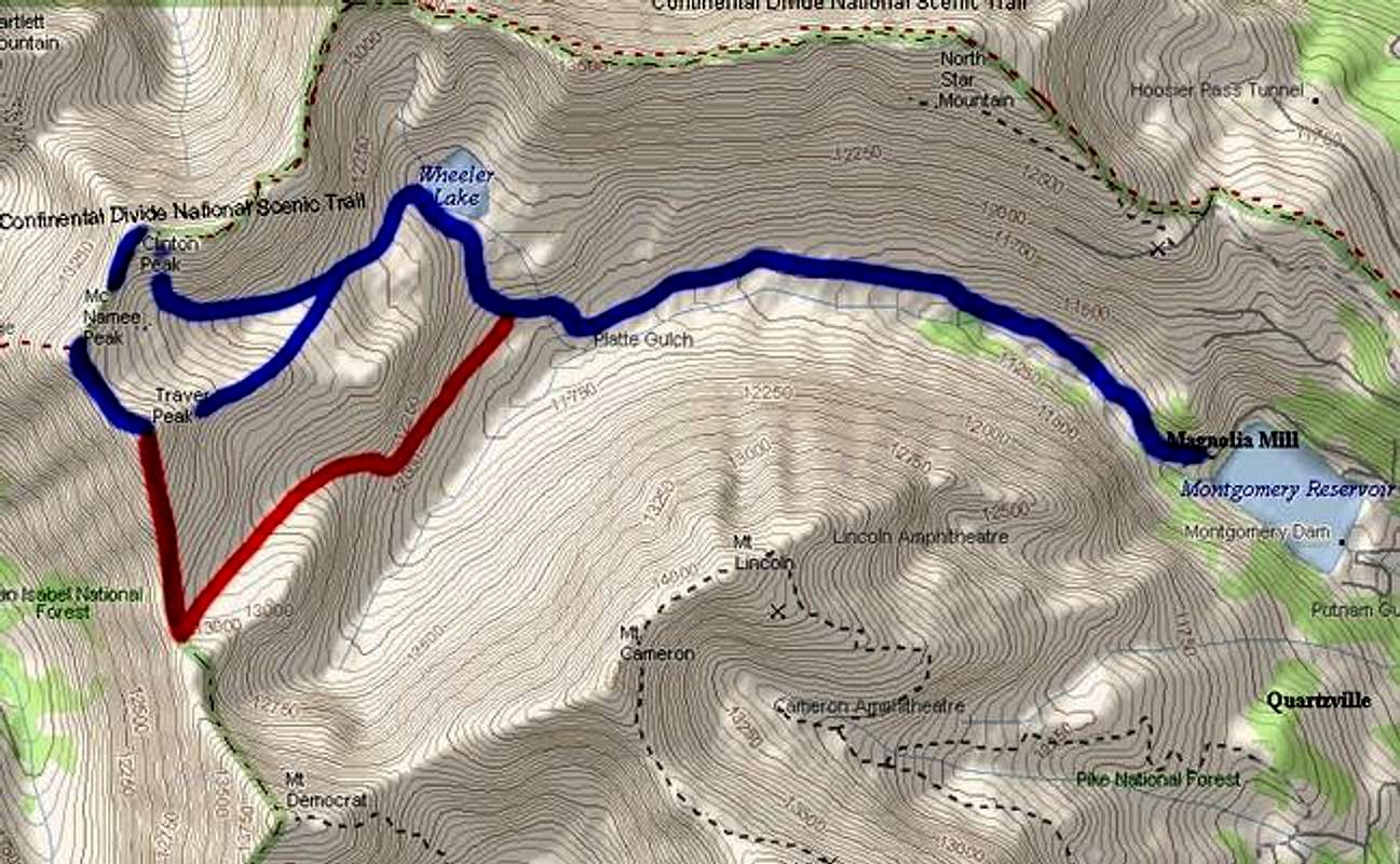
Total Mileage: 5.2 from 4WD parking; 10.0 from trailhead.
Total Elevation Gain: 2,500 feet from 4WD parking, 3,250 feet total from trailhead.
Just FYI: Gerry Roach lists this hike as a *Classic* in his Colorado's Thirteeners book. Enjoy!
Start from the Montgomery Reservoir Trailhead. This is just over a mile west on Park County 4, off of Colorado 9, as described on the main page. It is accessible in winter.
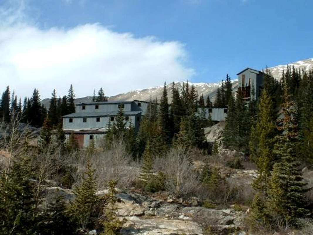 | If you do not want to take your chances with your 4WD vehicle (as I did not), park within sight of the Magnolia Mine. There is plenty of room for parking in this area; just don't block the road. This is a neat area, complete with old mining buildings and even waterfalls in the background! |
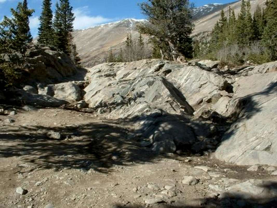 | For those who have a good 4WD vehicle and KNOW HOW TO USE IT: you can continue two and a half miles west on a rough four wheel drive road I would equate to the South Colony Lakes Road in the Sangres. There are very rough places along this road, with very few spots to turn around, and even less places to park. Walk or carefully drive the dirt/rock road west. This can be very wet and (if you are walking) you will probably have to take side trails through the brush to the side of the road at times. Note: At 2.4 miles, the road splits. You want to park here and walk the upper (right/north) "road" toward Wheeler Lake. |
Route Description
 | When the road ends, you will find yourself at Wheeler Lake. This old rusted car sits just above the lake's north side. According to Roach, you should begin your ascent up the ridge to your left (west) before this point, at the south end of the lake. Because of snow conditions, I chose instead to angle up and left directly behind this old automobile. This worked out just fine. |
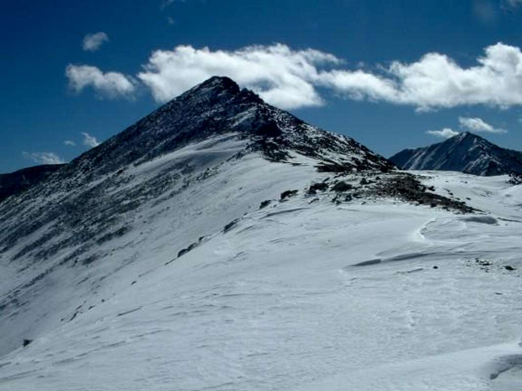
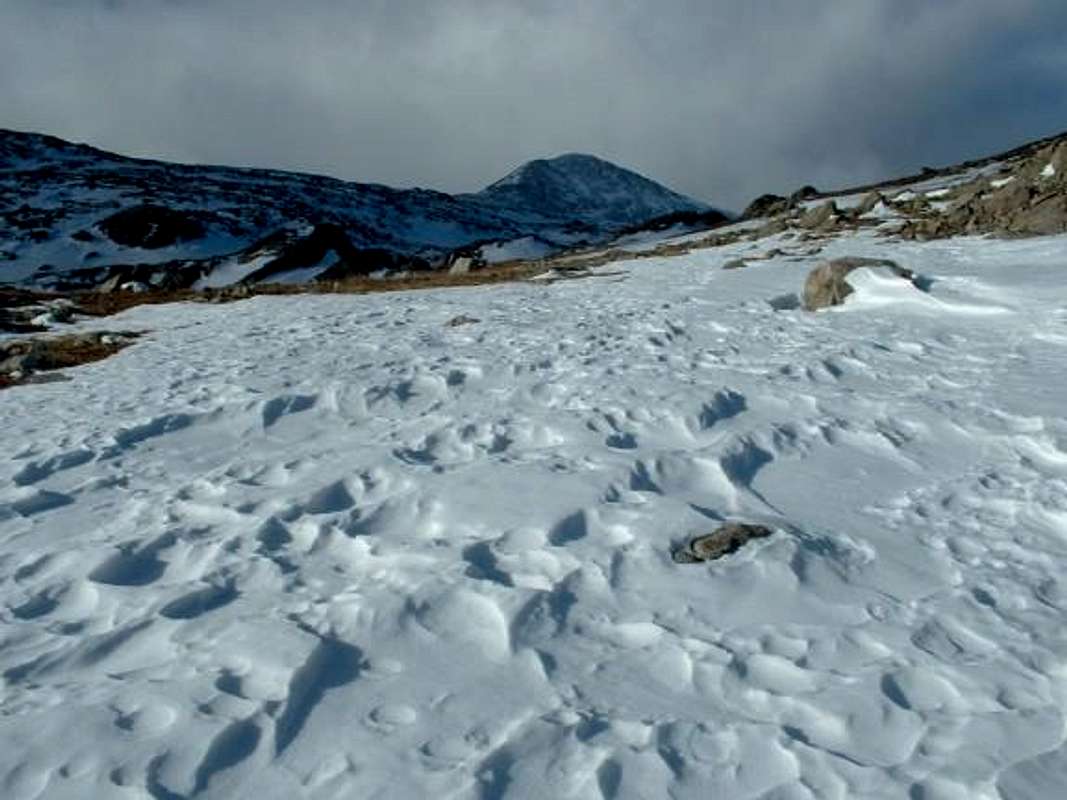 | Regardless of where exactly you begin your ascent, continue uphill into what seems like one large basin after another. Eventually you will come to the highest basin, with McNamee Peak right in front of you, Traver on your left (south) and Clinton on your right (north). |
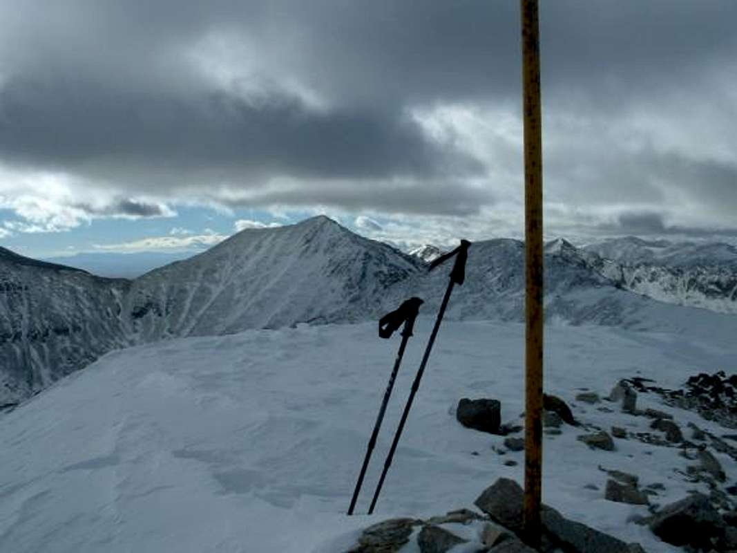 | I had a little difficulty determining which was the actual summit of Clinton Peak when I was right underneath it. Simply turn right and go up the slopes to your north and you will find the highest point when you get to the top of the ridge. There is a tall yellow (metal) pole at the summit. |
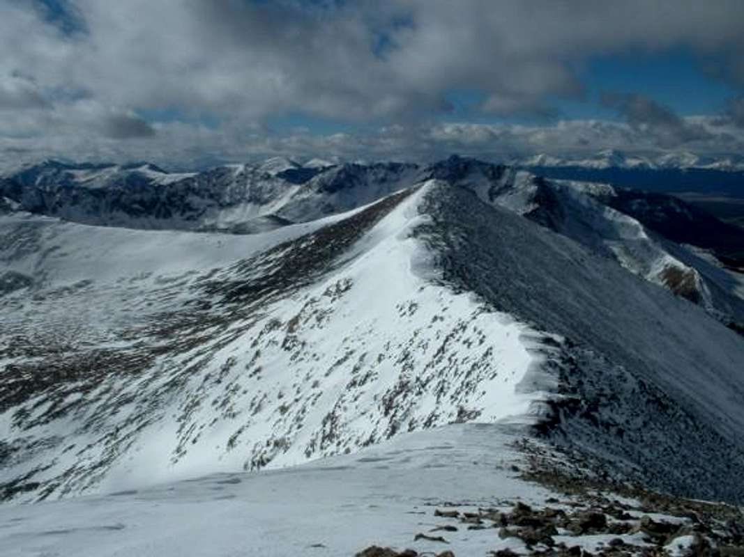 | From there it was a 25 minute walk (probably a good bit shorter without snow) down and then up and over a false summit to get to McNamee Peak. |
 | The walk down to the McNamee/Traver saddle was a very easy one. From the saddle on up to Traver's summit is steep at places and a fun scramble to the summit. Again, it took me 25 minutes between summits, but with some not-so-optimal snow conditions. |
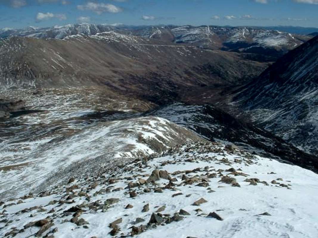 | From Traver's summit, descend the peak's gentle east ridge and drop back down into the basin to complete your loop. Exit the mountains via the same dirt road upon which you entered. |
As an alternate exit, you could drop down to the Traver-Democrat saddle (Traver's south ridge- class 2), then drop into that basin and meet the Wheeler road farther down in the valley. This makes a larger loop and is a bit longer of a tour.
Essential Gear
Nothing special. In the winter, depending on the amount of snow, snowshoes would be helpful. Crampons would even be useful if there is abundant ice or hard snow along the ridges.
Miscellaneous Info
If you have information about this route that doesn't pertain to any of the other sections, please add it here.