Toggle navigation
Mountains
Routes
Images
Trip Reports
Forum
What's New
People
Areas & Ranges
Articles
Trailheads
Canyons
Huts & Campgrounds
Albums
Logistical Centers
Fact Sheets
Lists
Custom Objects
Gear
Plans & Partners
WELCOME TO SUMMITPOST
SIGN IN
REGISTER
Mount Mansfield
Additional Parents
Image
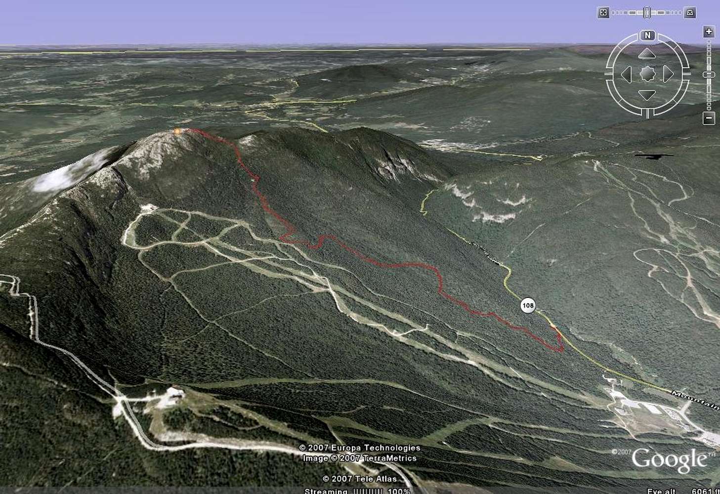
Mt. Mansfield 3D View
View High-Resolution Image
Mt. Mansfield 3D View
Long Trail, as seen on Google Earth. I used a Garmin Forerunner 305 to map out my hike up Mt. Mansfield. October 2007
« PREV
NEXT »
TJ311
on
Oct 14, 2007 8:15 am
Comments & voting
Other parents
Lat/Lon:
44.54400°N / 72.815°W
Image Type(s):
Hiking
Image ID:
347320
4088 Hits
73.06
% Score
3
Votes
Log in to vote
Comments
No comments posted yet.
to post!
Don't have an account?
Mount Mansfield
(Mountain/Rock)
« PREV
Viewing
#90 of 174
GALLERY
NEXT »
TJ311's Image Gallery
« PREV
Viewing
#81 of 253
GALLERY
NEXT »
Hiking Photos
(Album)
Loading....
×
You need to login in order to vote!
User Name
Password
Remember me
Forgot your password?
Log me out when I close my browser.
Keep me logged in all the time.
sign in as a user
Don't have an account?
Register now for FREE
Rating available
Suggested routes for you
People who climb the same things as you
Comments Available
Create Albums
Register Here


