Mount McLoughlin Solstice
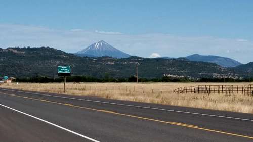
I drove to the trailhead Friday after work for my first ever Mount McLoughlin climb as part of my I’m-Not-That-Damn-Old-Yet Summer Tour and Solstice Celebration™. As I went through Central Point and White City and headed east on highway 140, I got my first look at the mountain and was surprised to see very little snow on its western slope. I had never seen McLoughlin when it was not covered with snow. I guess it has been a dry year...
![Mt McLoughlin]() View of Mt McLoughlin from the west
View of Mt McLoughlin from the westI continued past Fish Lake and turned up Fourmile Lake Road to the trailhead, and not finding an out-of-the-way flat spot to park there (and wanting to avoid bothering, or being bothered by others), I backtracked a bit and found a quiet little spot in the woods about a quarter-mile away where I could park well off the road and bed down in my car.
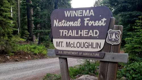
![Trailhead]() This is the place
This is the placeSaturday morning I dressed and enjoyed a small breakfast and a visit to the facilities at the trailhead (where you cannot see any trace of the mountain for a pre-climb ocular assessment). A gentleman was there who said he had been up to the summit the previous week, so I asked him
about the snow. His reply was very direct and simple: “You can do this climb in tennis shoes.” I had already figured on leaving the ice axe, gaiters and crampons in the car, but this made me feel better about that weight-saving gear reduction.
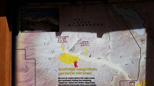
![Trailhead Sign]() See this? Don't do that.
See this? Don't do that.There’s a box at the trailhead for a $5 parking permit, but it was covered by a plastic bag that had been ripped open. There were no pay envelopes in the box, so nobody was paying for their stay at the trailhead, and I hoped my Northwest Forest Pass would suffice. I suspect the additional fee was the trailhead toilet-paper fund, as the facilities were notably lacking in that department.
I started up the trail at about 7:30 AM. It’s a very gentle trail for the first couple of miles and you are in the trees without any views of the mountain for the longest time. There are two clearly-marked trail intersections in the first mile-and-a-half where you join, and then diverge from the Pacific Crest Trail. You pass within a quarter-mile of Freye Lake, but I never saw the lake or any sign to reach it. As the trail gets steadily steeper, it gets fainter and is difficult to follow in some areas.
It was a warm, sunny day so I stopped and traded my long pants for shorts, and strapped my hefty knee brace onto my cranky knee. There were some mosquitoes, but they weren’t bad at all. I almost regretted applying my pre-hike DEET because it smells so bad.
I was finally getting some glimpses of the mountain here and there in the forest, and just before breaking out of the trees I stopped for a snack and exchanged pleasantries with a couple of other small parties of climbers as they passed by.
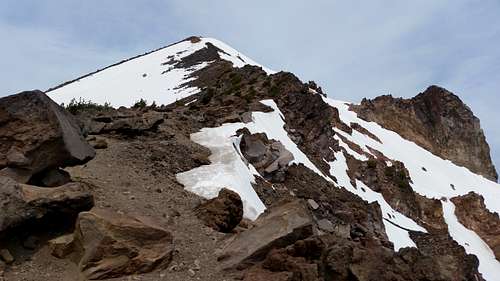
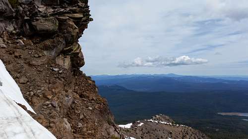
Proceeding above the tree line onto the southeast ridge, I could finally see the mountain and the last 2,000 feet or so to the summit. The east bowl was full of snow and the views in every direction were spectacular on this beautiful solstice day. Mount Shasta was clearly visible to the south, and the horn of Mount Thielsen was in the distant northeast sky. There was a large, very steep snowfield immediately south of the summit with some glissade tracks in it. That must have been a hell of a ride down and then a painful traverse back east over to the ridge trail, I thought.
![Unnamed Image]() Looking up the ridgeline
Looking up the ridgeline![Looking northeast from the ridgeline]() Looking northeast from the ridgeline
Looking northeast from the ridgeline
As with most climbers’ trails, this one has many options as spider-web trails go off in every direction on both sides the ridgeline. There was a very chilly west wind so I tried to spend as much time as possible on the east side of the ridge, but it was not always possible as the east side has most of the exposure on the route. All of us climbers tried to pick our way up the ridge along path segments of least resistance, but a fair amount of boulder scrambling seems to be required no matter which way you go, and it is hard work.
There was some climbable snow on the east side of the ridge, but most of us opted not to go that route as a slip would almost certainly mean a long fall into the bowl. I felt slow going up the ridge, but was making progress comparable to others, so I just continued my scrambling-and-resting pattern.
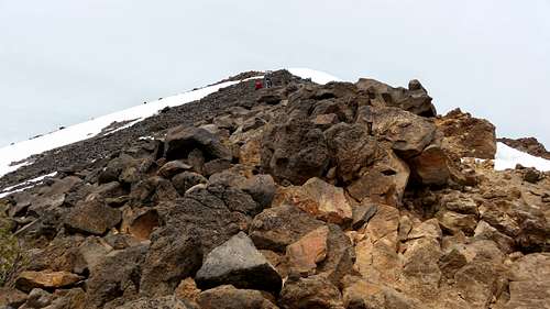
![400 vertical feet to go]() 400 vertical feet to go
400 vertical feet to go
Much huffing and puffing later, I started up the final snowfield leading to the summit crest just as two gentlemen were coming down. They did not have hiking poles and they looked like they really wanted some. It was steep and slippery, and as we met in the middle I stepped aside to let them continue their cautious progress downward, watching as they stepped tentatively into others’ footprints.
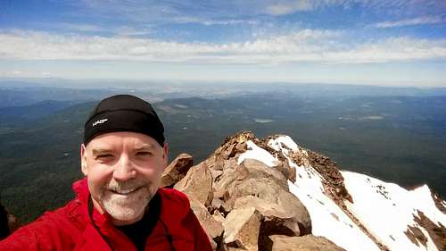
I made it to the top of the snowfield and I crested the ridge onto the rocky ridge. There’s a short knife-edge walk on some more snow from there over to a large bouldery summit area. I joined a friendly group of about ten folks there who were all together and looked a little attire-challenged for such a trip. Tennis shoes, jeans, and one heavily-perfumed woman with a tiny and very uncomfortable-looking thong under her jeans. I know because it was impossible to avoid seeing her plumber’s crack and regrettable choice in undergarments as she later descended in front of me.
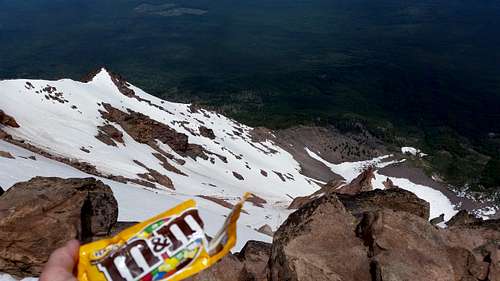
At any rate, I took some summit selfies and other pictures and video, and just enjoyed the grand view while I ate my summit candy. The cold wind was warmer and calmer up here, the rocks were dry and it was just a beautiful and comfortable place to hang out. The large party left and I had the place to myself for a while, which is always a treat.
![Stolen Benchmark]() Stolen Benchmark
Stolen Benchmark
![Summit Candy]() Summit Candy
Summit Candy![Summit Selfie]() Summit Selfie
Summit SelfieAfter a bit I went back to the southern edge of the summit ridge and chatted with three folks from Portland who had been leapfrogging me on the way up. As I went to leave them, I said goodbye and they said they were certain they would see me again on the way down, but gravity is my friend and I was pretty sure I was going to make good time on the descent.
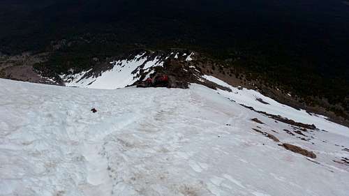
As I started down I saw the large party of ten from the summit now working their way down the snowfield. They were side-by-side, arms locked tightly together, side-stepping down in little baby steps into the preceding person’s kicked-in footsteps. A little odd, but when everyone is trying to descend steep snow in tennis shoes, I guess you gotta do what you gotta do.
![Starting down]() Starting down
Starting down
Every bit of information you may read about climbing Mt McLoughlin seems to include cautionary tales of hikers taking the wrong descent line off the summit and ending up too far south to easily or safely traverse back over to the southeast ridge and the main trail. As I discovered, this is probably because it’s difficult to follow the rocky ridge down, and it’s very easy to be lured into taking some southerly tacks to circumnavigate the many obstacles. I did some southerly excursions on my way down, but I didn’t get too far off track and my traverses back to the east filled my boots with scree, but otherwise weren’t too bad.
Leaving the ridgeline and going back into the forest, trail-finding on the way down through the faint-trail section was made much easier by small spots of white paint that someone has applied to many rocks. Generally when you were at a white spot, you could see the next white spot further down the trail. They’re painted in such a way that I didn’t really notice them much on the way up, but they’re great guides for the descent.
It had taken me about 4:45 to summit (slow, I know), but I plunge-stepped down the snowfields and tromped down the trail in pretty short order and made it from summit-to-car in 2:40 (including one stop to dump the dirt and rocks out my boots). And as is my custom, I ran out of water about an hour before I ran out of trail. Three liters is not enough on a
warm day.
The trailhead sign says it’s an 11-mile roundtrip, but I think it’s really more like 10. But whatever it is, it’s a beautiful trip and well worth it.


Comments
Post a Comment