
-
 7435 Hits
-
 76.44% Score
-
 7 Votes
|
|
Mountain/Rock |
|---|---|
|
|
49.05885°N / 124.64642°W |
|
|
Hiking |
|
|
Spring, Summer, Fall, Winter |
|
|
4790 ft / 1460 m |
|
|
Overview
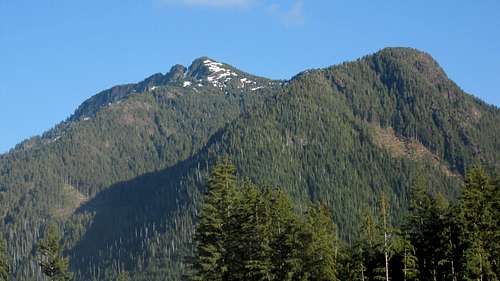
Mt Spencer NW Aspect
Many visitors to Vancouver Island come to hike the world famous West Coast Trail and at least half of them drive the gravel road between Port Alberni and Bamfield in order to access the northern trailhead at Pacheena Bay. Few, if any, of these visitors pay any mind to the mountains they drive through along the way. In fact not that many locals do either unless it’s to hunt or fish in the lower reaches.
Many of the mountains are heavily impacted by logging. Neverthless they still offer much of interest once the climber it above the carnage. And let’s not forget the convenient access that the industrial roads afford the climber.
The mountains don’t seem to be acknowledged as belonging to any particular range. They just seem to fall under the general aegis of the southern limit of alpine terrain on the island.
Mt Spencer lies roughly in the centre of a group about 15 km east of the Alberni Inlet of which Mts McQuillan and Olsen form the northern and southern limits with a mish mash of heavily logged peaks in between. Although views to the north are rather spoiled by logging, those to the south are very fine indeed.
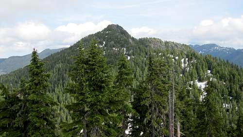
Mt Spencer S Aspect
Getting There/Approach
Vancouver Island can be reached directly by air from Toronto, Vancouver, Seattle, Calgary, Edmonton and recently from San Francisco to either Victoria, Nanaimo, Comox or Campbell River and by ferry from Port Angeles to Victoria on The Coho and on BC Ferries from Vancouver to Victoria or Nanaimo. Public transport on the Island is notoriously poor and anyone arriving by air would be advised to rent a car.Access to Mt Spencer involves steep, rough, logging roads with some deep water bars. Once off the the main logging arteries onto the approach spurs, a 4WD vehicle with high clearance is pretty well essential in order to reach the trailhead. Chains will also be required if the roads are still under snow. This can occur well into May.
From Parksville or Qualicum Beach on the Island Highway 19, take highway 4 west towards Pt Alberni and Tofino. As you approach Port Alberni watch for a signed left turn to Bamfield. Follow the signs through town and, once the last houses are left behind, onto gravel. This is the Bamfield Road and is wide and well surfaced.
From the outskirts of PA drive ~22 km and find Corrigan Main on the left. Take Corrigan Main for ~ 800m and find branch/spur C7 on the left. Drive up the spur for 3.3 km to 10 U 376632 5434899 where you will find another branch on the right. This branch winds its way around a ridge and the head of a high valley before coming to an end (2012) at 10 U 378911 5434157. Park here.
South Ridge Route
The south ridge proper lies to the northeast from the start point on the far side of a knoll that just pokes into the alpine at 1,360m. Locate a flagged route from the start point on the road and make your way through a short initial logging slash phase aiming for the first flag.Once on route, follow the flags or make your best route up some easy angled slabby ground into the forest. Continue ENE for ~ 500 metres up towards the top of the alpine knoll. Depending on conditions, it might be possible to contour the summit on the left (north) thereby avoiding some unnecessary elevation loss and gain.
Drop very steeply 50-60 metres northeast from the knoll into a wide bowl studded with tarns. Walk northeast across this area to find the south ridge proper.
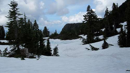 Tarn Area Below S Ridge | 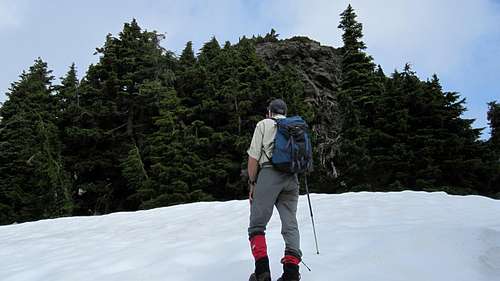 Mt Spencer Summit Block | 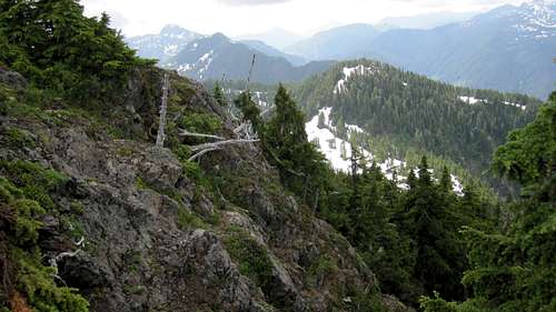 Mt Spencer S Ridge | 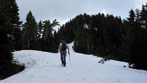 Alpine Knoll |
There is a summit register to sign and a geocache which proclaims itself the hardest of such to reach on Vancouver Island. I doubt that. Views to the north are somewhat unfortunately marred by logging detritus but are very fine to the south, particularly to Mts Grey and Olsen.
Route Summary:
Distance: ~ 8km return
Net Elevation Gain: ~350 metres
Total Elevation Gain: ~ 550 metres
Time: 5-6 hours return
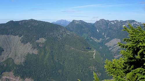 Mt Spencer Summit View N | 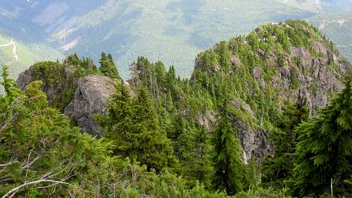 Mt Spencer E Ridge | 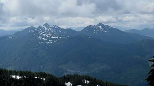 Mt Spencer Summit View S |
Red Tape/Safety Considerations
No red tape.Be aware that there’s no such thing as an intentions system in this neck of the woods. Make sure, therefore, that you have left a detailed trip plan with someone responsible. The RCMP and the appropriate SAR agency will respond in an emergency but it is up to you to have the mechanism in place that will initiate the call-out process if it becomes necessary.
I did not check for cellular service on Mt Spencer. Given the proximity to Port Alberni I believe that there would be service at least somewhere on the mountain.
Camping
Most if not all will day trip Mt Spencer. If you need to car camp for an early start – as we did – there is plenty of room at the start point. Or go and explore some of the other branches higher up C7 that get very high on the ridges west of Spencer and offer wonderful views.Useful Links
Island Alpine – A Guide to The Mountains of Strathcona Park and Vancouver Island, Philip Stone, Wild Isle Publications, 2003, ISBN 0-9680766-5-3 and/or visit Island Alpine Climbing GuideFor precise directions get hold of a copy of Backroad Mapbook. Volume 7: Vancouver Island
Weather
To the westTo the east