Mt Stuart Climb -Onward
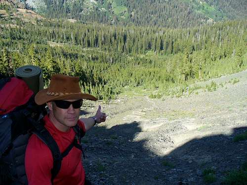
On August 15, my buddy George and myself set off to take on Mt. Stuart. This was finally the weekend where we would see if all those Manastash hikes payed off. It took us about a month to get in a shape that we figured would enable us to climb this mountain successfully. We climbed to Longs pass and looked down the snake shaped climbers trail going down the face of Longs.
![Longs pass route to Stuart]() Looking down on the Climber trail down Longs Pass.
Looking down on the Climber trail down Longs Pass.
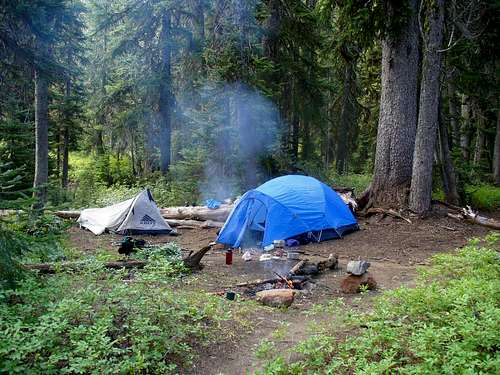
With heavy packs of 45 lbs, we stumbled our way down the climbers route to the lower bench we planed to use as our base camp. The main valley camp on Ingalls can get a bit crowded, FYI. Part of our thinking was less climb back out of the valley when it was time to go home, tired and beat as I knew we would be.
![basecamp]() Base camp on the bench above Ingalls creek.
Base camp on the bench above Ingalls creek.The Climb
So the climb began at 8:30 am up to the meadow where you enter at the edge of the forest/meadow interface. This route takes you to Cascadian Coulier. We started off on a good trail that became sand and gravel. As we climbed up the route further, it was straight up the chute, with a mix of boulders and other talus.
![Cascadian coulier]() Looking up Cascadian
Looking up Cascadian
We did out best to stick to the rock, as the sandy stuff was a real pain, and you slide down hill a lot with wasted energy. There was no water anywhere, as we guessed, thus we carried 3 liter military water bags. There was some snow pack left up top, so I used some of that to augment my supply. The lower 2/3rds of the Mountain is like this, talus, sand and boulder fields. We chose to boulder when we could. Once you hit the upper 1/3, you have no choice but to boulder. There is one chute you have to climb up that is mixed gravel and boulders, and it is a real pain due to its steep nature. Once past this chute, it is bouldering city.
![Bouldering or climb]() Upper boulder fields
Upper boulder fields
Eventually these lead to the false summit and even steeper boulder fields that require some bouldering skill and light climbing. Some of these scrambles are near shear cliffs, so take it slow is my motto.
![False summit]() Upper boulder fields
Upper boulder fields
As you can see, the trail is not evident because there is none. All you have to go on is what looks like it is less impossible to climb..lol. So just follow the darn rock cairns. After a long set of mini climbs up boulder chutes, we finally hit the real summit. Well worth it I would say, what a view!
![the tip top]() Main summit
Main summit
Funny thing about mountains, once you summit you have to climb down. We took route two to the east of Cascadian. I don't recommend this route as it peters out in the middle, causing lost time, sharp decent over a steep waterfall, and nasty slippery scree and sand. The climb up and back, well it took us about 11 hours with lots of stops and food/drink/ find more water events. Good luck and god speed......-Michael


Comments
Post a Comment