|
|
Mountain/Rock |
|---|---|
|
|
16.44658°S / 152.25542°W |
|
|
Hiking |
|
|
Spring, Summer, Fall, Winter |
|
|
1220 ft / 372 m |
|
|
Overview
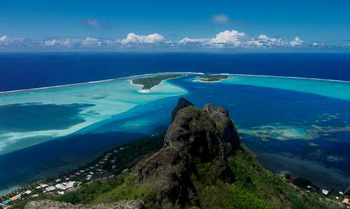
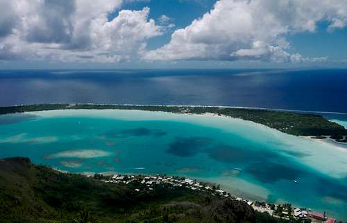
This mountain is known variously as Teurafaatiu, Teurafaatui, Nuupere, or Nuupure. Whatever the name, it is the highest (and almost the only) peak on Maupiti island, and the views, as expected, are stunning.
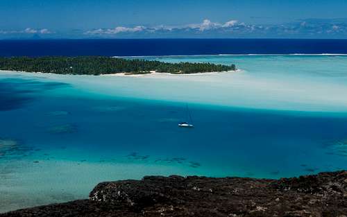
From the summit you can see much of the lagoon and a number of the surrounding motu, as well as Bora Bora and Raiatea on the horizon if it's a clear day.
Even if getting to the top of the island is not in your list of things to do on Maupiti, definitely try to climb as far as the first viewpoint, about 10 minutes and 100 meters up. The view is almost as impressive as from the top, and it provides a perspective on the island that you cannot get from street level or from the water.
A number of people discussing this hike online claim that a guide is necessary. We were advised by our hosts that no guide is needed, and they were right. The route-finding is very straightforward: as of September 2013 the trail was clear and well-travelled, marked with arrows, with no significant branching paths, and an obvious trajectory (up to the summit, then back down). Ultimately, Maupiti is simply too small to get lost on for any length of time.
Note however, this is not a gentle stroll. The path is steep and difficult in places, with some rock scrambling and rope sections. It is unsuitable for inexperienced hikers, with or without a guide. Also do not attempt it when the ground is wet. The first section to the viewpoint may still be doable, but take extra care.
Time: 2 hours
Elevation gain: 360 meters
What to bring:
- Footwear with good traction
- Two litres of water - hiking in the tropics is sweaty business
- Hat, sunscreen, sunglasses
Route
The hike begins with a flight of wide concrete steps, almost directly opposite the Snack Tarona ("the restaurant") in the main village.
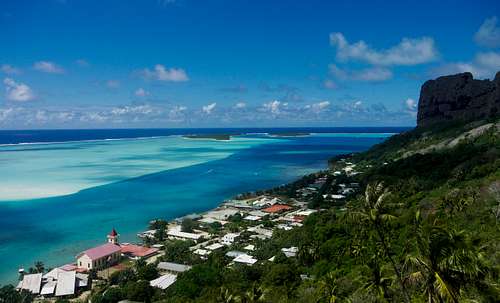
It quickly becomes a steep trail leading up 100 meters to a rocky outcrop with views of the village, motu Tuanai (with the airstrip) to the west, and the twin motu of Pitiahe and Tiapa'a to the south.
From here it is largely a forest walk until you get to the second viewpoint - a narrow crag about 3/4 of the way up. Much of the path is signposted with spray-painted orange arrows. Some of these arrows point in rather arbitrary directions, but at least you know you are still on the trail if you see them. There are also some sections of rock and a couple of ropes along this part of the trail. Test each foothold and each rope thoroughly before putting weight on it. Do not attempt to climb wet rock, and remember that some of these sections are harder on the way down than on the way up.
After the second viewpoint it's a short final ascent to the peak. Teurafaatiu has two peaks - both are reachable, but views are only available from the eastern, slightly lower one, where the trail emerges. The rocky landing here is quite exposed, so watch your step. Enjoy the view from one of Polynesia's most beautiful spots!