SummitPost.org
  • Mountains
  • Routes
  • Images
  • Trip Reports
  • Forum
  • What's New
    • People
    • Areas & Ranges
    • Articles
    • Trailheads
    • Canyons
    • Huts & Campgrounds
    • Albums
    • Logistical Centers
    • Fact Sheets
    • Lists
    • Custom Objects
    • Gear
    • Plans & Partners
  • SIGN IN
  • REGISTER
  • Images

Images


Viewing: 1-30 of 30
Viewing Images attached to Album: My informational images
View All Images
Add Image to My informational images: Create New Attach Existing
peterbud peterbud
Score: 80.49% Views: 8402
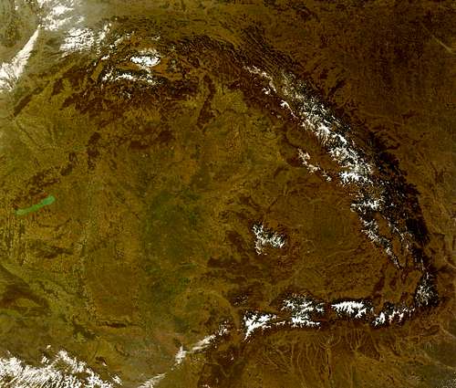
Satellite image of the Carpathians

Satellite image of the Carpathians

My informational images

Created: Dec 07, 2007

peterbud peterbud
Score: 77.48% Views: 3242
Highpoints of Börzsöny

Highpoints of Börzsöny

My informational images

Created: Mar 17, 2008

peterbud peterbud
Score: 75.81% Views: 2773
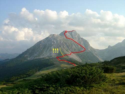
Safe and less safe route to Kom Vasojevićki

Safe and less safe route to Kom Vasojevićki

My informational images

Created: Aug 15, 2008

peterbud peterbud
Score: 75.81% Views: 3136
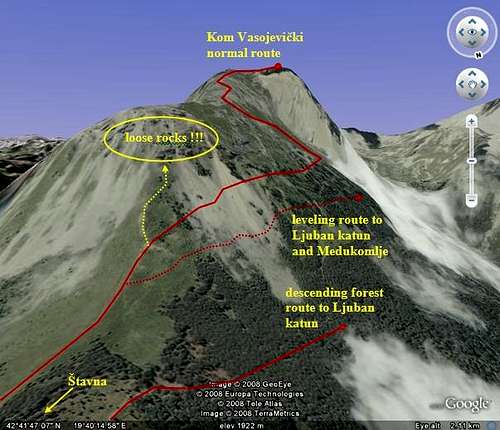
Routes on Kom Vasojevički

Routes on Kom Vasojevički

My informational images

Created: Aug 28, 2008

peterbud peterbud
Score: 74.92% Views: 2777
Borsa > Rodna trail transect

Borsa > Rodna trail transect

My informational images

Created: Jun 23, 2007

peterbud peterbud
Score: 74.01% Views: 2170
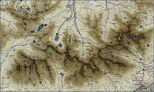
High Tatras overlay map

High Tatras overlay map

My informational images

Created: Oct 26, 2007

peterbud peterbud
Score: 73.06% Views: 2483
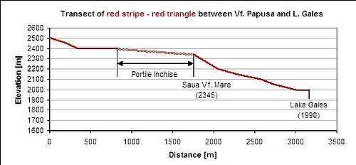
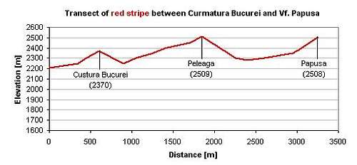
Red stripe to Păpuşa

Red stripe to Păpuşa

My informational images

Created: Oct 07, 2007

peterbud peterbud
Score: 73.06% Views: 9074
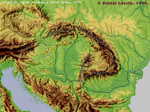
The Carpathians and their neighbors

The Carpathians and their neighbors

My informational images

Created: Dec 03, 2007

peterbud peterbud
Score: 73.06% Views: 3749
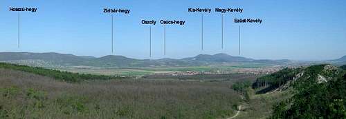
Southeastern part of Pilis - labeled version

Southeastern part of Pilis - labeled version

My informational images

Created: Feb 13, 2010

peterbud peterbud
Score: 73.06% Views: 1252
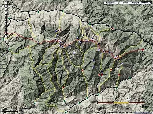
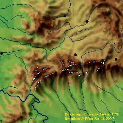
Marked trails of Rodnei Mountains

Marked trails of Rodnei Mountains

My informational images

Created: Jul 22, 2008

peterbud peterbud
Score: 72.08% Views: 1376
Route via the main ridge

Route via the main ridge

My informational images

Created: Sep 16, 2009

peterbud peterbud
Score: 72.08% Views: 1220
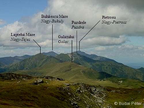
The central part of the main ridge - notated

The central part of the main ridge - notated

My informational images

Created: Sep 18, 2009

peterbud peterbud
Score: 72.08% Views: 1546
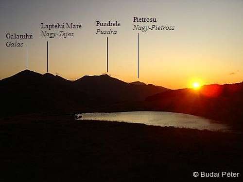
Golden sunset - notated

Golden sunset - notated

My informational images

Created: Sep 21, 2009

peterbud peterbud
Score: 72.08% Views: 2581
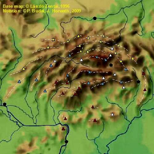
Nortwestern Carpathians

Nortwestern Carpathians

My informational images

Created: Dec 03, 2007

peterbud peterbud
Score: 72.08% Views: 2521
Southern Carpathians

Southern Carpathians

My informational images

Created: Dec 03, 2007

peterbud peterbud
Score: 72.08% Views: 2022
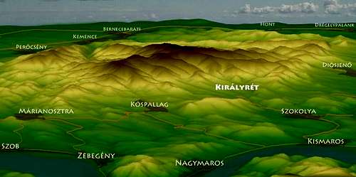
Digital elevation model of Börzsöny

Digital elevation model of Börzsöny

My informational images

Created: Dec 03, 2010

peterbud peterbud
Score: 72.08% Views: 1986
Northeastern Carpathians

Northeastern Carpathians

My informational images

Created: Dec 06, 2007

peterbud peterbud
Score: 71.06% Views: 881
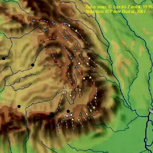
Southwestern Carpathians

Southwestern Carpathians

My informational images

Created: Jul 01, 2009

peterbud peterbud
Score: 71.06% Views: 1392
Route via the Lala valley

Route via the Lala valley

My informational images

Created: Sep 16, 2009

peterbud peterbud
Score: 71.06% Views: 1772
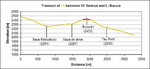
Yellow stripe to Bucura I

Yellow stripe to Bucura I

My informational images

Created: Nov 04, 2007

peterbud peterbud
Score: 71.06% Views: 2041
Normal route from Borşa

Normal route from Borşa

My informational images

Created: Sep 17, 2009

peterbud peterbud
Score: 71.06% Views: 1543
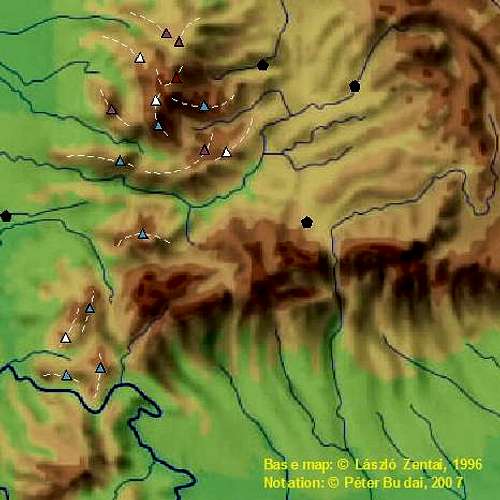
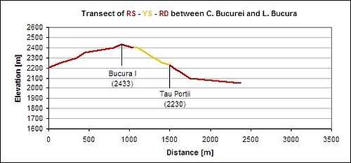
Red stripe and red dot to Bucura I

Red stripe and red dot to Bucura I

My informational images

Created: Nov 04, 2007

peterbud peterbud
Score: 71.06% Views: 1174
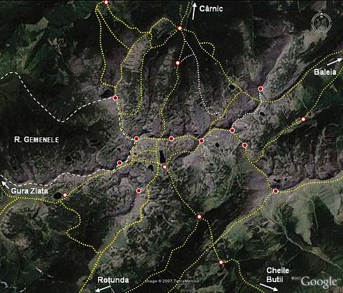
Overview of central Retezat

Overview of central Retezat

My informational images

Created: Nov 10, 2007

peterbud peterbud
Score: 71.06% Views: 3042
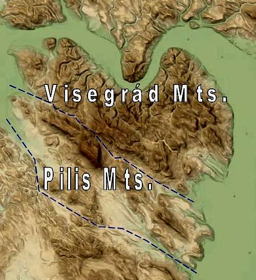
Overview map of Pilis and Visegrád Mountains

Overview map of Pilis and Visegrád Mountains

My informational images

Created: Jan 25, 2010

peterbud peterbud
Score: 71.06% Views: 1754
Eastern Carpathians

Eastern Carpathians

My informational images

Created: Dec 05, 2007

peterbud peterbud
Score: 71.06% Views: 1674
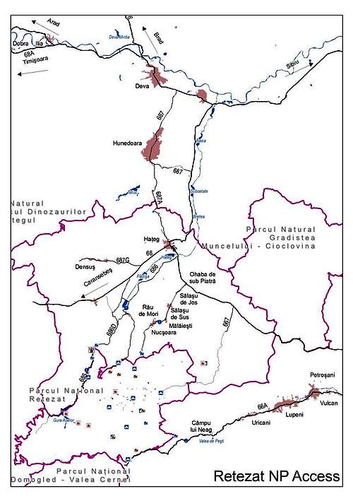
Access of Retezat

Access of Retezat

My informational images

Created: Dec 07, 2007

peterbud peterbud
Score: 71.06% Views: 1437
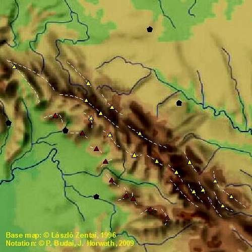
Red stripe to Peleaga

Red stripe to Peleaga

My informational images

Created: Oct 01, 2007

peterbud peterbud
Score: 71.06% Views: 1500
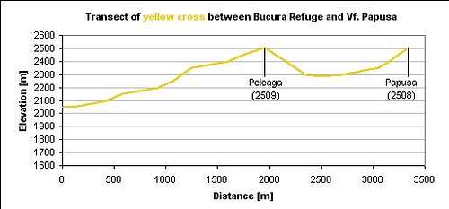
Yellow cross to Peleaga

Yellow cross to Peleaga

My informational images

Created: Oct 01, 2007

peterbud peterbud
Score: 71.06% Views: 1595
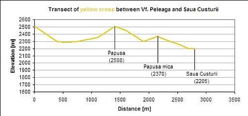
Yellow cross to Păpuşa

Yellow cross to Păpuşa

My informational images

Created: Oct 07, 2007

peterbud peterbud
Score: 0% Views: 1387
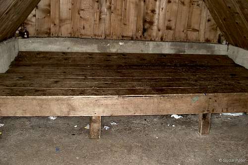
Inside the bivouac

Inside the bivouac

My informational images

Created: Aug 26, 2010
Viewing: 1-30 of 30
Recent Forum Posts
Current Time: 6:06 am
Thread Time
Personal Websites 1:22
What happened to the skiing? 11:45
FS: Scarpa Gea 24.5 Like New 11:28
User name change request 6:02
PM the Elves 5:59

SummitPost

  • FAQ
  • About
  • Terms of Service
  • Site Geo-Map
  • Contact

Tell Others about SP!

"Nihilists! I mean, say what you like about the tenets of National Socialism, Dude, at least it's an ethos."   --Walter Sobchack   

© 2006-2021 SummitPost.org. All Rights Reserved.

You need to login in order to vote!

Forgot your password?

Don't have an account?

  • Rating available
  • Suggested routes for you
  • People who climb the same things as you
  • Comments Available
  • Create Albums
Register Here