
|
|
Route |
|---|---|
|
|
36.26305°N / 137.68674°E |
|
|
Hiking |
|
|
Spring, Summer, Fall |
|
|
Less than two hours |
|
|
T1/2 |
|
|
Overview
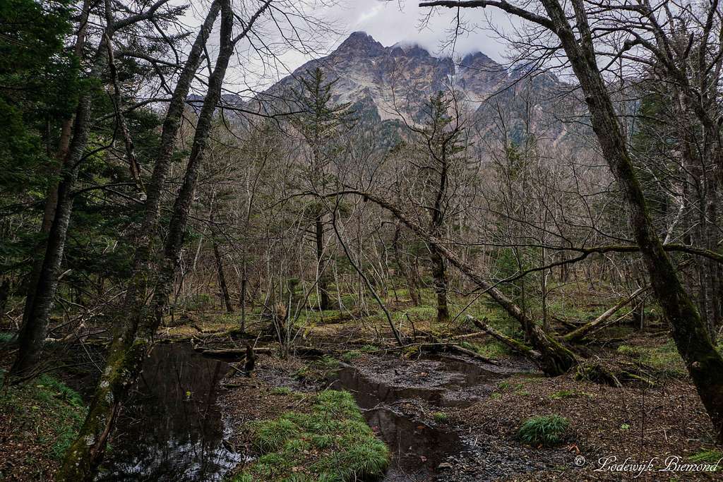
Myojin-dake (2931 m / 9616 ft) from the Forest
The trail from Myojin to Tokusawa is a scenic and easy trail in the Kamikochi valley in the Japanese Alps. The trail starts at Myojin, which is recognizable by the large wooden bridge carrying the same name: Myojin bridge. This trail is less popular and therefore also less crowded compared to the routes from the Visitor Center to Myojin. Because this route is somewhat more distant to the visitor center, most people do not come over here. As a result, the trail from Myojin to Tokusawa is quiet and scenic. The trail is marked very well and relatively flat. The gradation is somewhere between T1 and T2, an easy hiking path. It takes about 60 minutes to complete this trail one way. Return is the same way back so it takes two hours in total.
The trail is used by many climbers as well since Kamikochi is a starting point for many climbers who are heading out to Hotaka-Dake (3190m) and Mount Yari (3185m, Yariga Take). At the end of the trail is a big mountain hut named Tokusawa Lodge and besides this hut also a big campsite is present. The trail goes mainly through the forest. In early summer it is possible to see large outcrops of wind flowers, also there is an old pond and marshes along the trail. On the last part of the trail the path starts to go along the Azusa-gawa River offering nice views of the river and the surrounding mountains. The total distance of the trail is 3.7 km one-way.
Route Overview
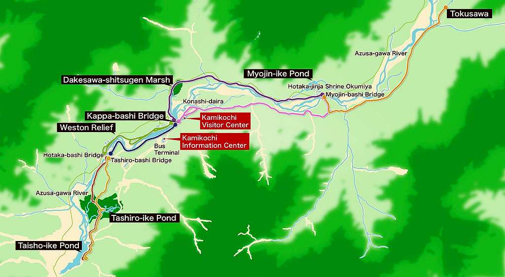
Kamikochi Trail Overview Map
Route Map

Myojin - Tokusawa Trail MAP
Route description
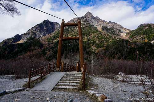 | The route starts from the Myojin Bashi bridge. Follow the trail from the bridge towards the east until you reach the big wooden signpost. |
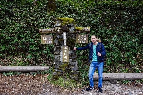 | Keep following the path until you reach this wooden signpost. Take a left here; this is the direction of the signpost that says ''3,4 km'', thus left on this photo. This is the true start of the trail to Tokusawa |
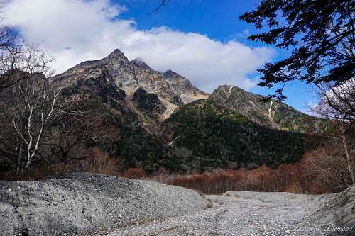 | On the first part of the trail you can see Mount Myojin Dake at all time looming above you. At this point you pass a river which is eventually joining the Azusa river. After passing the river you will encounter another signpost. Do not take a right here, but move straight forward. |
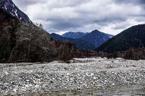
 | The trail steepens a bit and the views towards the Azusa river are very nice. At this point the trail goes into the forest. |
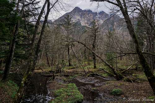 | The trail goes through the forest and passes several marshes and ponds. Behind still is Mount Myojin Dake. |
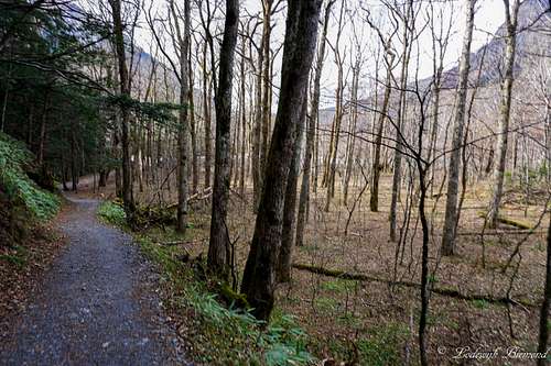 | The trail is easy (T1,2) and is easy to recognize. You won't get lost. |
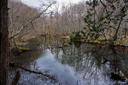 | There are some small ponds next to the path. This is the largest one, the Furuike pond. |
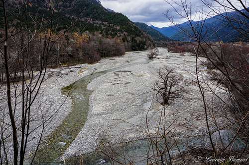
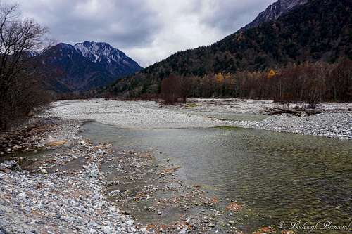 | On the last part of the trail the path leaves the forest and goes alongside the Azusa river. You are almost there. You can spot Roppyakusan mountain. |
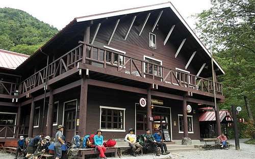 | Tokusawa Mountain lodge. This is the ending point of the route. Return in the same way. |
 | View from the Azusa river at Tokusawa. Ending point of this route, but starting point for climbs of Hotaka -Dake (3190m) The route towards this mountain goes in the direction this photo was taken. |
Getting There

Kamikochi Route Map
Access by train and bus: Take the Matsumoto Dentetsu Line from Matsumoto Train Station to Shin-Shimashima (30 minutes), followed by a bus ride to Sawando (60 minutes). You could also take a bus to Sawando/Hiraju directly. It is a 90 minute journey and you can meet the bus in front of the Matsumoto bus terminal located across the street from Matsumoto JR train station. The last option is preferable in my opinion. The bus ride goes directly to Sawando/ Hiraju and offers great views of the Japanese Alps. Very recommended! The same direct bus connection starts from the bus Terminal opposite to the Train station in Takayama. From here it is a 75 minute ride to Hiraju, from where you can get a bus or Taxi into Kamikochi.
Access by car: The road to Kamikochi is closed to private cars just below the last tunnel at Sawando. You can park your car at Sawando for 500 yen a day, and catch a bus or taxi into the park. The parking outside of Kamikochi is about 50 minutes by car from Matsumoto JR train station. When coming from Takayama it will take up to 60 minutes by car to get to Hiraju. From here you can take a bus or Taxi into the park.
This website describes all access routes to Kamikochi very well. Be sure to check this if you are planning to go to Kamikochi.
Essential Gear
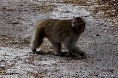
Japanese Macaque monkey
Weather & Climate

Kamikochi Climate Map