


Jerry L - Apr 14, 2005 9:00 pm - Hasn't voted
Pretty neat.How did you get the 3D effect ? It's pretty neat.

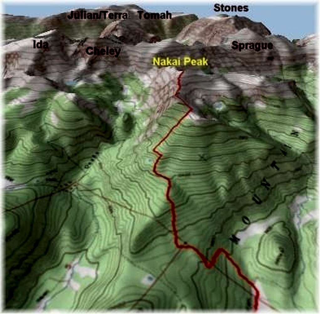
Kane - Apr 14, 2005 9:17 pm - Hasn't voted
Re: Pretty neat.Thanks, I purchased the 3D enhancement for the TOPO! program. The problem resides in creating a jpeg image because the program won't let you. The 3D program splits the screen in half, the left half showing the 3D and the other showing the actual topo.
So you have to "Print Screen" and drop the image in a photo editing program. Next, make it a jpeg and crop it, eliminating the topo part and keeping the 3D part. When you use "Print Screen" and crop it in half you get a very suspect image to post, thus the fuzziness. I wish I knew a better way to transfer the image to SP.
Jerry L - Apr 15, 2005 3:56 pm - Hasn't voted
Re: Pretty neat.It's beyond my limited talents with a computor. Good job though. You put up alot of really excellent, useful stuff.
Jerry

Karl Helser - Apr 15, 2005 10:54 pm - Hasn't voted
Re: Pretty neat.The software is called Terrain Navigator put out by a company called Maptech. I prefer National Geographic's TOPO software but I use Maptech's TN for the 3D effect.
Kane, thanks for the lesson. I always forget about the "print screen" option. That's a great idea.


Comments
Post a Comment