

-
 5319 Hits
-
 75.81% Score
-
 6 Votes
|
|
Route |
|---|---|
|
|
46.38761°N / 9.97687°E |
|
|
Mountaineering, Ice Climbing |
|
|
Most of a day |
|
|
Alpine AD |
|
|
Overview
This page will be kept in honour of Stefan Weber, the SP member known as kletterwebbi, the former owner of this page, died on May 28th 2004 in Southern France at the age of 37.
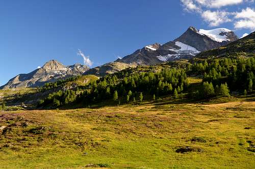
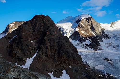
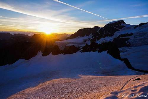
Piz Cambrena 3603 m is a mountain belonging to the Bernina massif located between Italy and Switzerland in the Western Rhaetian Alps. More precisely, the mountain is lying entirely in Switzerland in the Canton of Graubünden. between the Piz Palü and the Bernina Pass not far from the border with Italy. Piz Cambrena is one of the famous mountains of the "Festsaal der Alpen", as the mountain group around the Piz Bernina is called.
There is no easy route to the summit, all of them need at least basic rock and/or ice climbing knowledges. Nevertheless Piz Cambrena is climbed very often. The Diavolezza Hut is a real excellent starting point for Piz Cambrena allowing quite short approach. The most famous route is the traverse going up the NNW-buttress aka "Naso di Ghiaccio" ("Eisnase" = ice nose), a historic route opened in 1916 by Hans Frick, Christian Zippert and Hans Kasper. The descent is via Piz d'Arlas.
Getting there
To get to the Piz Cambrena travel to the Engadin. Villages like St. Moritz or Pontresina are good places to start. The best trailhead is the Diavolezza hut (2973 m). This can be reached by a cable car from the route to the Bernina Pass. For more info about the cable car see: Diavolezza. It's also possible to hike up from the road to the hut (it takes about 2-3 hours).
Start at the Diavolezza hut and follow the path of the regular route to the Piz Palü. After about one hour the Persgletscher is reached (nearby the Fuorcula d'Arlas). Crossing the glacier direction N brings you to a steep ice / snow field. On most days there should be a good path.
Route Description
Naso di Ghiaccio report - UIAA Scale
Summit altitude: 3603 m
Difficulty: Alpine AD, 55° on ice the nose and II UIAA on the rocks
Difference in level: 630 m from Refuge Diavolezza
Approach
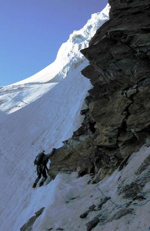
Starting from the Diavolezza hut follow the standard route to the Piz Palü: pass the ski lifts and head to the SE, following the access track to the glacier, which goes around to E the Piz Trovat and descends on the glacier through the Fourcla Trovat 3019. After about one hour the Vadret Pers (Persgletscher) is reached at about 2890 m. Crossing the glacier brings you to a steep ice-snow field. On most days there should be a good path. Start the route traversing the ice field from left to right reaching the base of the NNW-buttress.
Report
Follow the rock of the buttress up to a shoulder. There it starts a first snow field. Going up this snow field at the left side of the buttress. Great view to the seracs on the N-face of the Piz Cambrena. This brings you to a rock step. Climb this step, UIAA grade II, if it's icy it's possible to meet some difficulties. Above the step it starts the ice-nose. This are some pitches of moderate ice climbing up to 55°. Finally go up the harmless snow fields up to the summit. The right summit is the highest point of the Piz Cambrena. The route is shown by the red line in the routes overview photo.
Essential Gear
Crampons, rope, ice screws, one or two ice axes (depends on your personal possibilities), helmet.
Red Tape
No fees no permits required
Hut
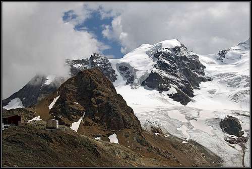
To climb the Piz Cambrena most people will start from the Berghaus Diavolezza. For Reservations: Berghaus Diavolezza Familie Lühr CH-7504 Pontresina Tel: +41 81 842 62 05 / Fax +41 81 842 61 58 (200 beds)
Camping
There are two campgrounds at Pontresina, one directly at the crossing Pontresina / St. Moritz about 3 km NW of Pontresina. The other one - Camping Plauns - can be found about 5 km SE of Pontresina below the Morteratsch glacier (direction Bernina Pass).
When to climb
It is highly advisable to perform this climb at the beginning of summer or in the spring on skis. From April (ski-mountaineering) to July.
Meteo
Guidebooks and maps
Guidebooks
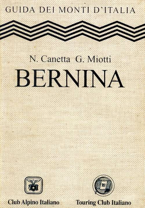
"Bernina" - N. Canetta, G. Miotti - Collana Guide dei Monti d'Italia CAI-TCI
"Bernina & Bregaglia Selected Climbs" - Lindsay Griffin ISBN: 0900523603
"Berninagruppe" Gebietsführer für Wanderer, Bergsteiger und Hochalpinisten - Walther Flaig ISBN: 3763324178 Bergverlag Rudolf Rother, München
"Clubführer SAC Bündner Alpen band 5" ISBN: 3859021311
Maps
"Bernina" sheet 1278 - CNS 1:25.000
In Memory of Stefan "kletterwebbi" Weber
A note from the SP staff Stefan Weber, the member we all used to know from his climbing pseudonym kletterwebbi, died on May 28th 2004 in southern France at the age of 37. Stefan joined SP early on in 2002 and contributed a number of excellent pages and routes to this site. He was an accomplished climber excelling in difficult alpine and technical routes. The Dolomites, especially the area around Gröden / Val Gardena were special to him, as it was his old ancestral home. Kletterwebbi was always willing to share his knowledge and experience with other climbers, mainly here on SP, but also on other sites. He contributed his expertise as webmaster of his local section of the German Alpine Club, where he also engaged in leading trips for fellow members. Besides his climbing and mountaineering activities he was a musician, a composer of contemporary music. Stefan will be greatly missed by us all.
This page will be kept in honor of kletterwebbi, one of SP's most talented, knowledgeable members, and without a doubt, one of our greatest fellow mountaineers.
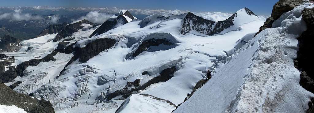
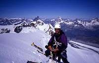
The picture was taken on the summit ridge of Lyskamm.
Miscellaneous Info
If you have information about this route that doesn't pertain to any of the other sections, please add it here.