
|
|
Mountain/Rock |
|---|---|
|
|
4.89065°N / 75.32373°W |
|
|
17470 ft / 5325 m |
|
|
Overview
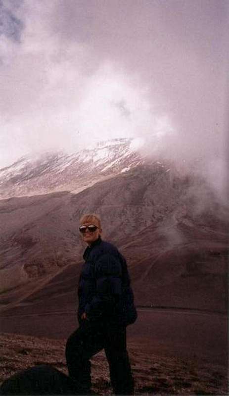
Nevado del Ruiz is one of the deadliest mountains in the world. It is a huge volcano with three craters and summits. The highest point is Arenus Crater at 5325 meters and emphasis of this page is on the highest summit. A second crater is named Pirania. Cráter de La Olleta, the third crater is at 4875 meters and will be covered on a separate page since the hiking route is different. When Arenus Crater is legally closed, you can usually climb Volcan de la Olleta for a good look and view of Arenus Crater.
Ruiz is a very easy climb for a mountain of its elevation. In fact, Arenus Crater is probably one of the easiest 5200 meter (17,000 feet) peaks in the world to climb, but acclimatization is very important. The weather around the volcano is also very nasty for most of the year and you must go well prepared for adverse weather and visibility changes.
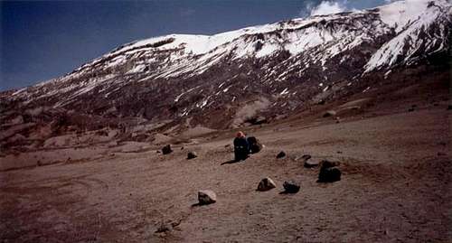 Nevado Ruiz from the old refugio (hut). The refugio was blown away from the volcanic eruption.
Eruption History
A single eruption killed over 23,000 people on November 13, 1985. The eruption wasn't huge, but it melted a good portion of the once huge icecap within a matter of seconds. The resultant flood completely destroyed the town of Amero, burying the town in 100 meters of mud. The last previous eruption was in 1845. Unfortunately, the disaster could have been much less catastrophic had the Colombia government heeded the warnings from American geologist. The geologist warned the Colombian government that the volcano was about to blow and sent several videos of the Mount Saint Helens eruption to the government officials, but the government officials refused to listen, in fact the accused the American geologist of devaluing property values around the volcano. The Arenus Crater has a diameter of 800 meters and a depth of 200 meters, at least at the present time.
Ruiz hasn't had any major eruptions since 1985, but the mountain could still blow at any time and has had several small eruptions. The volcano is closed to climbing when the eruption danger is perceived as being higher than usual.
According to the Global Volcanism Program, Arenas Crater itself has had the following known eruptions:
| START DATE | END DATE | VOLCANIC EXPLOSIVITY INDEX* |
| April 23 1994 | April 23 1994 | ? |
| September 11 1985 | July 13 1991 | 3 |
| December 22 1984 | March 19 1985 | 1 |
| 1916 | 1916 | 2 |
| February 19 1845 | ? | 3 |
| 1833 | 1833 | 2? |
| 1831 | 1831 | 2 |
| Jule 18 1829 | ? | 2 |
| June 1828 | ? | 2 |
| 1826 | ? | 2? |
| March 14 1805 | ? | 2 |
| 1623 | 1623 | 1? |
| March 9 1595 | ? | 4 |
| 1570 | ? | ? |
| 1541 | ? | ? |
| ~1350 | ? | 4 |
| 675 AD +/- 50 years | ? | 3 |
| 200 BC +/- 100 years | ? | 4 |
| 850 BC? | ? | 4 |
| 6660 BC? | ? | ? |
*A.k.a., VEI. Used to measure the size of an eruption/explosion and on a scale of 0 to 8. **A.k.a., VEI. Used to measure the size of an eruption/explosion and on a scale of 0 to 8. Click here for a detailed explanation.
Getting There
To get to the trailhead, start in Manizales (8 hours by bus from Bogota). There is no public transport to the trailhead, so you'll have to check several tour companies for a trip. The road heads east and up the mountain to El Secreta, where you turn south on a dirt road to the trailhead. We paid $10 a person for five people, which included a tour of the Ruiz area and a visit to the hot springs, and a lunch. Park entry was an additional $10 and there was a small fee to bathe in the hot springs in El Secreta.
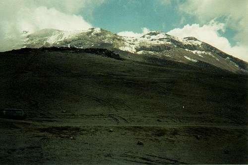 Ruiz from the west.
Routes Overview
By far the most popular rotue is via the West Slopes Route which is a simple climb up the steep sandy/snow slope to the crater rim in about 2 or 2.5 kms. The elevation gain is only 531 meters (1742 feet), so this is one of the easiest places in the world to reach this high of an elevation. The route was formerly a glacier, but the eruption melted the glacier, but the route still is covered with snow for much of the distance, so an ice axe is handy. Crampons are needed in icy conditions. The mountain will slowly build glaciers again.
There are several other routes available, if the mountain is stable; ie no eruption danger. The east face used to be the most challenging route and required ascending an icefall, but all the ice was probably blown away by the 1985 eruption. The north slopes have a realitively easy route as well.
For any route, make sure to acclimatize somewhere, as the highest trailhead is at 4790 meters (15,715 feet)!
Note: The peak is oftten closed due to eruption danger. In that case you will have to settle for climbing Olleta Crater, just west of Ruiz.
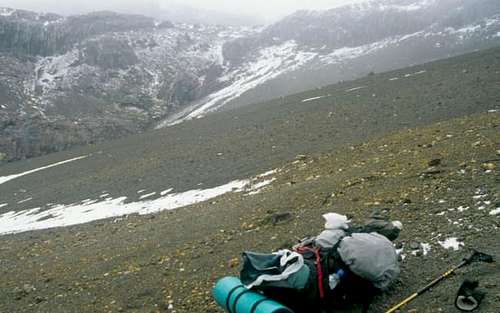 West Slopes of Ruiz
Red Tape
Ruiz is often closed by national park authorities due to eruption danger or other reasons. If so, you can still climb the nearby Volcan de la Olleta for a good look at Ruiz.
Park entrance in 1998 was $10 per person.
Update from SP member Federico1:
As of 2008, access to the summit has become more controlled.
You must pay an entrance fee and have an obligatory guide. Tourist can climb to the “sightseeing point” at 5146 meters. In order to get to the true summit, you must have a special permit that must be obtained two weeks in advance and cost $100 (with a guide).
When To Climb
The dry season is December through March, and this is the best time to climb. The rest of the year is very rainy/snowy and chances are you wont even see the mountain!
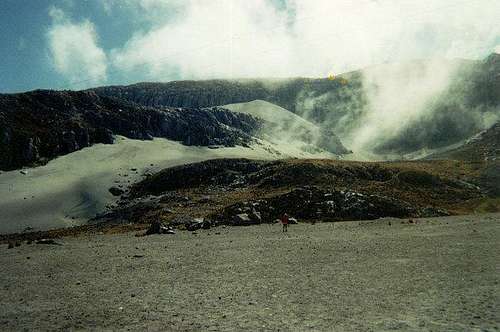 The active and very deadly Nevado Ruiz.
Camping
Camping is allowed anywhere in the national park when eruption danger is low. It is very cold and windy at these altitudes, so a strong 4-season tent is needed. The national park is known for bad weather, so go well prepared.
The rugio high on the mountain has now been reopened (as of 2008).
Mountain Conditions
You can check the weather conditions and forecast for Manizales by clicking HERE, but of course at higher altitudes, it will be much wetter and colder.
 Ruiz from Olleta summit in the so called "dry season".