
|
|
Route |
|---|---|
|
|
40.76500°N / 110.135°W |
|
|
Scramble |
|
|
One to two days |
|
|
Class 2+ |
|
|
Overview
This is likely the easiest route up Cleve Peak, but it still has a steep section getting up from the Fox Queant Pass to the summit.Getting There
There are several driving routes to the trailhead, but this is the quickest. A good road map is needed.From Roosevelt, take State Highway 121 north. This is where the elbow in Highway 40 is, right downtown, so the turnoff is easy to locate. Stay on Highway 121 north, follow it as is makes a sharp turn at Neola and heads due east. The highway will reach a "T" and turn south. At the "T", turn left (north) to the town of Whiterocks. From Whiterocks, drive northwest along the paved road. Not long after passing the fish hatchery, will be another junction. Go straight (not left). The road heads north, then east, then north again. At the next intersection, go straight and to the Elkhorn Guard Station.
Turn left and continue on the Elkhorn Loop Road, up Pole Mountain, and to Forest Road 110 before heading to Pole Creek Lake. Don't take the Elkhorn Loop to Pole Creek Lake, but turn right onto Forest Road 110. If you reach Pole Creek Lake, you overshot the turnoff. Follow Forest Road 110 north for about four miles to the signed (for West Fork Whiterocks Trailhead) turnoff to the left. Turn left to the trailhead. Most of the Elkhorn Loop as well as Forest Road 110 is gravel, but usually in good condition for cars, provided you drive slowly.
 A moose as seen along the West Fork Whiterocks River.
Route Map
Click for full size. The Red Line marks the route up Cleve Peak (a.k.a. North Cleve) from Fox-Queant Pass.
Route Description
From the trailhead, follow the well-used trail along Whiterocks Creek. There are a few short up and downs, but the trail is mostly an easy stroll to beautiful Cleveland Lake which is four miles from the trailhead. At Cleveland Lake, there is a junction. The trail to the right goes to Quent Lake and then north to Taylor Lake. Stay straight along the trail that follows the shore of Cleveland Lake. From Cleveland Lake, the trail gains altitude slowly before climbing steeply to Fox-Quent Pass. The pass is 6.5 miles from the trailhead and has absolutely stunning views of the Upper Uinta River Basin as well as the Whiterocks Drainage. After enjoying a well-deserved rest at Fox-Quent Pass, scramble up the steep slope to the south. There is no trail and some boulder-hopping. This is the steepest part of the climb. Once the ridge becomes well-defined, it becomes gentler. Follow the ridge south to the broad summit of "North Cleve". The summit is about 1.3 miles from Fox-Quent Pass. If you use this route to climb "Cleve Peak" only, the round-trip distance is just under 18 miles from the trailhead. It can be done in one long day, but there are excellent campsites along the way, so a two day trip is pleasant.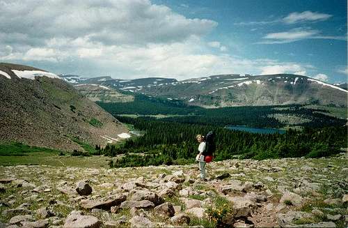 Fox-Quent Pass.