
|
|
Route |
|---|---|
|
|
40.48500°N / 105.893°W |
|
|
Scrambling |
|
|
Summer, Fall |
|
|
Half a day |
|
|
Class 4 |
|
|
Overview
The Nokhu Crags are series of striking towers that rise dramatically above the Cameron Pass area. There are two major towers amongst the others, and the rugged northern spire sits slightly higher than the southern. Reaching either of these two summits involves scrambling on relatively steep terrain that has been littered with loose scree and rubble. It is not uncommon for climbers to wait for snow and ice to hold the whole pile together, hoping to avoid the worst of the debris. This page will describe the route to reach the higher, and slightly more difficult northern summit. Currently, there is only one established route to reach this summit. There are several reports of climbers attempting to climb from the saddle between the two main summits, but there has yet to be a successful summit from that side.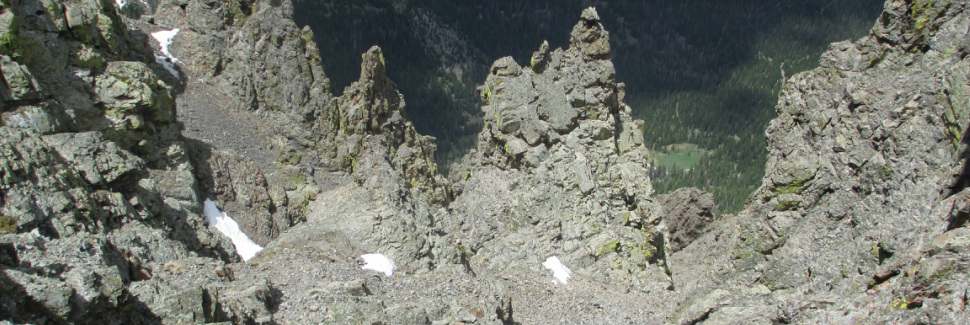
Getting There
For the North Ridge, you will want to park at the Lake Agnes trailhead. To reach it, follow HWY 14 to the summit of Cameron Pass then continue approximately 2.5 miles west from the pass. Turn south onto a well marked dirt road and make sure to stop at the small fee station. Continue a short distance and then turn right at a marked junction toward Lake Agnes. Continue straight ahead passing several signs until you reach the nice parking lot. This road can be a bit rough in spots, but it is commonly driven all the way to the lot by passenger cars.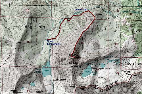
Park at the Lake Agnes TH
Route Description
From the Lake Agnes parking lot, bushwhack almost directly east (toward the Nokhu Crags) for 0.1 miles until you reach a dirt road. This road is marked on the map as Long Draw Road and although it would be possible to continue directly up the slopes, it is much easier to follow the road to an easier ascent route. Turn left and follow the road north for about 1.1 miles to a small grassy gully that leads upward toward the ridge above. Head up the gully as it gradually steepens until it you finally arrive on the Nokhu Crag's North Ridge. Follow the now gentle ridgeline directly toward the peak until you top out on a small knob at about 12,200 feet and easy progress is no longer possible.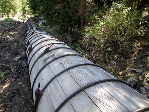 Interesting pipe along the "Long Draw Road". | 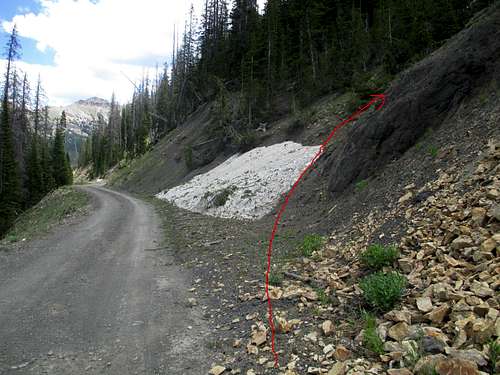 We found this to be the best place to gain the ridge. |
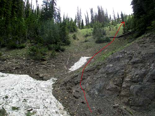 It may be steep, but dirt is better than scree. | 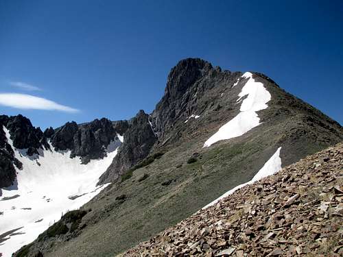 Nice lovely ridge right up to the summit bit. |
Describing the route from here can be challenging as there are many small gullies that look possible. If you keep a sharp eye out, a faint trail can be seem in places and there are a few cairns marking the correct way.
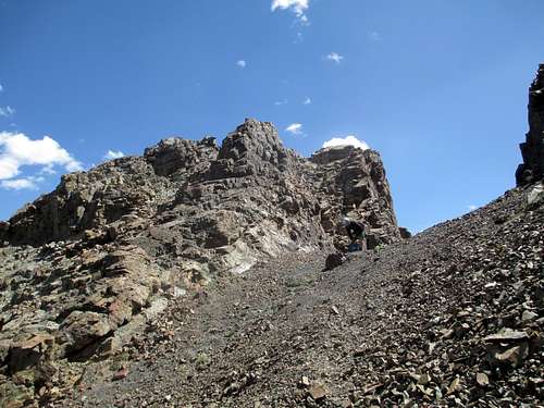
Looking back on the saddle that marks the last of the easy terrain.
Scramble down from the small point to a comfortable saddle immediately below the imposing summit cliffs. This is a good spot to put on your helmet. From the saddle, make a descending traverse out onto the west face until it is possible to move around the cliffs blocking your way. Only lose as much elevation as you need then continue working west until a small junction where several gullies meet. Instead of working up, continue further south the best looking gully, then turn left into a steeper and narrow gully that leads up toward the skyline. As you ascend you will pass two small gullies that branch off to the right. Do not continue all the way to the ridgeline, instead turn right into the second small gully. Entering this is the crux, but thankfully it is only a few moves and is over quickly. Once established in this gully, simply continue directly up class 3 terrain until you arrive abruptly on the summit.
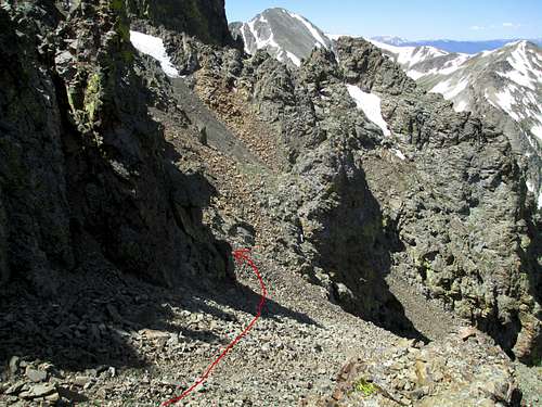 This is looking down from the saddle that marks the end of easy terrain. | 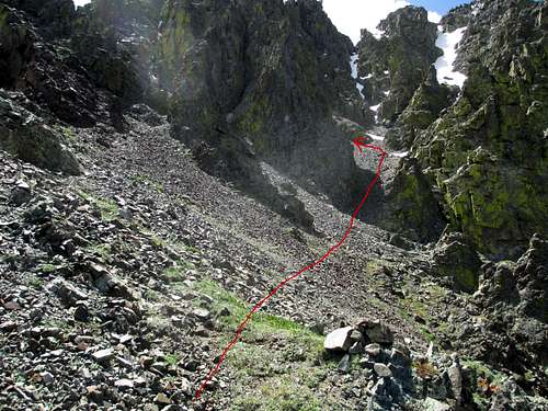 From a small junction, continue into the marked gully. |
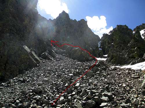 Scamper up and bank left into the marked gully. | 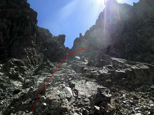 Do not go all the way to the obvious notch, instead take the 2nd one on the right. |
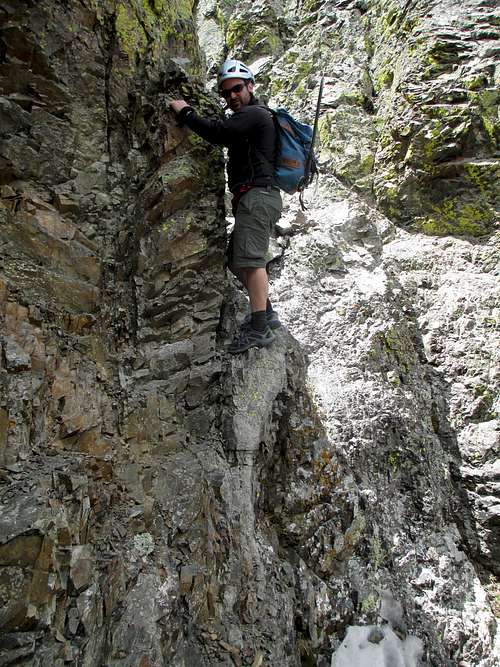 This is the crux step into the final gully. | 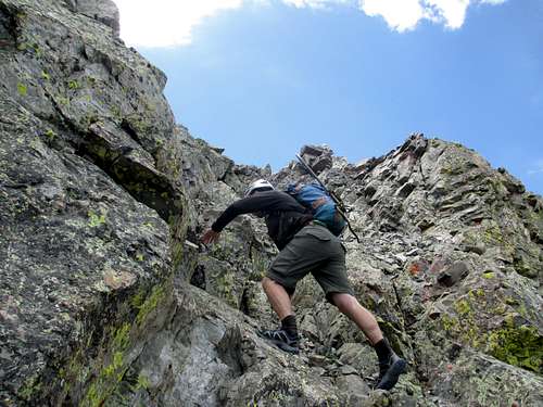 Last few moves to the top. Rock gets a bit better. |
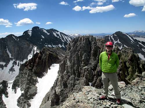
South summit is visible behind.
To descend, cautiously reverse the route.
Essential Gear
The only essential gear for this route in DRY conditions would be a helmet. The rock is extremely unstable and this should be considered mandatory.If any snow is present, an ax and crampons would be required gear as well.
Feel free to carry a rope, but solid anchors will be challenging to find and the rope will only cause more rockfall.
External Links
Weather: NOAATrip Reports: Brian in the Wild