
-
 13095 Hits
-
 74.92% Score
-
 5 Votes
|
|
Route |
|---|---|
|
|
40.48780°N / 121.5039°W |
|
|
Basic Snow Climb, scramble |
|
|
One to two days |
|
|
Class 2, Moderate Snow Steepness |
|
|
Approach
The description for this route are given for a winter ascent:
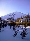
From Redding, drive on SR 44 east. This eventually runs into SR 89 before one encounters the national park entrance and visitor center. The road beyond here is closed. Follow the remaining paved and unblockaded roads beyond the park entrance to the waterfront of Manzanita Lake. Park here and begin hiking on the road.
Distance: 4 miles
Elevation Gained: 1200 ft
Walk back to the main road and continue hiking on SR 89 beyond its closed point. After about 3/4 mile one will encounter the Chaos Jumbles, which is a large clearing in the forest that starts at the Chaos Crags and cuts downhill past the road. Hike up this clearing until the small bowl at the base of the Chaos Crags are reached. Form here, hike up the souther ridgeline about 200 vertical feet before traversing to che right. Beware- if one goes too high, the terrain to be traversed becomes quite steep and harder to travel across.
The traverse will lead to a long clearing along the base of the cliffs of the Chaos Crags. The ground is flat on the far west side of the clearing. Walk up the clearing as it dips slightly and then begins gaining elevation as it curves to the left. Once a steep terminating headwall along the arcing clearing can be seen, begin heading into the sparse forest heading directly towards Lassen Peak, which by now should be in sight.
The clusters of pine trees between this long clearing and the tree line provide good terrain for camping, with many fairly flat spaces.
When doing this route I took a different return route that saved me some elevation gain and an extra mile. When returning along the long open clearing at the bottom of the Chaos Crags, a low hill will rise to the left. As this hill disappears, arc to the left. Keep heading in whatever direction has the most downhill element. Go down the hill, which starts out mild and becomes steeper until Manzanita Creek is reached. From here walk parallel to the creek all the way back to the road! Stay a little above the creek to be on faltter more open terrain, although the terrain becomes more steep and some mild bushwacking is encountered during the last quarter mile.
 |  |  |  |  |
Route Description
Distance: 1.8 miles
Elevation: 3,346'
Continue heading straight towards the peak and some more long clearings will be encountered. Up on the peak one can see a series of cliffs clustered together - head just left of the center of these.
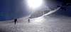
Once treeline is reached, continue up the steep ridgeline that is on the left side of some cliffs. The hiking here is steep and exceeds 40 degrees, but is probably less than 45 degrees. Eventally the top the first ridge is gained. From here two large openings can be seen in the cliffs above. Head along the ridgeline towards the right opening. This right openeing is further divided into to smaller passages by a comparatively small cluster of rocks. When I did this climb (March 2004), I saw what appeared to be a cornice blocking the right opening. It seemed that any debris from there would be funneled down and to the left of the ridgeline, keeping most of the route safe.
As the large rightmost cliff wall is approached (which is easily discerned due to its large gendarme), traverse off of the ridge to the left across the chut to a series of small rocks below the small openeing in the cliffs above and to the left. Form there follow this smaller ridgeline over the horizon.
Beyond the cliffs one can see the edge of the crater bowl about 1,100 feet above. Continue hiking up this steep slope straight up to the skyline. The ridgeline gained is the North Ridge. Follow this ridge to the right, and it then turns left and descends into the summit crater. Cross the bottom of this crater, winding around the spring rock formations, and then scramble straight up the last 100' to the summit!
 |  |  |  |  |
Essential Gear
Snowshoes, crampons, an ice axe, and avalanche rescue gear are a must in addition to typical winter camping gear for snow ascents.
 |  |  |  |  |
Miscellaneous Info
If you have information about this route that doesn't pertain to any of the other sections, please add it here.
 |  |  |  |  |