
|
|
Route |
|---|---|
|
|
46.36000°N / 13.44300°E |
|
|
Hiking, Scrambling, Via Ferrata |
|
|
Summer, Fall |
|
|
One to two days |
|
|
max UIAA II |
|
|
Overview
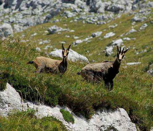 Chamois of Val Resia
The Alta Via Resiana is a short trekking route through one of the most loved and beautiful groups of the Julian Alps, the Canin group. It is a very challenging itinerary in a wild and solitary environment, that offers amazing views all the way: It’s basically a trek for “old fashioned” alpinists, that are more attracted from fantastic landscapes and from the loneliness of sharp crests than from the difficulties of a rock wall. The Val Resia is truly one of the jewels of the Julian Alps, a spectacular valley still wild where local people are very proud of their culture, that is very different from all others of the Friuli Venezia Giulia. In this valley you can find more than 25 centuries of history, a strange, unique language, fine folk music, art and architecture ( unfortunately partly lost in the terrible earthquake of 1976 ). Due to a very humid and relatively mild Mediterranean weather, the Val Resia is extremely rich of both flora and fauna. Almost 50% of the valley is a protected area inside the Parco delle Prealpi Giulie.
There are several options to climb this route and many possible variations. Usually it’s done as a three day trek in anti-clockwise direction ( see the good Trip report of Saman ), but It’s also sometimes partly climbed as an ascent to Monte Canin in the other direction, from the spectacular north-west ridge of the mountain. The most challenging part is the first part of the ridge, that requires a couple of very exposed climbing passages ( around the II UIAA degree, not protected ) on the sharp crest. But also the climb of the via ferrata “Rosalba Grasselli” on the NW of Picco di Carnizza shouldn’t be underestimated, though all the aerial passages are well secured with iron ropes. There are often strong winds on this crests and the weather can change very fast, so it’s better to climb this route only on nice summer days. On the west side of the mountain we can find snow and ice even in july and august, so although some parts are protected with iron ropes, it’s better to bring at least an ice axe.
Route Description
Day 1 Canin
Canin| route type | hike |
| max elevation | 2137 m |
| elevation gain | 1500 m from Stolvizza |
| total length | around 11 km |
| Difficulty | easy hike |
| Time required | 4/5 hours |
The route starts from Stolvizza, borgo Lodina ( indications for Sella Buia, marked path n°643 ), we follow a short path through some houses and then a wide cart-track that goes up with several switchbacks to the nice south shoulder of Monte Tanarado, where we can find some beautiful old stavoli ( mountain houses used in the past by local farmers and hunters ) and where we can enjoy a nice view of Monte Canin and Monte Sart. From there the path goes up steep through the centuries old woods of beech to the crest. After a crossroad ( we follow the path on the right, n°632 ) we pass a couple of gendarmi and we reach the Ricovero/bivacco Igor Crasso ( 1640 m, 2.30 hours from Stolvizza ), one of the best I’ve ever seen.Going up to the bivouac we can see on the left a small stream: this is the only place where you can find water for the whole route, because the spring near the marussich bivouac is almost always dry in summer. Now we are on the crest and the view opens wonderfully to the very deep Val Raccolana and to the Montasio group. If we look towards west we can recognize many summits of the Carnic Alps and of the Dolomiti.From the Ricovero we can reach in few minutes Sella Buia, from where we can clearly see the next part of our path, a long grassy mule track on the south side of Cresta d’Indirinizza that goes up to the plateau of the Canin group. In the middle there’s a cross and a book of signatures of the itinerary.
 Monte Cimone Monte Cimone |  Ricovero Igor Crasso Ricovero Igor Crasso |  Monte Sart Monte Sart |
On our right the view opens wide to the plains of the Friuli venezia Giulia, to the city of Udine and to the Adriatic sea. We reach the southern slopes of Monte Sart, the environment is typically carsic, with strange rock formations and the scary “pozze” ( open sky abysses ) all around. After a few short bends we can decide if we want to climb Monte Sart ( easy scramble, half an hour to the top ) and go down following the SE ridge or go straight to the Forchia di Terrarossa. The climb of Monte Sart is actually part of the Alta Via Resiana, but can be avoided, especially if you already climbed the mountain. Once reached the Forchia the view becomes amazing to every direction, especially to the Julian Alps. The best thing to do it’s to start the route in the early afternoon, so you can reach the Canin plateau in the evening and enjoy a stunning sunset.
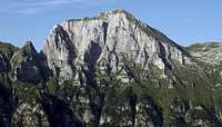
 Carnic Alps and Dolomiti
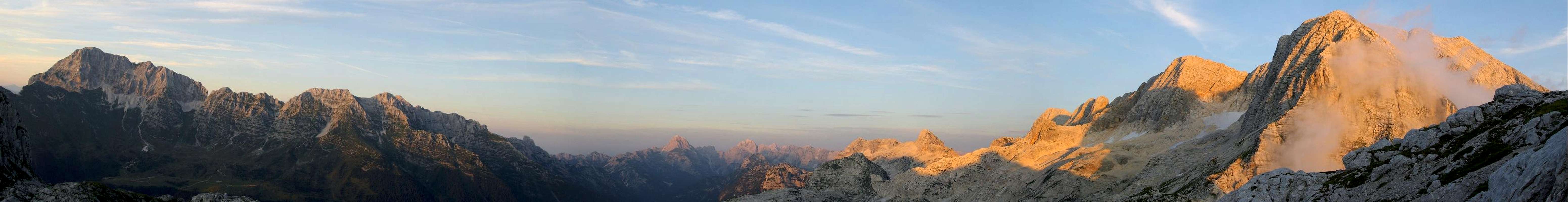 |
From the Forchia we follow the path on the north side of Picco di Grubia and in few minutes we reach Sella Grubia/Peravo and the Marussich bivouac ( 2041 m, 2 hours from the Ricovero Crasso ), where we will spend the night. This place can be reached also from Sella Nevea, taking the cableway to Rifugio Gilberti and then the marked path n°632.
 Monte leupa Monte leupa |  Jof di Montasio Jof di Montasio |  Canin group Canin group |
Day 2
 Sunrise on Mangart and Jalovec
| route type | scrambling-via ferrata |
| max elevation | 2587 m |
| elevation gain | 550 m from Sella Grubia |
| total length | around 14 km |
| Difficulty | medium via ferrata- exposed passages of the UIAA I and II degree on crest |
| Time required | 6/7 hours |
 |
|---|
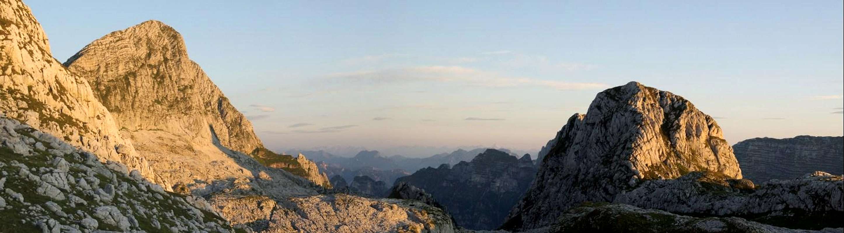
The ascent of Monte Canin it’s not long but it’s better to start early to enjoy the spectacular views with the morning sunlight. From the bivouac we go first up to the saddle and then again up on the left, following a path marked with red triangles. Then we go down to another smaller notch and up until we reach the base of Picco di Carnizza, where the Via Ferrata “Rosalba Grasselli” starts ( sign ). After a first easy part we will find the most difficult part of the ferrata, a slightly overhanging crack that requires caution, though it’s well protected with the iron ropes and there’s the help of some rungs. Then we continue to go up on the exposed crest overcoming easier and fun passages, until we reach the final scree slope that brings us to the summit of Picco di Carnizza, where the view is really amazing, though it’s just an “appetizer” of the broader one that we will have on the summit of Canin. We go down following the red triangles to a small notch and then we start to go up on the west side of Monte Canin ( short passages of the I degree, secured in some parts ), where we could find ice and snow also in the summer season. Once reached the crest we have to face the most difficult part of the route, two short but extremely exposed passages of the II UIAA degree. But all this part on the crest requires very secure step, no mistakes can be forgiven . The following part on the west face is a fun scramble that brings you again on the crest and then on the summit of the mountain ( 2587 m, 2 hours from Sella Grubia ). Needless to say that the 360° view it’s wonderful, one of the best of this part of the Alps.
 via ferrata Grasselli via ferrata Grasselli |  NW crest NW crest |  View from the beginning of the ferrata View from the beginning of the ferrata |
We follow the same route to go back to the Marussich bivouac ( 1.30 hours ), staying always well focused because some passages can be more tricky during the descent ( especially if there’s wind, snow or ice ).
 Bivacco Marussich
From Sella Grubia we go down on the left following the marked path n°634, on the right side of Canin’s “carnizza”, the very deep and impressive ravine below the west face. We enter then in a beautiful forest, and after many switchbacks we reach the river Resia, the Borgo Lodina and the car ( 3 hours from Sella Grubia, 6/7 hours total ).
Summit Views
Picco di Carnizza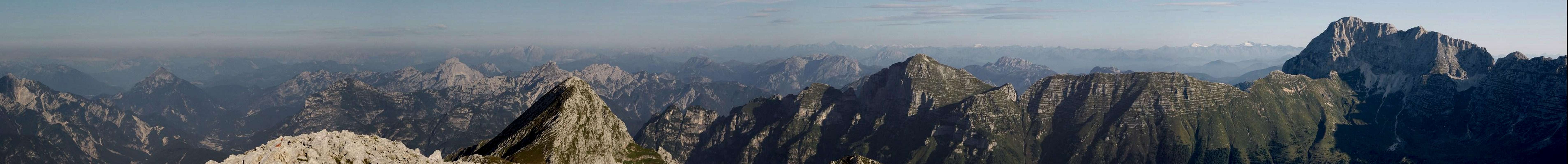 |
 NW view NW view |  Julian Alps giants Julian Alps giants |  Jof di Montasio Jof di Montasio |
Monte Canin
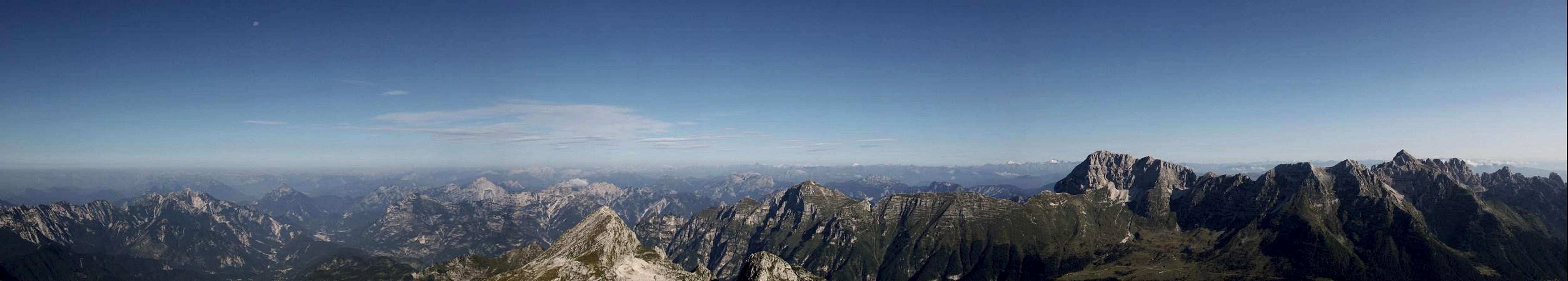 |
 Val Resia Val Resia |  Monte Cimone Monte Cimone |  Isonzo/Soca valley Isonzo/Soca valley |
 South ridge South ridge |  Julian Alps giants Julian Alps giants |
Getting There
Stolvizza can be easily reached following the road of the Val Resia from Resiutta, on the main national road Udine-Tarvisio.When to climb
The best season is from july to September.Meteo Friuli
 Prato di Resia
Maps
Tabacco 1:25000Map n°27 – Resia-Monte Canin
Tabacco Maps