Overview
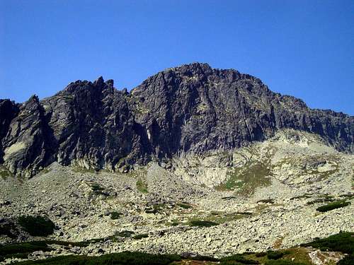
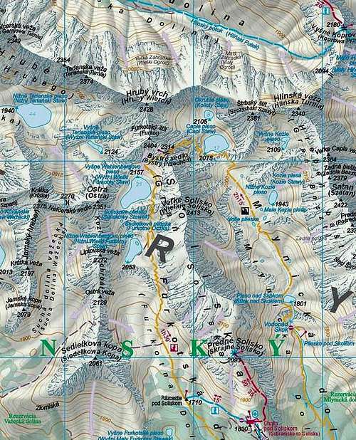
Ostrá, Ostra, Osztra, Scharfes Eck is extensive and crumbly peak situated between Furkot (Furkotský štít) from which is separated by Furkotna Przełęcz (Furkotské sedlo) and Krótka (Krátka),from which it is separated by Niewcyrska Przełęcz (Nefcerské sedlo).
South ridge of Ostra devides dolina Furkotna od dolina Sucha Ważecka.
It starts from Liptowska Przełączka (Liptovská štrbina), Zadnia Liptowska Turnia (Liptovská veža), Ostra Przełączka (Ostrý zárez), Ważecka Turnia
(Ostrá veža), Siodełko (Sedielkový priechod), Siodełkowa Kopa
(Sedielková kopa).
It was climbed completely first time by Alfred Martin and Johann Franz (senior) 19th September 1907.
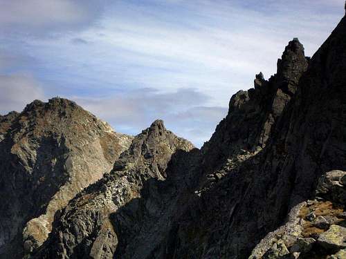
North –east Ostra’s ridge is also quite interesting ,goes from Furkotna Przełęcz (Furkotské sedlo) and includes:
Mała Furkotna Turnia (Malá Furkotská veža), Niżnia Furkotna Ławka (Nižná Furkotská štrbina), Pośrednia Furkotna Turnia (Prostredná Furkotská veža), Pośrednia Furkotna Ławka (Prostredná Furkotská štrbina), Wielka Furkotna Turnia ( Veľká Furkotská veža), Wyżnia Furkotna Ławka (Vyšná Furkotská štrbina).
Routes
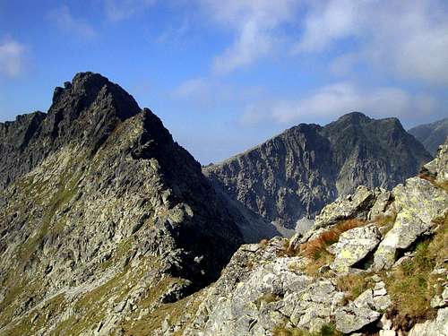
There is no marked trail to Ostra but all routes which go to the summit are well known since a long time. For me the most interesting climbing routes are through south or north-east ridge(II-III UIAA)
The easiest way to Ostra :
You can climb first Siodełko (Sedielkový priechod) from Furkotna od dolina, then descend to Sucha Ważecka dolina and ascend though wide and easy couloir directly to the top of Ostra.
When to climb
Ostrá is avaiable whole year through the easiest route.
Red tape
The “High Tatra” is a National park, UN Bioheritage area and a European BioHeritage,if you are not a member of any climbing club you can move only on marked trails - so you can visit Ostrá only with Tatra guide.
From 1.11 to 15.06 year by year all marked routes in TANAP(the whole Slovak side of Tatras) are being closed for tourist activity
(except the routes leading to mountain chalets).
Accomodation
The best starting point is Štrbské Pleso
You can reach Furkotna valley by yellow marked trail.
There is only one chalet near by Ostrá :
Chata pod Soliskom - situated not far from Štrbské Pleso on the Predné Solisko south slope. Chalet is opened all the year for hiking, climbing and ski mountaineering.
Other accomodation you can find
here Mountain conditions
Web forecast:
situation at this moment and
forecast
Information of avalanche danger:
TOPR and
HZS
Rescue:
On Slovakian side acts HZS (Horska Zachranna Sluzba)
Starý Smokovec 23, 059 60 Vysoké Tatry
phon.: 052/4422820, fax: 052/4422855,
mobil: 0903624869
e-mail: vtatry@hzs.sk
Maps