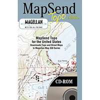
MapSend 2D Topo
Product Description
This product is only available in North America.The most advanced GPS topographic software available, Magellan® MapSend® Topo In the US maximizes the navigation capabilities of your Meridian® series, SporTrak® Pro, SporTrak Pro Marine, SporTrak Map, MAP 330 or MAP 330M handheld receiver.
The MapSend Topo in the United States software contains highly-detailed 3D topographic maps that can be easily downloaded from your PC to your handheld GPS receiver for a fun and simple way to navigate.
Map details include streets, lakes, rivers, coastlines, parks, railways and points of interest for the entire United States. You choose the regions and level of detail to download for maximum memory efficiency. The data can then be updated or overwritten with new map regions. Topography derived from the U.S. Government Digital Elevation Model (DEM), provides elevation details for every location on the map.
Create your own waypoints and routes on your PC, edit and download them to your GPS receiver for use on your adventure. Save thousands of routes on your PC for recording your every journey.
Plotting your current position in relation to surrounding landmarks is fun and easy, and your GPS search function will find street addresses and points of interest, quickly and safely guiding you to those locations.
Click here to preview software.
Images
Reviews
Viewing: 1-2 of 2 |
mtnbnd - Oct 30, 2005 8:44 pm - Voted 1/5
Untitled Review
This is one of the worst programs I have ever used. Junk. The topos are not accurate!?! There are no trails. You cannot pan across the map, you must zoom out and then zoom in on the new location. I cannot believe they charge money for this program.
Viewing: 1-2 of 2 |


Alpinist - Dec 16, 2003 8:16 pm - Voted 2/5
Untitled Review- create a route that follows a trail
- mark a point on the trail for where you want to turn off-trail
- mark a point along a trail where you wish to camp
The only way to do these things using MapSend is to look at a separate topo map that has trails on it, then mark the spot in the MapSend software and hope it is accurately placed. This is complicated by the fact that different maps have different scales and contour intervals. Trying to precisely match a location on 2 different maps is a pain in the neck. What I do to get around this problem is to download map regions from the MapSend software, and then create routes and waypoints using some other mapping software that has trails in it. How stupid that you are forced to use 2 different software packages.
Other than that obvious limitation, the software functions well. You can transfer routes and waypoints to/from your GPS. But without any trails, it's really cumbersome to use for mountaineering.
Customer support is also pretty poor. I submitted a support form on their website asking about the trails and did not get a response for 10 days. They did however, finally respond when I emailed them.