Toggle navigation
Mountains
Routes
Images
Trip Reports
Forum
What's New
People
Areas & Ranges
Articles
Trailheads
Canyons
Huts & Campgrounds
Albums
Logistical Centers
Fact Sheets
Lists
Custom Objects
Gear
Plans & Partners
WELCOME TO SUMMITPOST
SIGN IN
REGISTER
Bighorn Crags
Additional Parents
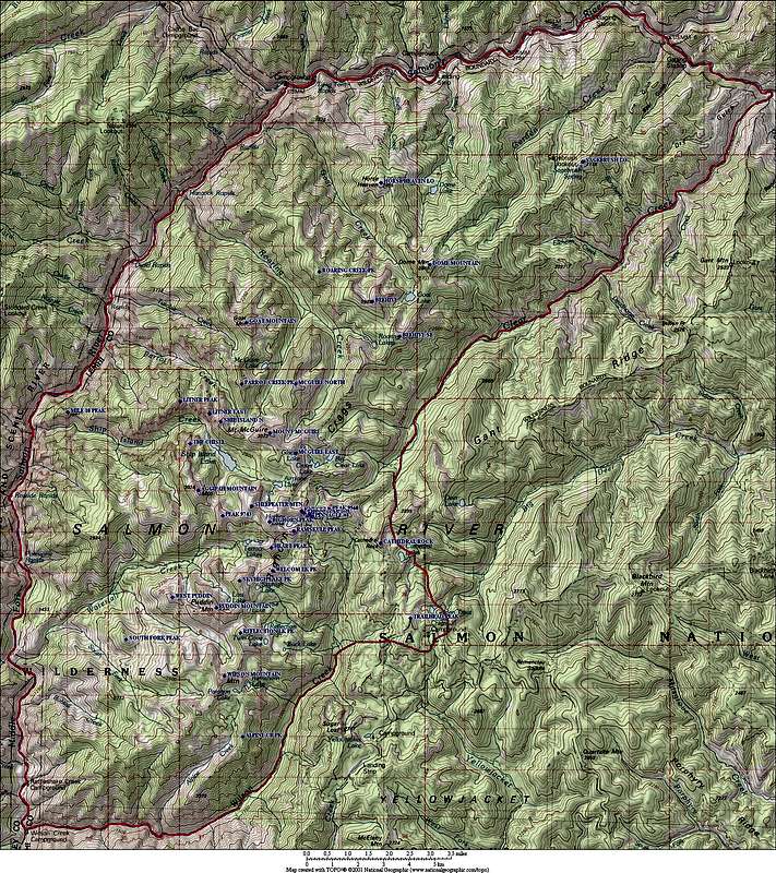
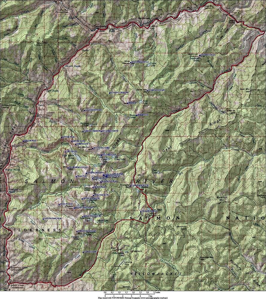
Image
Overview Map
View High-Resolution Image
Overview Map
Overview map of the Bighorn Crags, including labeled peak names. The unofficial range boundaries are marked in red, a total of just under 200 square miles.
« PREV
NEXT »
Super Dave
on
Jul 25, 2007 1:01 pm
Comments & voting
Other parents
Image Type(s):
Topo/Diagram
,
Informational
Image ID:
316142
15074 Hits
77.48
% Score
8
Votes
Log in to vote
Comments
No comments posted yet.
to post!
Don't have an account?
Bighorn Crags
(Area/Range)
« PREV
Viewing
#21 of 74
GALLERY
NEXT »
Super Dave's Image Gallery
« PREV
Viewing
#361 of 487
GALLERY
NEXT »
×
You need to login in order to vote!
User Name
Password
Remember me
Forgot your password?
Log me out when I close my browser.
Keep me logged in all the time.
sign in as a user
Don't have an account?
Register now for FREE
Rating available
Suggested routes for you
People who climb the same things as you
Comments Available
Create Albums
Register Here


