
-
 72739 Hits
-
 91.75% Score
-
 36 Votes
|
|
Mountain/Rock |
|---|---|
|
|
48.83079°N / 121.27185°W |
|
|
Hiking, Mountaineering, Scrambling, Skiing |
|
|
Spring, Summer, Fall, Winter |
|
|
8311 ft / 2533 m |
|
|
Overview
This mountain boasts what some call the "Best View in Washington" however that claim should probably be disputed as many peaks in the North Cascades have incredible views. It's located within the Picket Range in the rugged and remote North Cascades National Park. Luna Peak is the perfect mountain for those who dream about unspoiled wilderness devoid of roads and trails and an alpine panoramic view of the entire Picket Range. The standard route for this peak is plenty difficult enough that only a handful of climbers even attempt it each year. The notorious weather of the North Cascades makes the odds of getting rained out a real possibility coupled with the time and energy required to get here, there are very few parties attempting it. If you do, you will certainly be rewarded, as the bushwacking, the heather slopes, the talus fields, the boulder fields, and the summit scramble make for the complete North Cascades climbing experience! Note that Luna has two summits; the easier but slightly lower south peak is reached via the Class 2 south ridge, however the higher north peak is the true summit which requires some Class 3 scrambling. The traverse from these two peaks is the crux of Luna.
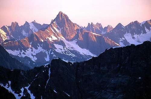
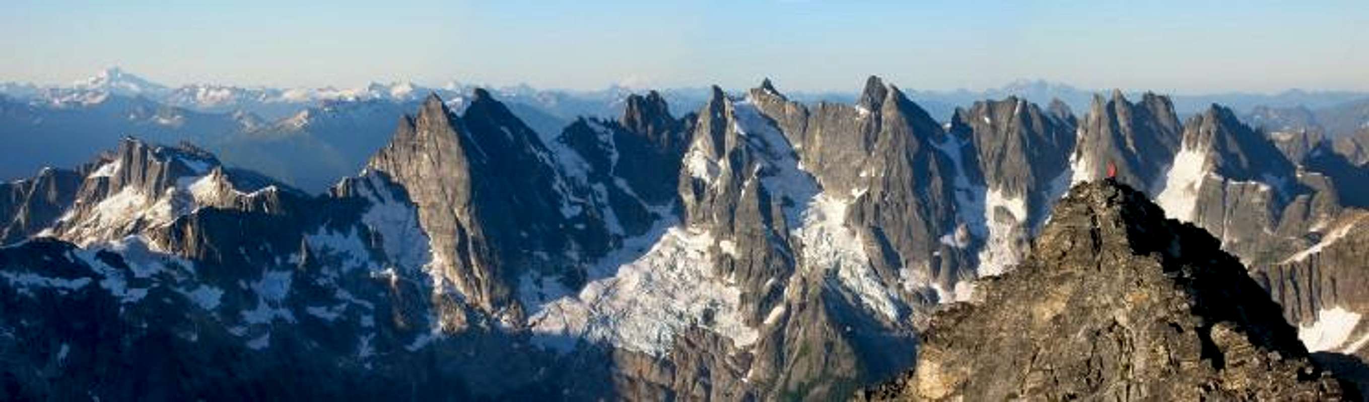 Southern Pickets panorama from Luna Peak
Getting There
From Seattle, go north and take SR 20 (North Cascades Highway) towards Ross Lake. Park at the Ross Lake Resort Trailhead 13.4 miles east of Newhalem. The folks at Ross Lake Resort run a ferry boat that can take you and your gear up Ross Lake to the Big Beaver Trailhead. Making a reservation for the boat ride is highly recommended simply so they know to pick you up. The cost is now $60 per ride regardless of how many climbers are on the boat (a group of 6 and huge packs fills the boat nicely). You should set an arranged time to meet the ferry and be sure to account for the 20 minute hike on the trail leading down to the lake shore from the highway parking area. Upon arriving at the dock, there is a phone attached to a pole you can use to call the Ross Lake Resort office (located across the lake) so you can let them know you're ready, and they will send a driver with the boat to pick you up.
Alternatively, if you are on a budget you can also skip the boat ride and hike the lakeshore trail, which follows the west side of Ross Lake, for 7 miles one way to the start of the Big Beaver Trail. The trailhead parking is the same. This adds 2-3 hours each way to the journey.
 Boat ride up Ross Lake Boat ride up Ross Lake |
 View from Big Beaver Trail View from Big Beaver Trail |
 Elephant Butte from the approach to Luna Col Elephant Butte from the approach to Luna Col |
Approach - Big Beaver to Access Creek
Once you reach the Big Beaver Trailhead (20 minutes on the boat; elevation 1,600 feet), hike up the very mellow trail through nice old growth forests for 8 miles to the established Luna Camp. An additional 1.5 miles north of Luna Camp along the trail, you will leave the comfort of easy walking and begin the real adventure. Try to locate a small boot path heading left, and cross Big Beaver Creek just north of where Access Creek enters Big Beaver Creek. Some years you can find a convenient log to cross, and some years you will have to wade. This crossing is around 2,460 feet in elevation. Hike along the north flank of Access Creek in semi-open forest. Near 3,700ft, where travel becomes very brushy, cross to the creek to its south bank. From here, look for cairns and a faint trail that will utilize talus fields and avoid much of the slide alder brush and deposit you into the upper basin at the headwaters of the creek. There is good camping here. If you cannot locate the small boot path, you will be in for some annoying bushwhacking most of the way but it never gets truly unbearable as long as you stay on the north side of Access Creek up to 3,700 feet where you will definitely want to cross to the south side.
From the Access Creek headwaters at about 4,400 feet, ascend southwest up broad talus (or snow) gullies heading up towards a noticeable gap in the ridge. Once on the ridge, traverse south of Point 6,730 on grass and heather and emerge into a large basin to the SE of Luna Peak. Traverse across this basin at the 6,600 foot level towards Luna Col, which is the obvious notch between Luna Peak to the right and a small tower to the left. There is a great spot to camp at this col, or just 150 feet below it on the east side. A map showing the entire route in detail is shown below.
 Hiking Big Beaver Trail Hiking Big Beaver Trail |
 Wading Big Beaver Creek Wading Big Beaver Creek |
 View from camp just below Luna Col View from camp just below Luna Col |
Standard Route - South Ridge Class 3
From Luna Col (elevation 7,200 feet), look north. The route ascends the broad ridge up Class 2 talus for 1,100 feet to the false summit (south peak). This ascent crosses some loose rock so be careful of climbers below you. From the false summit, the traverse is in full view. Downclimb 50 feet or so and make a short, 5 foot step down to the notch between the two summits (crux). Stay on, or just a few feet below the ridge crest on the east side the entire way to the true summit. There is good exposure here but the rock is sold and the scrambling is pretty easy. The traverse between the two peaks takes 15-20 minutes or so, depending on your comfort level with exposure. Retrace the route back over the false summit to Luna Col then consider your future. Will you continue south for a full Pickets traverse or return down Access Creek? There are many options for a longer Pickets venture but your allotted time and comfort level will dictate this. Most importantly, enjoy this beautiful place!
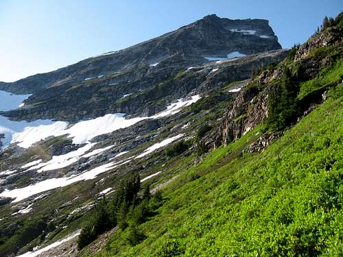
 Looking up the south ridge from Luna Col Looking up the south ridge from Luna Col |
 Hiking up the south ridge Hiking up the south ridge |
 Mysel standing at the summit rock Mysel standing at the summit rock |
Camping/Red Tape
Camping in Access Creek Basin is wonderful but expect small critters that might try to get your food. Water is not a problem as the creek flows nearby.
Camping at Luna Col is incredible and thanks to a small snowfield right at the saddle, there is normally running water. Only bad thing here is there isn't many flat spots for a tent. Don't expect a meadow; just rock and great views.
There are limits as to how many people can enter the wilderness and group size is limited as well so please check with the rangers in Marblemount. It is also safe to say that during the Summer months, open fires are not allowed. The phone at the Ranger Station is (360) 856-5700 or you can call the visitor information at (360) 856-5700. There is no need for a parking pass. The boat, while not technically "red tape" needs to be taken care of in advance as well. So call Ross Lake Resorts at (206) 386-4437.
 Typical camping in the Pickets...
When To Climb/Gear Needed
Spring/Summer is the best time. In early season, expect snow from Luna Camp and beyond, requiring heavier boots, ice axe, and possibly snowshoes/skis. Bushwhacking through wet bush and devil's club is not many people's idea of fun so if it recently rained be prepared to get soaked! Climbing Luna (or anything in the North Cascades) in November/December would be the worst time as not enough snow would have fallen for an enjoyable winter outing. In midsummer, weather tends to be stable, but check the forecast. Without snow in the gullies leading to the ridge above Access Creek or on he traverse to Luna Col, the entire route can be done in tennis shoes pretty easily. Microspikes and a small axe may still be helpful though for short snowfields that persist.
Other than the normal clothing/shoes/food you should consider bringing an ice axe and either microspikes or aluminum crampons at all times of the year. In winter, steel crampons and mountaineering boots may be necessary. A rope and rock pro is not needed in summer since the scramble between the two summits is just Class 3. If you get to the false summit and need the comfort of a rope you are not ready to tackle this peak. Protecting this short traverse with rope and cams/stoppers will do little to save you in the event of a fall as you are traversing horizontal terrain, and a huge pendulum fall will still likely cause severe injury. If someone still wants the extra comfort though, use the shot rope method the same way mountain guides help their clients rather than leading across the ridge in long pitches.
Photo Gallery
Here is a gallery of photos that depict the beautiful scenery found on and around Luna Peak.
 Luna from near Challenger Luna from near Challenger |
 Luna Peak from Challenger Luna Peak from Challenger |
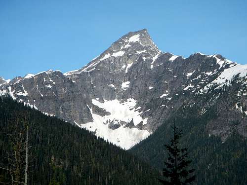 Luna Peak East Face Luna Peak East Face |
 Luna and the Pickets Luna and the Pickets |
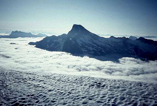
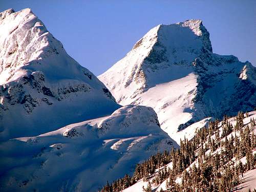 Luna Peak under Snow Luna Peak under Snow |
 Luna Peak from the traverse to Mount Fury Luna Peak from the traverse to Mount Fury |
 View west from Luna Peak View west from Luna Peak |
 Traversing to the true summit Traversing to the true summit |
 Traversing to Luna Col Traversing to Luna Col |
Eric Sandbo - Feb 16, 2005 1:58 am - Voted 10/10
Untitled CommentLuna Lake, 3,500 feet below and to the W, has larch trees around it. I've never seen larches anywhere near that far W anywhere else in the N Cascades. The barrier of the Northern Picketts must create a microclimate comparable to the Liberty Bell area there.
Lee Stamm - Feb 16, 2005 10:41 am - Hasn't voted
Untitled CommentTrue and quite interesting. Beckey makes a brief mention of the "microclimate" larches west of Ross Lake in the Alpine Guide. There are also timberline groves on the Mt. Prophet massif, just east across the valley of Beaver Creek from Luna, which can be seen glinting gold in the autumn from the North Cascades Hwy.
sstratta - Aug 1, 2015 4:23 pm - Hasn't voted
LunaThanks for the info on this peak, it was very useful this past week. A couple of things to maybe change/add: They told me it now costs $60 one way for a boat ride, though less if you team up with other people on the same boat. Since that was a lot of money I opted to just hike instead, which adds 7 miles one-way from the Ross Dam parking - a nice option for those who have the time and want to save some cash. I also never found a log crossing for the Big Beaver...one area that came close (maybe one of the logs washed away?), but I ended up just having to wade across (crocs and some ski poles are nice to have). This might be an issue though earlier in the season when the water is higher since the water came up almost to my waist.