
|
|
Mountain/Rock |
|---|---|
|
|
40.62190°N / 115.4747°W |
|
|
Elko |
|
|
11387 ft / 3471 m |
|
|
Overview
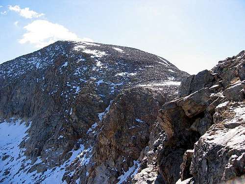
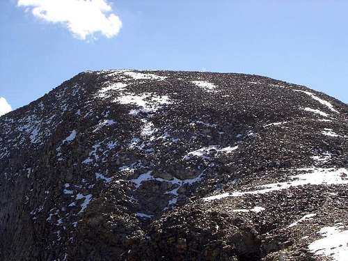
Ruby Dome
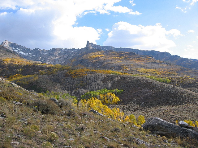
As you travel through Nevada, you are amazed at how one mountain range appears ahead of you and another disappears behind you. As I-80 traverses Nevada from east to west, it crosses range after range, giving the traveler who loves mountains a little more to look at and enjoy than just the desert that most people think Nevada is. One of the most gorgeous mountain areas in all of Nevada is to be found in the little known Ruby Mountains. The Rubies are real gems and Ruby Dome is the reigning king.
Ruby Dome is located near the center of the Ruby Mountains that span over 75 miles and reach a width of 10 miles. The U.S. Congress designated the Ruby Mountains Wilderness Area in 1989 and it now has a total of 90,000 acres. Glaciers scoured the northern end of the Rubies during the last ice age, creating the U-shaped Lamoille Canyon, also known as Nevada's Yosemite. Hanging valleys, towering summits, and year-round snowfields characterize the wilderness. The Rubies contain 10 peaks above 10,000 feet (including ruby Dome at 11,387 feet) and more than two dozen alpine lakes.
A person could easily spend a couple of weeks exploring the Rubies and their treasures but for the purpose of this page, I'll concentrate on one specific peak, Ruby Dome.
Ruby Dome is one of Nevada's premier mountains, ranking #13 on the list. Click here to see the list.
Ruby Dome is also the highest point in Elko county and is sought after by those who chase the county highpoints of Nevada. For more on Nevada's county highpoints, click HERE.
A helpful Trip Report by SP member Moapa Peak. Click HERE as he has some great pics and good information. More can be found at peakbagger.com
Getting There
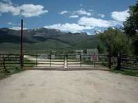
From the east, exit I-80 on exit 303 and turn left onto Kittridge Canyon, travel (southeast) for 0.2 mile to Idaho Street, turn right and follow Idaho street (southwest) for 1.6 miles to the intersection with state route 227 (Lamoille Highway). Turn Left and follow route 227 for 17 miles while heading generally in a southeast direction to the four-way intersection with Pleasant Valley Road. Turn right onto Pleasant Valley road and follow this dirt road due south for 3.4 miles to a sharp right hand bend in the road. Find a place to park near the locked gate.
From the west, exit I-80 on exit 301 and turn right onto Mountain City hwy, travel (southeast) for 1 mile to Idaho Street, turn left and follow Idaho street (northeast) for 0.8 miles to the intersection with state route 227 (Lamoille Highway). Turn right and follow route 227 for 17 miles while heading generally in a southeast direction to the four-way intersection with Pleasant Valley Road. Turn right onto Pleasant Valley road and follow this dirt road due south for 3.4 miles to a sharp right hand bend in the road. Find a place to park near the locked gate that is the entrance to the campground.

Topo of full route
~ From Gate to Trail-head ~
Some have climbed over the locked steel gate, and followed the dirt road a few hundred yards to a intersection, stay right and follow up hill (gaining about 500 feet) to the end for about a mile total distance from the gate. At the end of the road is a campsite and some parking to the left. We paid the fees and camped at the campsite to get an early start in the morning from and save the hassle of having our vehicle parked down at the gate and most of this is covered in the Red Tape section below. Those who park at the gate may be cited by the sheriff's department.
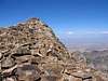
Summit visitors/register
When we were there, we signed a register placed next to a large cairn. Unfortunately, it has been reported by others that this register was missing but most likely a newer one has been placed since. A great resource to see who has climbed this mountain can be found at peakbagger.com
Peakbagger also has a large number of trip reports and county highpointer trip report links as well. Thanks to Greg Slayden who is the person who has spent zillions of hours creating the peakbagger resource. See the full Ruby Dome peakbagger page HERE.
Red Tape
There is no red tape to climb this peak from the locked gate on Pleasant Valley Road. But if wanting to reach the trailhead, obtain the key (for $10 a person and $25 returnable deposit) from the Spring Creek Property Owners Association, 451 Spring Creek Parkway, Elko NV 89801, or by calling the office, (775) 753-6295, Mon. - Fri. 8:00 am - 5:00 pm. Their office is located about 3 miles on Spring Creek Parkway from the intersection with Route 227 in Spring Creek..
More information by Richard Carey is to be found HERE.
We were treated very well by the folks at the Spring Creek Prop. Association but the cost was actually 20 bucks as you have to pay for the day in and the day out even if you camp only one night. We also found the campsites to be in lousy shape and the outhouse was locked up and in poor repair. Mosquitoes were plentiful even in October so be forewarned. Yet, all of this didn't deter us from enjoying an early morning start and we appreciated saving the 2 1/2 miles saved and the 500 feet of elevation saved. You could probably park outside of the gate as many do but having our vehicles inside and somewhat protected was meaningful to us.
When To Climb
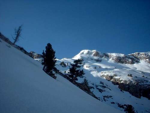
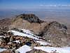
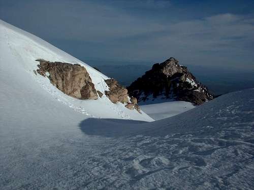
The high country above Griswold Lake on the way to Ruby Dome
Even though this peak is generally climbed in the summer months (based on the lack of trail usage) this peak could be climbed all season. The roads are all plowed to the locked gate. With the correct gear, snow (winter) conditions make the travel extremely easier.
Camping
There are about 10 campsites at the trailhead, which can also shave off about 1.2 miles and 450’ of elevation. To use these campsites contact the Spring Creek Association Campground. It is possible to obtain the key (for $10 a person and $25 returnable deposit) from the Spring Creek Property Owners Association, 451 Spring Creek Parkway, Elko NV 89801, or by calling the office, (775) 753-6295, Mon. - Fri. 8:00 am - 5:00 pm. Their office is located about 3 miles on Spring Creek Parkway from the intersection with Route 227 in Spring Creek. I didn’t use this approach so I’m not sure how difficult it could be to get and return the key.
The following was our experience:
We had no problem in getting the key to the campground and the folks at the Spring Creek organization were very helpful. Be prepared for a campground that is not much of a campground. Few tables, the outhouse was closed and the campsites were lousy. However, since we car camp (sleep in our vehicles) it didn't matter as we appreciated the fact that we didn't have to leave our vehicles parked on the road and the savings of 1.2 miles and 500 feet of elevation gain allowed us an extra hour of sleep the morning of our effort.
We had no problem getting our deposit back since we got there before 5 pm.
Camping can also be found at Griswold lake and a few other locations can be found below Griswold lake. There is plenty of water from the trailhead to Griswold lake.
 |
Mountain Conditions
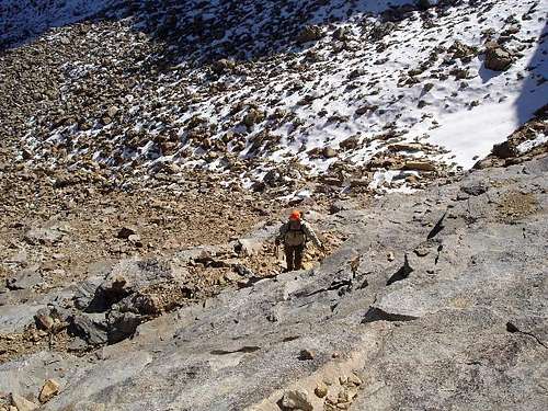
The lower portions of the trail up Hennen Canyon are dry and exposed for the first mile or so, which can be extremly hot in the summer months, it then moves into a more wooded environment for another two miles.
Snow pack can still remain well into the summer months at higher elevations.
National Weather Service
Elko Weather Forecast Office
3720 Paradise Drive
Elko, NV 89801
Tel: (775) 778-6716
 |
 |
 |
 |
 |
Gear
Nothing special is required in the summer months—Crampons and Ice axe are required during snow packed conditions.
Weather at nearby Elko Nevada
Here is the weather report for ELKO
Copy these lines of html:
Postscript
On August 13, 2006, Arizona resident Scott Surgent climbed Ruby Dome and wrote a terrific trip report. With Ruby Dome climbed, he had completed the last county highpoint he needed to finish the state of Nevada. Congratulations to Scott. His trip report? See it HERE.
Elko County Nevada
Since Ruby Dome is the county highpoint of this county, here is some information I found at Wikipedia.
In the year 2000, the population was 45,291. Its county seat is Elko. The county was organized on March 5, 1869, being taken from Lander County. Elko County is the 6th largest county (by area) in the United States.
History
Elko County was created out of eastern Lander County in 1869. Several explanations for the derivation of its name have been offered. One explanation is that Elko is an Indian word meaning either "white woman" or "beautiful." Another explanation credits railroad owner Charles Crocker with the naming of a railroad station after elk roaming in the area, and adding an "o" to form "Elko".
famartin1 - Oct 24, 2014 3:29 am - Hasn't voted
register missingCouldn't find it when I summitted on 7/25/2014. I was hoping to see my entry from 2010 in there. :(
Apeakhikernv - Aug 5, 2015 6:52 pm - Hasn't voted
Ducks to the top!As of aug. 5 2015.. Someone has placed ducks all along the route to the west ridge of Ruby dome... Very easy to follow and a great route. Thanks!
Fred64 - Sep 2, 2023 7:32 am - Hasn't voted
Ruby Spring Camp2023 The campground has been improved and cleaned up. water and fire rings etc.