
-
 56925 Hits
-
 91.88% Score
-
 37 Votes
|
|
Mountain/Rock |
|---|---|
|
|
43.96070°N / 109.3393°W |
|
|
Mountaineering |
|
|
13164 ft / 4012 m |
|
|
Overview
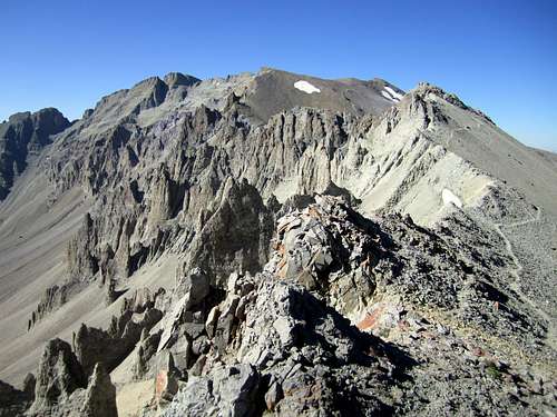
Francs Peak from the northeast
Francs Peak is the highest peak and sole 13er of Wyoming's Absaroka Range. Its several-square-mile massif includes 8 measured sub-summits over 12,000 feet occupying several ridges and sub-ridges with the west face dropping steeply for 4000 feet to the Greybull River. In addition to reigning over the Absaroka Range and the Big Horn Basin, the expansive view from its summit includes the highpoints of Wyoming's other 13er ranges - Big Horn, Wind River, Teton, as well as Montana's highpoint. It was likely climbed by prospectors in the late 19th century from the nearby mining encampment of Kirwin and is named for Otto Franc, a Big Horn Basin homesteader. It is the only major Wyoming peak that has seen mining activity.
Francs Peak sees many ascents every year due to its prominence and stature as a range highpoint. Because it is the highest point in Park County, it has seen even more activity in recent years due to the increasingly popular hobby of county highpointing. Even without all of the accolades, the summit is well worth a visit, as it towers 500 feet over any other peak in the Absarokas!
Note: Original page was written by jimmyjay
 Francs Peak
Approaches
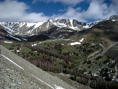 The southern approach through Meadow Creek Basin
Both approaches begin in Meeteetse (home of the world's rarest mammal). Turn on highway 290 by the gas station, and drive for about 7-8 miles, where you will see the left turn onto the Wood River Road.
For the southern approach, turn here and continue along the good county road (paved for a while) and eventually enter the Shoshone National Forest. After 21 miles and the Brown Mountain campground the road becomes rather rough for cars. 4WD is not necessary, but high clearance is needed in some areas to cross the streams as well as the big crossing of the Wood River just before the Meadow Creek trail head.

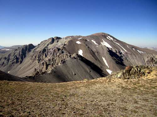
Northeast ridge

For the northern approach continue on the highway past the Wood River Road turn, branching off on the Phelps Mountain jeep road by some tanks a couple miles past the Four Bear hills & oil field. To avoid the 4WD section, continue on the main road for several more miles to the campground and trailheads at road end. The Jack Creek trail heads due south for 7 miles to the north slopes of the mountain.
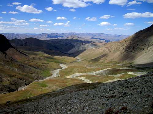 The Jack Creek drainage
Regulations and Requirements
There are no permit requirements to climb Francs from either side. Wilderness rules and etiquette apply for group size, fires, and water filtration. Francs Peak is on the Washakie Wilderness boundary and administered by Shoshone National Forest. Francs is a known grizzly habitat; take precautions.
Camping
There are two basic Forest Service campgrounds on the southern approach (Wood River) road. High camp can be made in Meadow Creek Basin to shorten the summit day. The northern approach is on alpine tundra with sparse water availability.
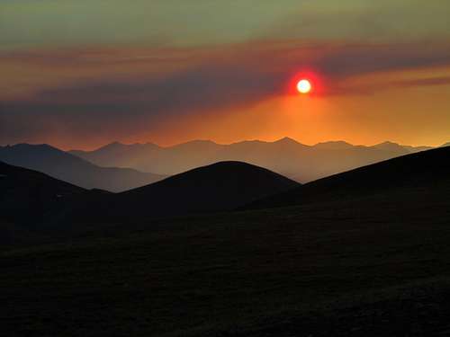 Smoky Absaroka sunset
Geology and Trivia
- The latest government survey lists the elevation at 13164' (4012m), an increase of eleven feet.
- Francs is the fourth highest Range Highpoint in Wyoming and the lowest 4-km peak.
- It was Otto Franc's accusation of cattle theft that resulted in the conviction of Butch Cassidy (Butch was later pardoned by Governor Richards). In Germany, Franc was a Count; in Wyoming he was a land baron, sheriff, and judge.
- Absaroka (pronounced 'ab-SOR-kuh') is from the Crow indian word for themselves and translates to 'Sparrowhawk People'.
- The rock in this region is Absaroka breccia making technical ascents rather dangerous.
- The Absaroka Range stretches 160 miles from Livingston, Montana to a point east of Dubois, Wyoming. At their widest they are about 75 miles thick. The are bounded by the Beartooth Range and Bighorn Basin to the north and east, the Wind River Basin and Jackson Hole to the south and the Yellowstone Plateau to the west. The largest section (Wyoming) was formed by extensive volcanism prior to the formation of the neighboring ranges of the Rocky Mountain chains. Though the volcanic activity has died and the sources have become indistinct, the active Yellowstone caldera hotspot is slowly creeping east, under the range. Breccia rock from the Abasaroka eruptions has been found as far away as Arkansas.
- Because it is one of only four Wyoming 13ers outside of the Wind Rivers, a range highpoint, a county highpoint, and a peak with both 4000' of prominence and a 50 mile dominance, mountaineering activity has increased drastically in recent years along with the rise in list-making.
- The Shoshone National Forest was the first in the nation and was created due to its proximity to Yellowstone NP.
- More info on the endangered Black-footed Ferret
- Meeteetse (meh-TEET-see), is Shoshone for "meeting place".
- "I have named these mountains 'The Sierra Shoshonee' because the right to name them is clearly mine, as I have been the first to cross them and mark out their geographical position and extent."
- Captain William Jones, Army Corps of Engineers, 1873.
Sources/Bibliography
Turiano, Thomas (2003). Select Peaks; Indomitus Books, Jackson, WY.
Bonney, O.H. (1977). Guide to the Wyoming Mountains, 3rd Ed.; Swallow Press. Chicago,IL.
Mercer, Lee and Maughan, Ralph (2000). Hiking Wyoming's Teton and Washakie Wilderness Areas; Falcon Press. Helena, MT.