
|
|
Mountain/Rock |
|---|---|
|
|
39.54879°N / 119.6618°W |
|
|
Washoe |
|
|
Hiking |
|
|
Spring, Fall, Winter |
|
|
5890 ft / 1795 m |
|
|
Overview
Peak 5890 – the Sparks Plateau is a wide plateau just east of Sparks, Nevada. It is part of a desert wilderness just outside the city. It can be combined with the Canoe Hills.
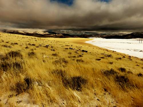
Looking down at the lower part of the plateau
Sparks Plateau isn’t high by Nevada standards. It does have a prominence of 360’ and there are nice views of the surrounding mountains. Because of its accessibility, the area around it is pretty popular. The summit itself isn’t frequently visited because roads don’t go all the way up to the summit. Only a mining road, not accessible by the public, goes within about 80’ and 250 yards.
The Sparks Plateau is approached generally from the north side, with hiking distances between 4 and 4 ¼ miles one way. There are a couple neighborhoods to the west that are only about 1 ½ miles from the summit. However, these are not good starting points because they are within compact residential neighborhoods, and there are private land concerns. It is better and more scenic to hike from designated trailheads.
The Sparks Plateau is best hiked in colder weather months. It can see some snow in the heart of winter, but generally the area is accessible all year round. The best times to hike are late October through late-March. The rest of the year is generally too hot; and you may run into snakes on a warm day in April, May, or September.
Getting There
There are two primary approaches. The first is from Golden Eagle Regional Park. The second is to use the primary trailhead below the Canoe Hills at Earthstone Drive.
From the Golden Eagle Regional Park. To get there take I-80 to the Vista exit. Head north for about 8 miles and follow signs into the park. Once entering the park, stay right and continue for almost a mile. There is a trailhead on a dirt road on the right. That is the starting point.
For the Earthstone Drive starting point, take Vista north for about 2.7 miles and merge east onto Los Altos Blvd. Follow it for about 1mile and turn right at a round-about up Belmar. Follow it up the hill to the end. It ends at Earthstone Drive. There is a dirt road heading towards the hills. Park anywhere on the street.
Route
From Golden Eagle Regional Park, there are two options. The shortest is to take the main road straight for about 2 ¾ miles to a T-junction. At this point, less than 700’ have been gained. Once at the T-Junction head left and then get off the road and head straight up the slope. It is about 1 ¼ miles up and over three false summits, gaining about 700’to reach the true summit. The total distance and elevation gain is about 4 miles and 1,400’.
The second option is to head to the benchmark via the switchbacks. To do this, take the main road for about 1/2 mile and there is a trail on the right. Take the trail as it switchbacks up to a bench on the top of the ridge, just below the east summit of the Canoe Hills. From here, continue on the ridge for almost 1 ½ miles to a road. You are now at the base of the Sparks Plateau at roughly the same point as described above. From the trailhead, the total distance is about 4.7 miles with an elevation gain of about 1,500'.
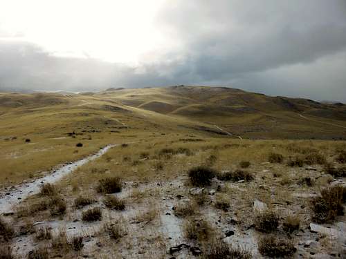
Sparks Plateau from the east summit of the Canoe Hills
From the Canoe Hills trailhead at Earthstone, continue up towards the base of the pyramid which is reached in about 0.8 miles. This is a great opportunity to hike up and down the pyramid in order to get two summits for the day. Continue past the pyramid for 2/3rds of a mile towards the east summit of the Canoe Hills – Point 5,356’. You reach the benchmark just below the summit. Follow the same directions as noted above. From the trailhead, it is about 4 ¼ miles to the summit, gaining about 1,200’.
Red Tape
At the trailhead at Golden Eagle Regional Park don’t park on the road across from the trailhead. There is a “No Parking” sign. There is parking at the trailhead, or a tenth of a mile away in the parking lot. There is a sign designating private land at the Canoe Hills trailhead, but that refers to the property next to the road and not the road itself.