Longest lines of sight photographed.......

Post general questions and discuss issues related to climbing.
User Avatar
395guy

 
Posts: 156
Joined: Thu Jun 05, 2003 4:00 pm
Thanked: 1 time in 1 post

by 395guy » Sat Feb 27, 2010 5:43 am

radson wrote:I always thought Mt Kenya to Kili was the furtherest visible distance between two pints?


I'd be curious about the distance of the sight line between Mt Kenya and Kili also. When I was in Kenya a few years ago, I spotted the peaks of Mt Kenya shining in the sun waaaay in the distance and pointed it out to my Kenyan host. He didn't think it was it and had never noticed it before. We checked on a map and there was no doubt, it had to be Mt Kenya. Very distinct shape to the peaks.

Later when we were in Eldoret, I spotted Mt Eglon (a 14er) in Uganda dozens of miles away in the distance. And again, my Kenyan host was surprised and had never noticed it way away on the horizon.

The rest of the week, I had fun joking with him. Every now and then, I'd point and say, "Hey, look... there's Kilimanjaro..." :-) (which wasn't visible where we were... and he had hiked it years ago)

This past summer, when I was driving westward across Washington state, I spotted Mt Rainier in the morning sun ~140 miles away on the interstate and pointed it out to the family. It just slowly rose on the horizon. Climbed it a few days later.

I also spotted Mt Shasta way in the distance from Mt Scott (high point at Crater Lake). It was probably ~100 miles away or so.

User Avatar
Iron Hiker

 
Posts: 42
Joined: Thu Mar 22, 2001 1:00 pm
Thanked: 3 times in 2 posts

by Iron Hiker » Sat Feb 27, 2010 6:27 am

395guy wrote:
radson wrote:I always thought Mt Kenya to Kili was the furtherest visible distance between two pints?


I'd be curious about the distance of the sight line between Mt Kenya and Kili also. When I was in Kenya a few years ago, I spotted the peaks of Mt Kenya shining in the sun waaaay in the distance and pointed it out to my Kenyan host. He didn't think it was it and had never noticed it before. We checked on a map and there was no doubt, it had to be Mt Kenya. Very distinct shape to the peaks.

Later when we were in Eldoret, I spotted Mt Eglon (a 14er) in Uganda dozens of miles away in the distance. And again, my Kenyan host was surprised and had never noticed it way away on the horizon.

The rest of the week, I had fun joking with him. Every now and then, I'd point and say, "Hey, look... there's Kilimanjaro..." :-) (which wasn't visible where we were... and he had hiked it years ago)

This past summer, when I was driving westward across Washington state, I spotted Mt Rainier in the morning sun ~140 miles away on the interstate and pointed it out to the family. It just slowly rose on the horizon. Climbed it a few days later.

I also spotted Mt Shasta way in the distance from Mt Scott (high point at Crater Lake). It was probably ~100 miles away or so.


Ask for Kenya to Kili and you shall receive :)

http://www.summitpost.org/image/149986/ ... as-of.html

This is currently the photographed line of sight champion, 227 miles from Mount Sanford to Denali in Alaska. Will it be broken soon? (There are MANY 250+ mile line of sights in the world that have not been photographed!):

http://www.viewfinderpanoramas.org/gall ... nford.html

User Avatar
Day Hiker

 
Posts: 3156
Joined: Fri Dec 26, 2003 2:57 am
Thanked: 61 times in 43 posts

Re: Not Rainier

by Day Hiker » Sat Feb 27, 2010 9:45 am

butitsadryheat wrote:
Iron Hiker wrote:
billisfree wrote:The sunset picture presented in the first post strongly appears to be Mt. Adams to me.


Image

It's kinda hard to get a really sharp detailed topo pictures... because I need
to back off quite a distance, to make sure the provile is not deformed
by rendering the pictures too close.

Mt Adams has 3 "humps" while Rainier has two.

Plus a few other obvious features.

Remember light bends in the air and can sometimes create mirages... making
a mountain look taller than normal.


Nice observations.....but not quite correct, I think. Your 3D of Rainier is actually too close to the mountain - if you back it off more to better simulate how it looks from that far away in Oregon, Liberty Cap will come into view and thus serve as the "hump" on the right. Point Success, Columbia Crest, and Liberty Cap are the three humps seen on Rainier.

I'm trying to figure out how to post a Google Earth 3D shot of Rainier from the ESE from my computer on here....never done it before.


Ask Dayhiker. He can make/take a look at anywhere from any distance with his software, like he did for me on the last page, of Bakersfield looking NE. Pick a town where you'd want to view them from and he could prolly figger it out. It's awesome.


I generated images of both Adams and Rainier from the Pendleton/I84 location described in the photo caption. Foreground topography was omitted from the image generation for both because it is only the shapes of the silhouettes that we want to compare; we were not trying to determine if these peaks are in fact visible from Pendleton. Obviously something is visible because the photo exists.

Compare the shapes.

Image

It's definitely Rainier.

It is interesting how Adams does a good job of fooling us by trying to mimic Rainier from this viewpoint. It's rather creepy, actually, like the thing from the movie The Thing.

But upon close inspection, the shape of Adams is definitely wrong.

Link to photo page: http://www.summitpost.org/view_object.php?object_id=340670

User Avatar
desainme

 
Posts: 6256
Joined: Thu Sep 19, 2002 6:02 pm
Thanked: 85 times in 65 posts

by desainme » Sat Feb 27, 2010 5:34 pm

Here is a curious fact: The five states, Wisconsin, Michigan, Illinois, Indiana and Ohio arising from the Old Northwest Territory are not known for any great elevations. However certain hills above the Ohio River in Lawrence and Gallia Counties, Ohio are within the "visibility cloak" of Knobs on Guyandot Mountain, Boone County and the next county over in WV. The knobs are Pilot Knob SW and Ivy Knob 3560 ft. The distances between Pilot Knob SW and Lawrence/Gallia Counties Ohio shown on the Hey What's That website are between 65 and 78 miles. No such elevations are visible from the remaining 4 states in the Old Northwest.

User Avatar
Gabriele Roth

 
Posts: 1376
Joined: Tue Dec 09, 2003 11:09 am
Thanked: 24 times in 17 posts

by Gabriele Roth » Sat Feb 27, 2010 6:46 pm

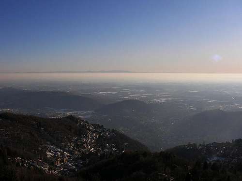
from Brunate to Appennines = ~ 220km

Image

no avatar
meganerd

 
Posts: 2
Joined: Sat Mar 02, 2002 12:47 am
Thanked: 0 time in 0 post

by meganerd » Thu Mar 04, 2010 11:32 pm

I'm way too fascinated by this topic...

I don't have time to fiddle with the line-of-sight software right now, but if anybody wants to plug it in, Denali is probably visible from the southernmost peaks in the Brooks Range, about 300 miles away. The mountains surrounding Coldfoot on the Dalton Highway for example are about 4000 feet high, and I may just have to hike up there within the next month or two to check it out (we get our clearest sky conditions this time of year usually).

On second look, maybe not. Though most of the line of sight passes over the Yukon and Tanana River flats, it also must crest a shoulder of moderately high mountains, a bit over halfway to Denali, right where it would accentuate the earth's curveture. Still I bet you could top 300 miles from somewhere in the Brooks Range, though the spot might be rather hard to get to.

User Avatar
Iron Hiker

 
Posts: 42
Joined: Thu Mar 22, 2001 1:00 pm
Thanked: 3 times in 2 posts

by Iron Hiker » Fri Mar 05, 2010 1:04 am

meganerd wrote:I'm way too fascinated by this topic...

I don't have time to fiddle with the line-of-sight software right now, but if anybody wants to plug it in, Denali is probably visible from the southernmost peaks in the Brooks Range, about 300 miles away. The mountains surrounding Coldfoot on the Dalton Highway for example are about 4000 feet high, and I may just have to hike up there within the next month or two to check it out (we get our clearest sky conditions this time of year usually).

On second look, maybe not. Though most of the line of sight passes over the Yukon and Tanana River flats, it also must crest a shoulder of moderately high mountains, a bit over halfway to Denali, right where it would accentuate the earth's curveture. Still I bet you could top 300 miles from somewhere in the Brooks Range, though the spot might be rather hard to get to.


Probably not. Here's the Denali view: http://www.viewfinderpanoramas.org/pano ... nali-N.gif
There's no sign of the Brooks Range, since the mountains around the Yukon River seem to block it. Mount Blackburn in the Wrangells seems to be the farthest spot you can see at over 260 miles: http://www.viewfinderpanoramas.org/pano ... nali-S.gif.

By the way, heywhatsthat.com has bad data for Alaska, so don't try using it to confirm this. It will glitch out over 200 miles. But Viewfinder does an absolutely fantastic job - I just wish there would be more American panoramas.....

User Avatar
Day Hiker

 
Posts: 3156
Joined: Fri Dec 26, 2003 2:57 am
Thanked: 61 times in 43 posts

by Day Hiker » Fri Mar 05, 2010 4:03 pm

meganerd wrote:I'm way too fascinated by this topic...

I don't have time to fiddle with the line-of-sight software right now, but if anybody wants to plug it in, Denali is probably visible from the southernmost peaks in the Brooks Range, about 300 miles away. The mountains surrounding Coldfoot on the Dalton Highway for example are about 4000 feet high, and I may just have to hike up there within the next month or two to check it out (we get our clearest sky conditions this time of year usually).

On second look, maybe not. Though most of the line of sight passes over the Yukon and Tanana River flats, it also must crest a shoulder of moderately high mountains, a bit over halfway to Denali, right where it would accentuate the earth's curveture. Still I bet you could top 300 miles from somewhere in the Brooks Range, though the spot might be rather hard to get to.


Without creating a simulated view, it can be calculated that this view is not possible. Between a 20,000-foot peak and a 4,000-foot peak on the Earth, the farthest possible view is in the range of 250 miles, and that is if the terrain at the critical points between them is at sea level.

Denali and Foraker are clearly visible from sea level at the shore in Anchorage, when the weather is clear. That is a 133-mile view from sea level, which is pretty cool.

27 August 2005:

Image

Image

User Avatar
mrchad9

 
Posts: 4545
Joined: Thu Jul 02, 2009 12:01 am
Thanked: 1338 times in 911 posts

by mrchad9 » Mon Jun 07, 2010 10:26 pm

It was amazingly clear yesterday. I've often been able to see the Coast Ranges from the Sierra (100-130 miles away), but I think yeserday is the first time I've ever been able to see the entire valley floor as well. Usually it is just the Coast Ranges peaking over the haze.

User Avatar
Day Hiker

 
Posts: 3156
Joined: Fri Dec 26, 2003 2:57 am
Thanked: 61 times in 43 posts

by Day Hiker » Thu Jun 10, 2010 8:15 am

butitsadryheat wrote:On the way back from the coast yesterday, I was able to see the Sierra from the intersection of Hwy 46 and Kecks road. I think I saw the Mineral King area, and the area north of that, possibly up to the Yosemite area (it was easy to see the snow capped peaks, but hard to identify any in particular), This had to be over (or around) 100 miles.
Day Hiker, can you run this through your software? It was ENE or NE of that intersection, west of Blackwells corner.


I've been kind of busy, so not too many labels, but here is an image. It's a 90-degree field of view, from due north to due east.

LOL at the big horizontal scroll . . .

Image

User Avatar
McCannster

 
Posts: 844
Joined: Tue Apr 26, 2005 10:56 pm
Thanked: 52 times in 36 posts

by McCannster » Thu Jun 10, 2010 10:02 am

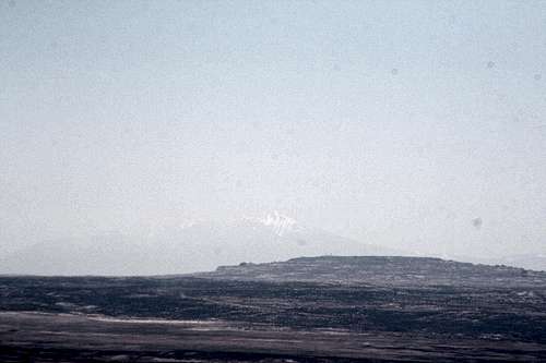
From <a href=http://www.summitpost.org/mountain/rock/397784/navajo-mountain-ut.html>Navajo Mountain, Utah</a>. Here is Humphreys Peak, located 125 miles to the south.
Image


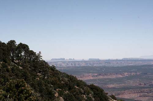
And Monument Valley, 42 miles to the east. I include this photo just because its so cool to see the features of Monument Valley so clearly, even though they are 42 miles away.
Image

Both shots taken from the same spot at around 8000 feet. The summit itself doesn't have a view, but I climbed one of the radio towers at the summit and got a 360 degree view that probably stretched across both Utah and Arizona east-west.

Both photos taken by Alex Loomis.

User Avatar
McCannster

 
Posts: 844
Joined: Tue Apr 26, 2005 10:56 pm
Thanked: 52 times in 36 posts

by McCannster » Thu Jun 10, 2010 6:20 pm

MikeTX wrote:when redneck and i were on baldy's summit last march, we could see charleston peak over in nevada. that was pretty cool.

there was something else farther off in the distance with snow on it that we couldn't figure out what it was. i was guessing humphreys over in az, but i just looked at the map and i think that's way too far.


Yeah, wouldn't be Humphreys, way too far away. Was it in the direction of Humphreys from Baldy though (roughly ENE-ish)? Maybe could have been those mountains above Kingman, AZ (blanking on the name...Huavasupai or something like that?)

PreviousNext

Return to General


  • Related topics
    Replies
    Views
    Last post

Who is online

Users browsing this forum: No registered users and 0 guests