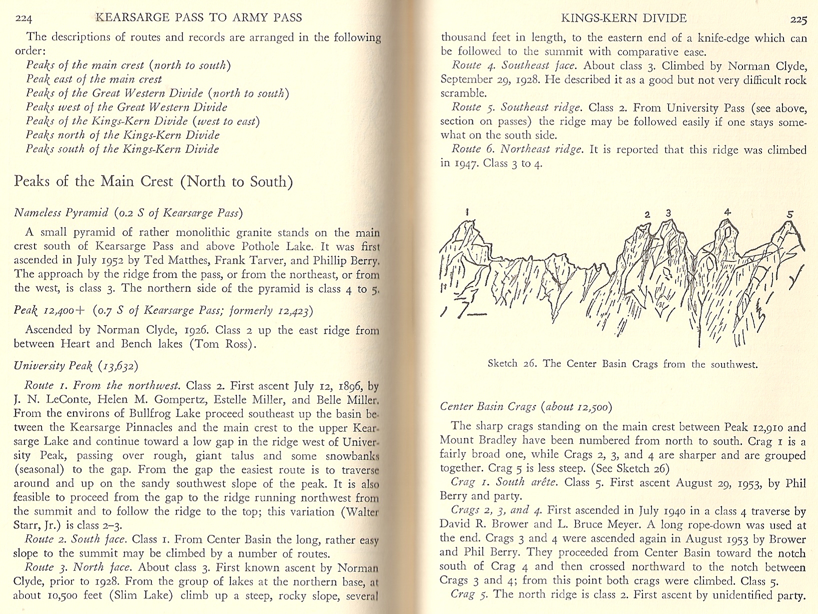
Center Basin Crags
I'm curious if anyone has any insight into the numbering of the Center Basin Crags, specifically No. 5. Secor describes the route to Center Basin Crag No. 5 as follows: "This is a class 2 scramble from the north." He also mentions that "[t]he notch between Crag No. 3 and Crag No. 4 is reached by traversing to it from the large scree gully that leads from Center Basin to the saddle north of Crag No. 5. I found an annotated image of the crags in question from the east, but when looking at photos from the west I can't help but wonder if No. 5 is mislabeled, either in the image or by Secor.
Annotated image from the east:

Then I found, and marked with letters, this image from the west:

When comparing the the two images with Secor's description of a 'class 2 scramble from the north', and the 'large scree gully that leads from Center Basin to the saddle north of Crag No. 5', I am wondering if Center Basin Crag No. 5 may be 'F' in the image taken from the west, and to the left (out of frame) of the crag labeled 'No. 5' in the image from the east.
For additional reference, here are some more images taken from the west:


Thoughts? I readily admit that part of the problem may be that sometimes I misidentify obvious 'large scree gullies', mistake notches for saddles, etc. It's also possible that 'F' and '#5' in the two images are the same and they just look different from the east and west (imagine that).
Annotated image from the east:
Then I found, and marked with letters, this image from the west:
When comparing the the two images with Secor's description of a 'class 2 scramble from the north', and the 'large scree gully that leads from Center Basin to the saddle north of Crag No. 5', I am wondering if Center Basin Crag No. 5 may be 'F' in the image taken from the west, and to the left (out of frame) of the crag labeled 'No. 5' in the image from the east.
For additional reference, here are some more images taken from the west:
Thoughts? I readily admit that part of the problem may be that sometimes I misidentify obvious 'large scree gullies', mistake notches for saddles, etc. It's also possible that 'F' and '#5' in the two images are the same and they just look different from the east and west (imagine that).