Page 3 of 6

Posted:
Mon Jun 14, 2010 11:13 pmby tb00957
Where did you camp? Do you have to melt snow for water?
Posted:
Mon Jun 14, 2010 11:31 pmby The Chief
tb00957 wrote:Where did you camp? Do you have to melt snow for water?
Camp here and you don't have to worry about crossing any snow bridges or log jams. Got plenty of open running water as well. Straight forward and far safer IMO.
Posted:
Mon Jun 14, 2010 11:34 pmby tb00957
Sorry for my ignorance, cant' tell where it is. Is this on the south side over bishop pass and thunderbolt pass? Never been up there.
Posted:
Tue Jun 15, 2010 12:08 amby The Chief
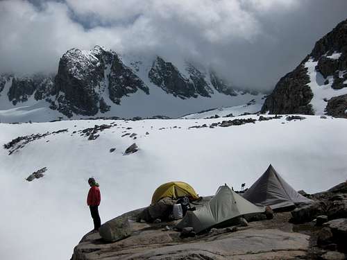
Nope. Well above Sam Mack Meadows actually. Kind of a secret spot and never will you find any other folks around.
Most will camp in this area...
Posted:
Tue Jun 15, 2010 12:38 amby Hyadventure
I camped in about the same spot as Chief’s second pic. It’s about 300’ below Gayley Camp. While passing through Gaylay Camp I did see at least one tent pad free of snow. We mostly melted for water, but there were many melt off streams on the more vertical rock. They just weren’t that close to camp and were too lazy.
Posted:
Tue Jun 15, 2010 1:11 amby Kaweah69
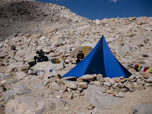
Chief, nice pic. Is that an old North Face Dandelion tent I see there (the teepee style one)? I own one -- it is the sturdiest tent I've ever run across. My kids won't use it -- it stinks of dad's old farts and and many a burned spliff.
Mike
Posted:
Tue Jun 15, 2010 2:32 amby rhyang
The Chief wrote:Nope. Well above Sam Mack Meadows actually. Kind of a secret spot and never will you find any other folks around.
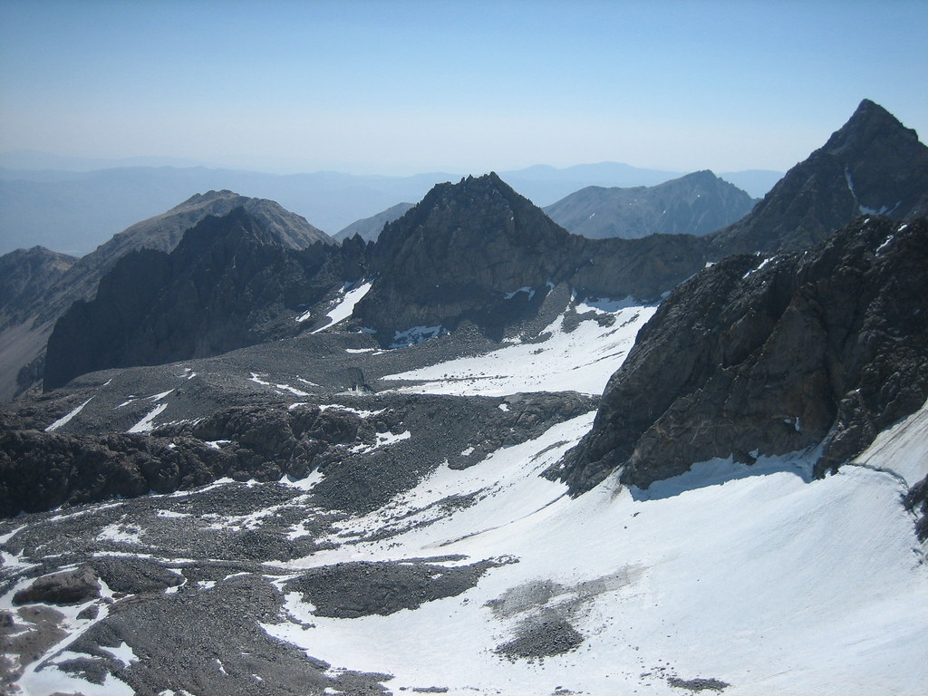
Hmm, could it be just to the right of center in this pic ?
(original sized pic
here)
Posted:
Tue Jun 15, 2010 2:48 amby The Chief
Nope.... more like in the lower left corner outta the pic.
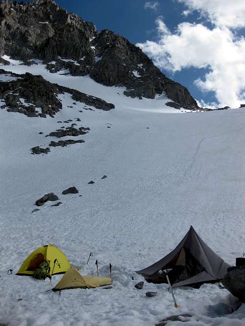
Here is another shot from the same spot, with my SD Origami 2, on a solo trip three weeks after the above posted shot.
 Kaweah69
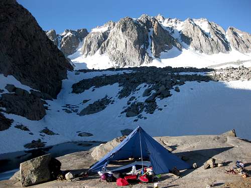
That is a Megamid. One of two that I own and use regularly year round in all conditions. One of em is an original
<C> that I have had since 1988.
Here it is on one of my many trips to Whitney...
Posted:
Tue Jun 15, 2010 8:21 amby hamik
Chief, is that just the lake above Sam Mack Meadows? I've only stayed in the little valley above the meadows and N of the principal glacial moraine, where there is running water in summer, but the lake sounds like a better option for now.
Posted:
Tue Jun 15, 2010 3:20 pmby rhyang
The Chief wrote:Nope.... more like in the lower left corner outta the pic.
Here is another shot from the same spot, with my SD Origami 2, on a solo trip three weeks after the above posted shot.
Heheh, that lake looks very familiar -
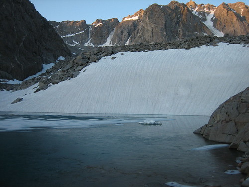
Pretty good clues

Posted:
Tue Jun 15, 2010 4:03 pmby The Chief
That's it Rob....
Keep it clean if ya'll use it, please.
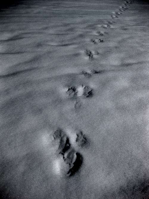
PS: Ran into what the local BIO confirmed from my photos as potenial Wolverine tracks in the snow just below there on my last trip last July.
Yup... more evidence of the illusive Wolverine in the Sierra. Tracks were indeed confirmed by the USFS Wolverine Bio folks in Idaho.
Posted:
Tue Jun 15, 2010 4:43 pmby tb00957
When are the pcitures taken?
Are there running water there now?
My friend's picture from this past weekend shows that lake frozen.
Posted:
Tue Jun 15, 2010 4:49 pmby The Chief
tb00957 wrote:When are the pcitures taken?
Are there running water there now?
My friend's picture from this past weekend shows that lake frozen.
Been there many a times when the lake is indeed frozen but the creek which flows from it down to Sam Mack Mdw will have enough open flow in order to get water from.
Posted:
Wed Jun 16, 2010 7:10 amby connollyck
Hyadventure wrote:I was up there June 4-6 to climb N. Pal. The trail was mostly snow free up to Third Lake. We crossed a large snow bridge (200’ long) at the mouth Third Lake and climbed the couloir behind Temple Crag. By the time we descended the snow bridge was 50% gone and what was left was 80% collapsed. I sure it’s gone now.
Travel on the glacier and the U-notch couloir was a little soft but not too bad. The U-notch firmed-up near the top, but I was still comfortable climbing without rope. Snow bridges over the bergshrund are thin. My partner postholed through (didn’t fall in) but I got a report of another climber (roped) falling in.
I’ll be back up July 4 to attempt Starlight
thanks for the info. see you up there on the 4th
Posted:
Mon Jun 21, 2010 4:54 amby TheNobleSunfish
Back from a great trip! The trail is snow-free up the stream crossing heading up to Sam Mack (right after the trail junction for Sam Mack / 4th Lake) . The standard traverse on the North face of Sill is free of ice and snow except for a couple of easily skirted patches. Thanks again for all the beta!