Here's what I found buried on another site:
What we have found again this year, is that the minimal snowpack there is, is confined to higher elevations and often on horizontal and north facing aspects. Generally speaking, in the south (Kern River) there is (for all practical purposes) no snow below 9,500’. For the Kings and San Joaquin 9,000’ and the Tuolumne ~8,000’. I have also observed that most seasonal snow is gone on south facing aspects above treeline to the highest elevations. However, north aspects are still holding considerable winter and seasonally transitional snow. (snow is lacking on east and west aspects as well)
The above is unofficial opinion by one of the guys who ventures the backcountry to do the official measurements. Most places up high enough to have snowpack are at about half of the most severe drought measurements of the late '70s, with San Joaquin about equal (unlike back then, lower elevation measurements are at 0). I hiked Taboose Pass on Saturday at the same time as a guy who had done the measurements with him. Even after the storm last week, he described the snow cover as reminiscent of mid-June of most years.
The storm last week provided some short term change, but probably didn't change the overall picture for hikers much. You have to go really high to encounter consolidated snowpack. Southern-Eastern-Western facing hikes that lack much shaded and/or horizontal and northern facing sections will generally be dry or not have snow worth much mention. South facing slopes to reach summits will generally be dry. Far Southern Sierra is drier than Central Sierra and probably mostly back to pre-storm conditions south of Langley. Soft, fresh snow is melting fast elsewhere.
http://cdec.water.ca.gov/cgi-progs/snow/DLYSNOWDPOwens Peak via PCT at Walker Pass had some snow for eating Wednesday. It should be all dry again by now. Wildflowers were abundant. Fedak signed the register about a week before me. There were a few backpackers out.
Olancha Peak Thursday via Sage Flat/Olancha Pass and the PCT had some snow on the PCT, especially when venturing farther north on the trail along the shoulder of Olancha Peak than necessary. There were some wildflowers down low. Snow can probably be avoided if any is left. I enjoyed the 2-12 inches I found (higher, shadier, horizontal, and north facing had more). The Gomez Meadow stream beyond Monache Meadow area is a horrible looking trickle and that is the lone running water source. I ate snow to supplement what I carried. I found no register for any signs of Carbo, but maybe (if not all melted out) bscott saw my tracks or those from the FJ Cruiser occupants who showed up Friday morning.

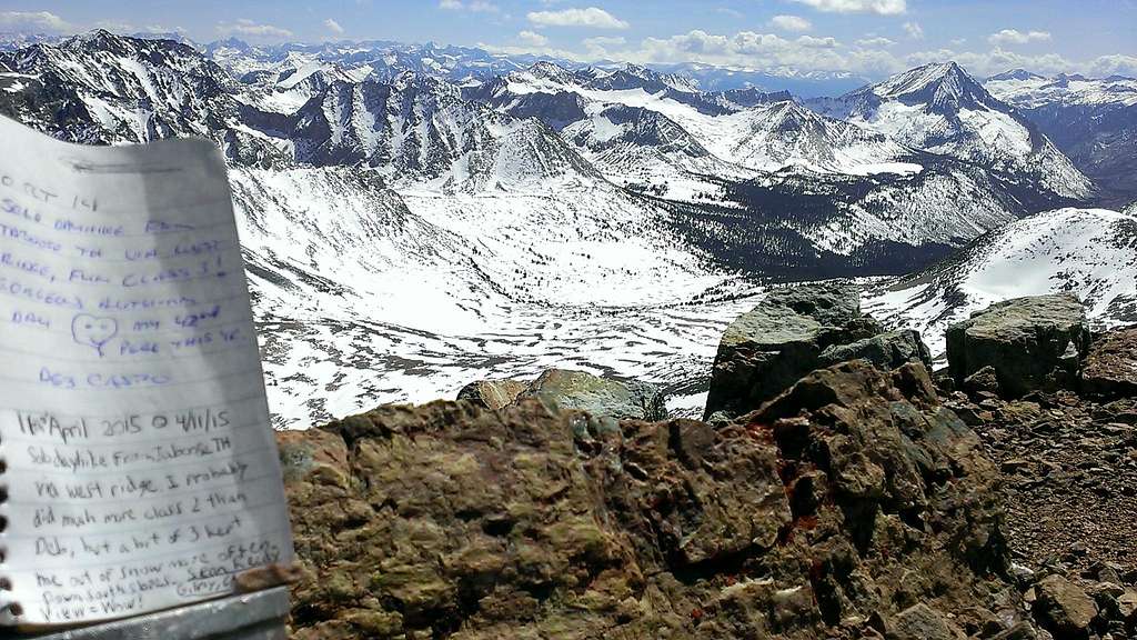
On Taboose, post-holing in patches of 3-18 inches of soft powder became hard to totally avoid above the big waterfall/last creek crossing at around 10,000 feet. Consolidated snow existed up near the pass around 11,000 feet and higher, but not deep enough to cover all rocks and slopes. If determined, one could probably summit Cardinal this week/weekend without touching much snow, but I embraced the easy hydration and cooling method again Saturday. Aside from the hydrologist mentioned above, one backpacker headed out for a week Sunday. The wildflowers were great near the trailhead. Deb beat me to the register by six months to close out 2014, but I was the first for 2015. Skiers visit in March and April of good snow years, but during a nice weather window it is now early summer. The summit was calm enough to lazily bask, prop the register up, and take in the fine views.
I've got plenty of images, especially of Taboose and Independence area if anyone is interested in something specific.
