Page 1 of 1
Road to Bloody Mountain.

Posted:
Tue Apr 25, 2017 1:50 amby Climber Dave
Next few weeks hope to hit the Mammoth area and have been considering climbing the north coulior of Bloody Mtn. Anybody been up that way lately? How far (if at all) can you drive up the 4WD road? Can you get up at all? Or is the snow too low?
Thanks
Re: Road to Bloody Mountain.
Posted:
Tue Apr 25, 2017 3:54 amby Romain
I suspect you would not get very far even if you could drive to where Laurel Lakes Road intersects Sherwin Creek Road. I went for a run on Sherwin Creek Road about 10 days ago and it is still closed where it turns to a dirt road - there were still 5-7 feet of snow on the road where they stopped plowing, probably more in the more shady spots near the campground. Might be a bit better now and all depends on what you mean by "next few weeks" but I would not expect to be able to get very far up Laurel Lakes Road...
Re: Road to Bloody Mountain.
Posted:
Wed Apr 26, 2017 2:54 pmby Climber Dave
Thanks, was considering something in the general area May 6 or 13 (now probably the 13th) was hoping to get up a bit closer. We shall see.
Re: Road to Bloody Mountain.
Posted:
Thu Apr 27, 2017 2:35 amby Clydascope
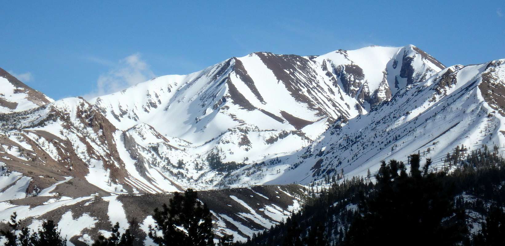
The road is clear of snow for the first half mile or so up from Sherwin Creek Road.
These photos are from today.
The lower switchbacks are snowed over.
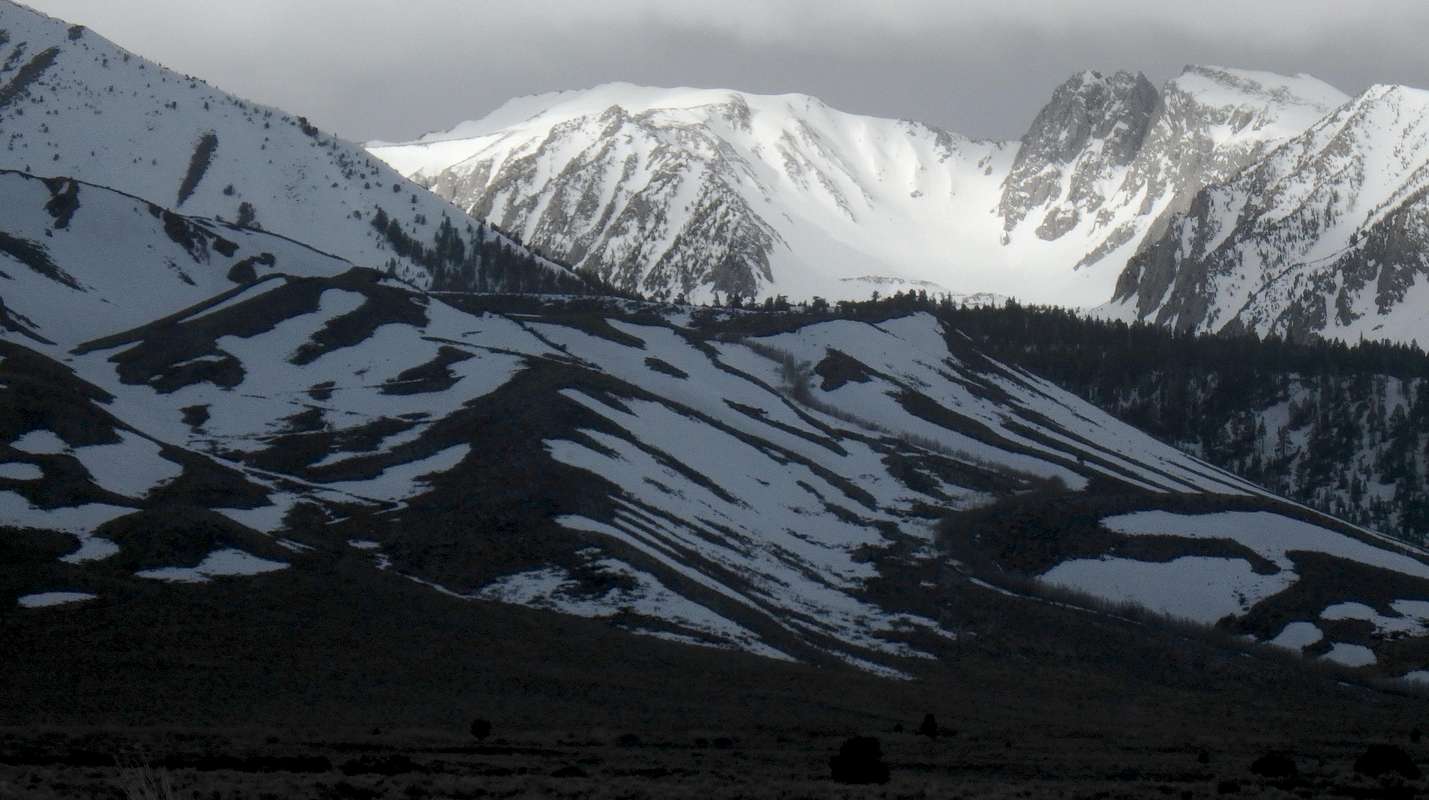
The upper canyon is buried.
Re: Road to Bloody Mountain.
Posted:
Fri Apr 28, 2017 5:20 amby Romain
Cool pictures. Did you reach that point driving on Sherwin Creek from 395 or from Old Mammoth?
Re: Road to Bloody Mountain.
Posted:
Fri Apr 28, 2017 1:11 pmby Clydascope
The first photo is from Hwy 395, the second from Hwy 203
Re: Road to Bloody Mountain.
Posted:
Sat May 13, 2017 4:14 pmby Clydascope
I made it 0.8 miles up this week, past the first snow patch but stopped at the second. The lower section might be melted out in a couple weeks but there is some erosion too.

