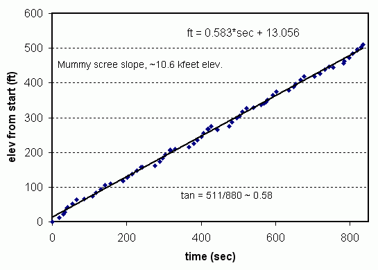
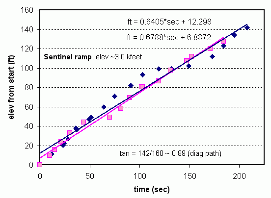
MoapaPk wrote:I'd like clarification on Ze's definition -- before I show plots for tan ~ 1.
From Ze's other link:
Ze wrote:The grade is defined as (vertical distance / horizontal distance) at any given moment.
Tangent, not sine.
Climbing, hiking, mountaineering forum
https://www.summitpost.org/phpBB3/
https://www.summitpost.org/phpBB3/vertical-ascent-rate-t52012-15.html
MoapaPk wrote:I'd like clarification on Ze's definition -- before I show plots for tan ~ 1.
Ze wrote:The grade is defined as (vertical distance / horizontal distance) at any given moment.
Day Hiker wrote:My point is NOT that there is a big difference between 18.8 and 18.5. My point is that you could determine for yourself that I was in fact using the correct definition (tangent) for the calculations. You had stated that you guessed I was using the wrong method:
kevin trieu wrote:boy, way too much science. what happened to heading outside for a walk in the woods without worrying about how far, how fast, how efficient...

Hmmm…. sounds like narc for the MLC SCboy, way too much science. what happened to heading outside for a walk in the woods without worrying about how far, how fast, how efficient...
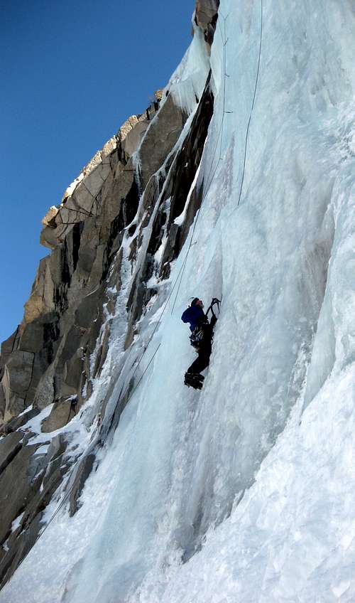
I don’t know, but probably not as speedy as these ice monkeys. Yeah yeah ….I know they’re TRing, but still pretty speedyThe Chief wrote:Whatta ya suppose VAR on these would be....
Ze wrote:What do you think happens when the grade gets close to 100%, and you're scrambling up?
Yury wrote:Do you have a similar plot of VAR vs. altitude?
This summer I have noticed that my VAR is significantly decreasing at higher elevation as compared to sea level.
Do you know whether somebody has calculated how severe is such decrease for other people?