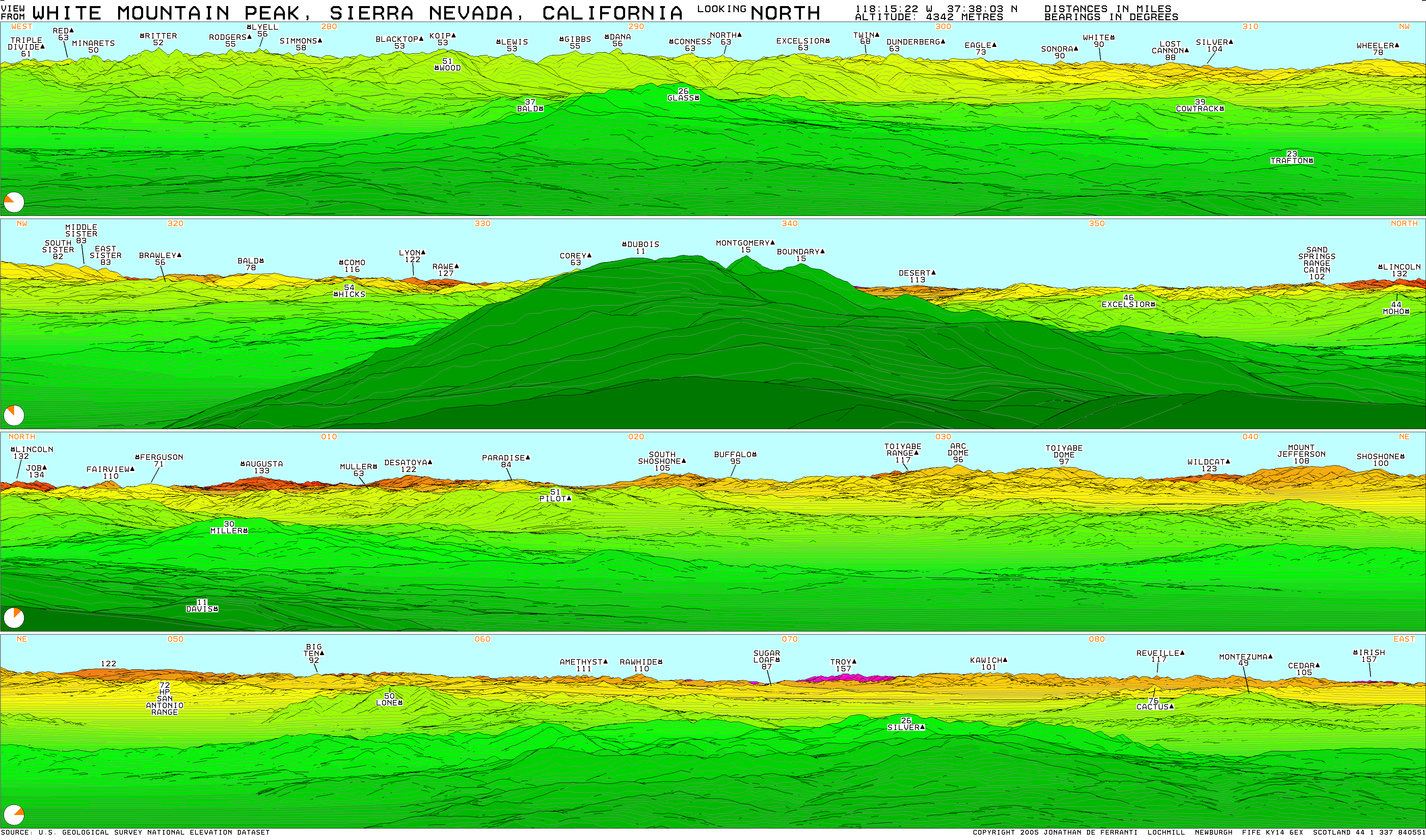
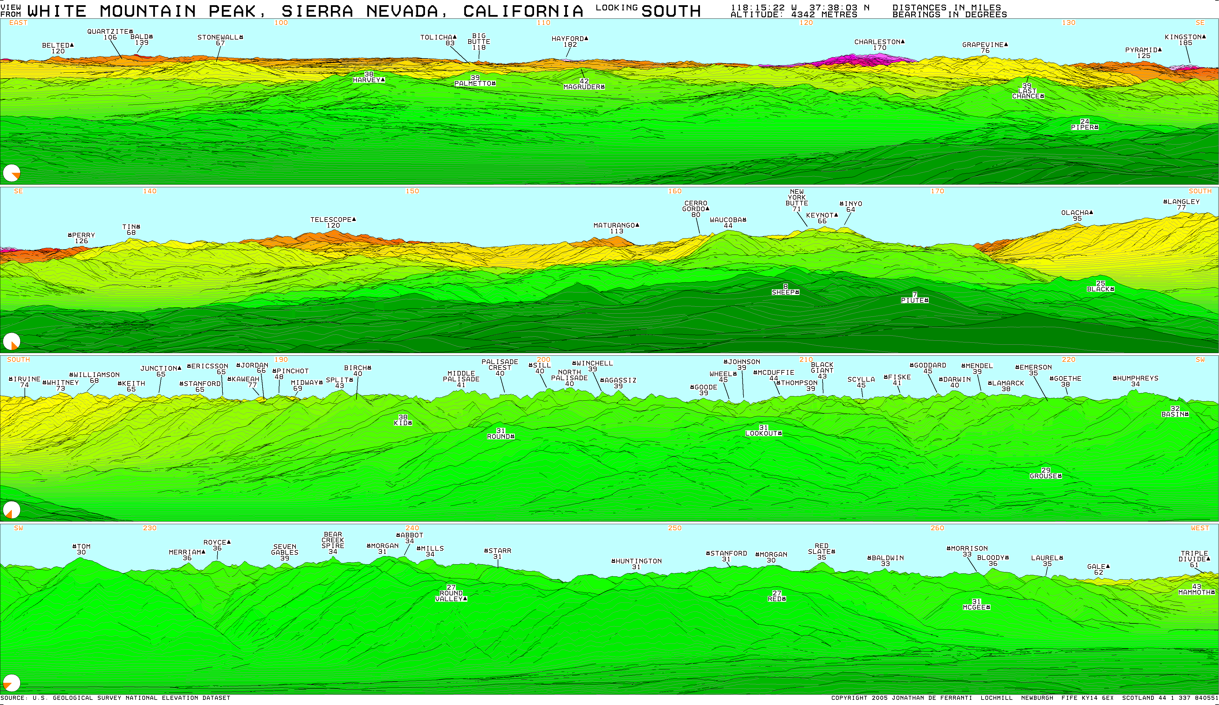
From the summit of White Mountain Peak, I used my program to check from bearing 052.7 to 181.0, and I also got the following visible peaks:
071.6 Troy Peak: 157.4 miles
088.9 Mount Irish: 156.2 miles
120.8 Angel Peak: 173.7 miles (interesting; Angel is only about 8900 feet)
121.9 Mummy Mountain: 171.0 miles
122.9 Charleston Peak: 169.9 miles
134.8 Kingston Peak: 185.0 miles (really far, and Kingston is only 7336 feet)
147.2 Telescope Peak: 120.0 miles
But I did not get results showing there is a direct line of sight to Hayford Peak. So I checked again, specifically targeting Hayford. The results I got show that Hayford should be just slightly (about .025 degrees or 1.5 arc-minutes) below the ridges of Timber Mountain, at bearing 110.9, here:
http://www.mytopo.com/maps.cfm?mtlat=37.06782&mtlon=-116.44467
Hayford does appear in the images generated by viewfinderpanoramas.org, so I am curious why theirs shows Hayford, and my results don't. I am wondering if we are using different values for the Earth's radius. I am using a spherical Earth, with radius 6371.009 km, which is the mean radius, defined by the International Union of Geodesy and Geophysics. Of course, the Earth is not an exact sphere, so using a simple radius is not exactly correct. But it's pretty close.
Or maybe the viewfinderpanoramas program tries to use the help of atmospheric refraction. My program ignores any potential help from the atmosphere because I'm not sure how much I can count on that phenomenon.
On thing I did see is that there may be a slight discrepancy between actual photos and some viewfinderpanoramas images. Some of the photos I compared on the viewfinderpanoramas site show that it
may be rendering distant objects higher in the image than what is actually observed:
http://www.viewfinderpanoramas.org/gallery/usa/whitney.html
In these images, the scale is approximately the same, which can be verified by looking at horizontal distances between corresponding peaks. But it appears to me that some distances in the vertical direction are a bit expanded. For examples, check below San Gorgonio, as well as the entire distant ridge between San Antonio and Waterman, particularly between Waterman and Skinner.
Of course my program is subject to its own errors. I'm not talking mathematical errors (hell no!); math errors probably would result in a completely incorrect image, not one that is only slightly off. But there could be errors due to slight inaccuracies in USGS topo data and maybe even because the Earth is an ellipsoid, slightly flattened at the poles, not spherical.
Of course the only true confirmation would be to look at an actual photo from White Mountain Peak in the direction of Hayford.