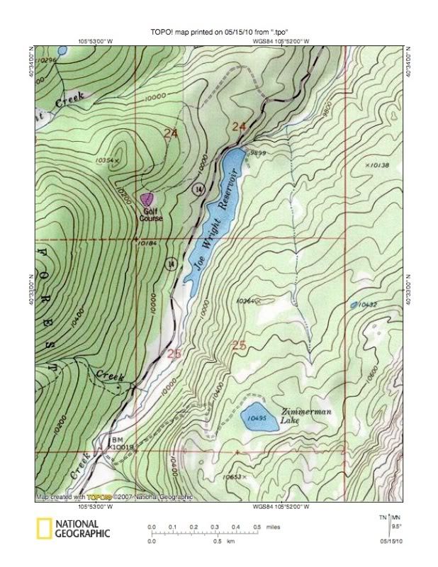
Buz Groshong wrote:nhluhr wrote:I don't know why anybody would use TOPO! unless they REALLY need the ability to center the area of interest on a print-out. But then you're limited by crappy print quality, smaller sheet size, badly aliased graphics, and you're still paying for each map you download!
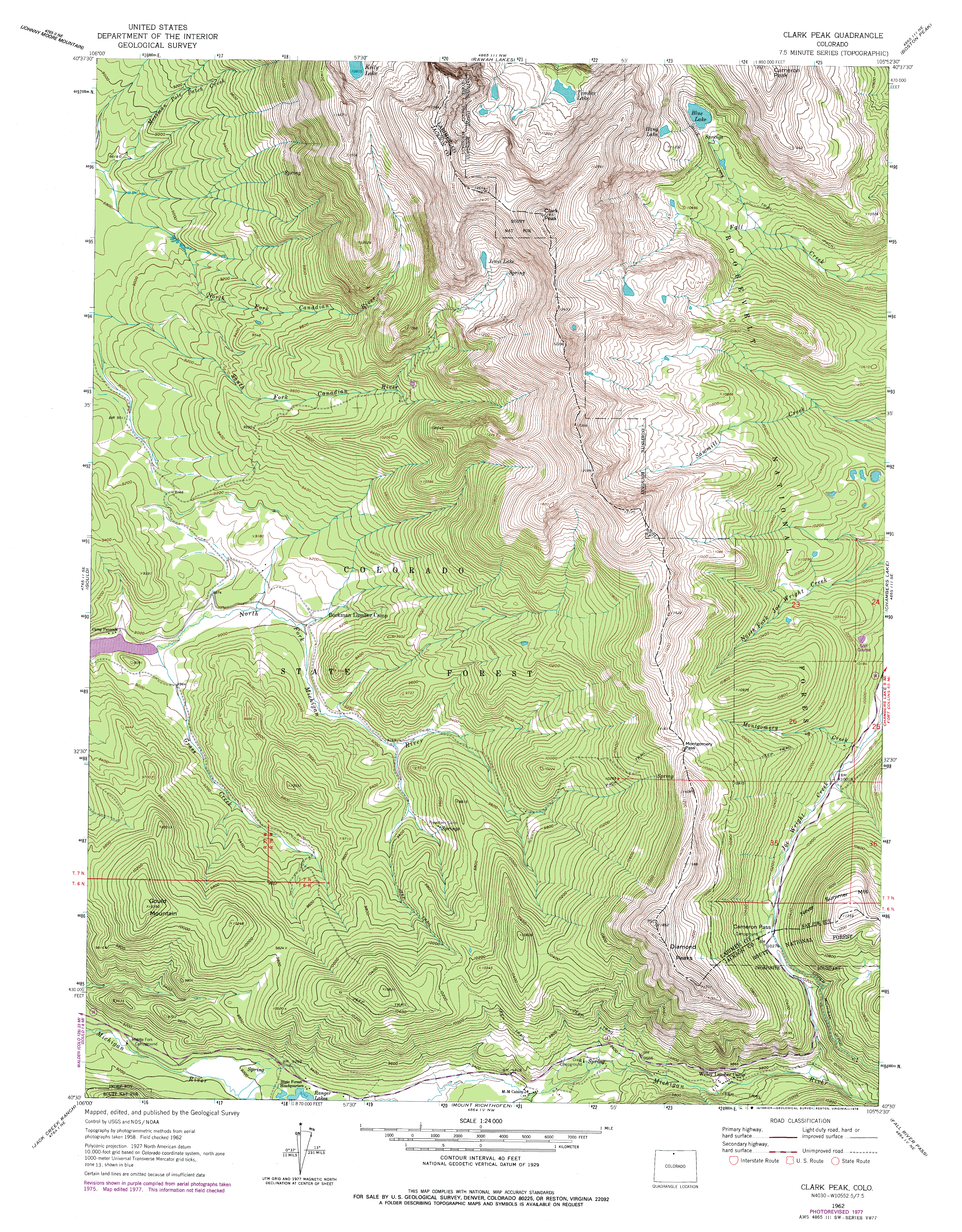
USGS quads are the way to go. If you can't find what you want locally, order it directly from the USGS!
http://store.usgs.gov You can even preview the full resolution pdf version of it first.
Reasons:
1. I can print on letter-size paper at home very cheaply (once I've bought the CD) - perfect for a typical day hike. I can also draw the route on it before I print it out and can annotate it however I please.
2. I can run a profile of the hike route.
3. I can upload data from my GPS and save it with the map file (or save it separately).
4. I can download waypoints from the map to my GPS.
5. The quality is only crappy when the corresponding USGS quad is crappy.
You are missing a big point on quality. Since you're limited to whatever your printer can handle (8.5x11), you either have to zoom out and have illegible map features or lost detail OR forgo all the context of the map that would be helpful for, you know, actual navigation.... Having a zoomed in snippet of a map is useless if you need to triangulate from distant landmarks. Also, the prints that TOPO produce are NEVER as clear to read as a professionally printed USGS quad. Even if you go to REI and get it printed from the TOPO! kiosk, it still sucks.
TOPO! still requires credits to purchase more quads/segments so it's not like it's still free. Once you use up the credits that come with your software (not a whole lot), you have to start paying again. If you just really want to print maps on 8.5x11, you can download every USGS quad for free from the USGS and print the PDF on whatever you want with far more control over output fonts, line thickness, etc thanks to the PDF format.
Regarding maps on your GPS, assuming you're using Garmin like 90% of the world, you can download free open source topo maps that are the same contour/scale/detail as USGS quads and you can also download transparent overlays for trails, landmarks, etc.
Seriously, who pays for all this? It's FREE already! The only thing worth paying for is high quality prints of the maps... and that's what store.usgs.gov is for.
