Read complete review with a FREE topo map of the route here: https://olympusmountaineering.wordpress ... a-v-170-m/
Approach
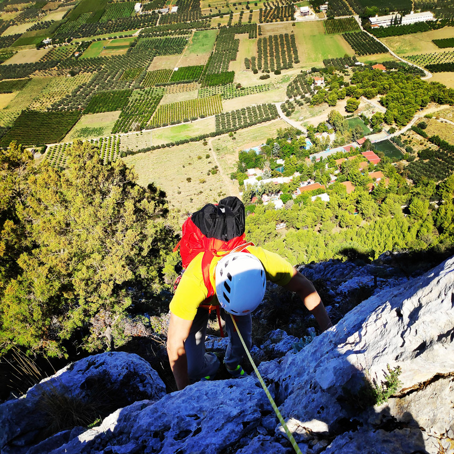
The route is located in the rocks under the peak Oxy on Mount Onia (Oneia) and specifically on the north face of the mountain. Its orientation is north.
Approaching the R0 requires about 20 minutes of hiking from the parking lot.
Parking lot coordinates: 37.876928, 22.970717
Beginning of the route: 37.874461, 22.967683


Route Description
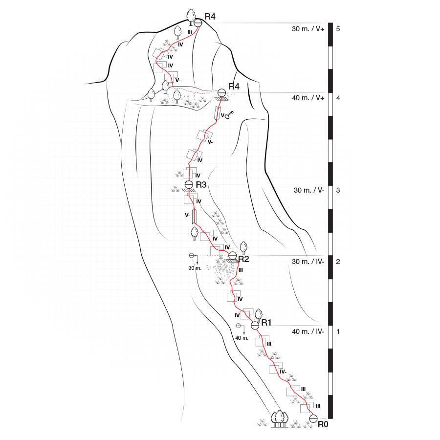
R0 – R1 | IV- 40 m.
The route starts with the first pitch (40 m.) exactly at the base of the north face (37.874461, 22.967683) between two couloirs. The climb starts with a III UIAA on top of a ledge where there is grass and rubbles and we continue scrambling (attention to the loose rocks) towards the top about 15 meters higher we climb a slab of IV UIAA and then we get a slight left direction.
We continue on a slab of III UIAA and we move towards the east (left) where we see a tree. On that tree with do the first secure belay.
The belay is comfortable for two people, but for a group of three, perhaps is better to use also the second tree that is situated there.


R1 – R2 | IV 30 m.
From R1 to R2, we soon start a climb on a slab of IV UIAA and upon that we continue to climb up in another slab of IV UIAA.
As soon we overcome the two slabs, we see some rubbles and we pass them from the right side. On that point, we have to do some easy scrambling of III UIAA up to the point we reach another tree (on our right side).
We use that tree for belay and the belay position is very comfortable on a ledge.


R2 – R3 | V- 30 m.
From R2 to R3, there is a IV UIAA grade passage on the ridge and soon after the difficulty becomes V- UIAA, though this part can be well protected and the climb looks more difficult than it is actual to be climbed.
Upon than we continue to follow the ridge up to a slab passage of IV UIAA grade. As soon we overcome that slab, we see a ledge and we create the third belay (R3).
On the third belay, the view becomes really nice and very enjoyable. One case see the beautiful Corinthian gulf, Geraneia Mountains, Acrocorinth, Elikonas, Kitheronas and on a clear day even Parnassos mountain.


R3 – R4 | V 40 m.
From R3 to R4, we continue to climb towatds the top in repetitive slabs of IV and V- UIAA.
On that point the view towards the Saronic and the Corinthian gulf become stunning. Just before the end of this pitch, we have the crux of the route, a small dihedral of V UIIA grade.
The R4 is done again on a tree on a very comfortable ledge with zero exposure.
From that point and on we have to do a traverse on a large ledge in order to start the fifth and final pitch.
R4 – R5 | V- 30 m.
From R4 to R5, we first need to walk on the ledge for about 25 meters and then to create a new belay on a tree (or on the rock).
From that point and on, we can start the fifth and final pitch which starts on a slab of V- UIAA and continues on slab of maximum IV UIAA grade. As soon we overcome the slabs, we continue with easy scrambling up to the point we see an obvious conical shape rock where we can do our final belay.
The view from the top is really nice and one can easily see the Acrocorinth, the Corinthian Gulf, the cities of Corinth and Loutraki up to Geraneia mountains.


Read complete review with a FREE topo map of the route here: https://olympusmountaineering.wordpress ... a-v-170-m/
Free Topo Map here:
https://olympusmountaineering.files.wor ... opo_en.pdf