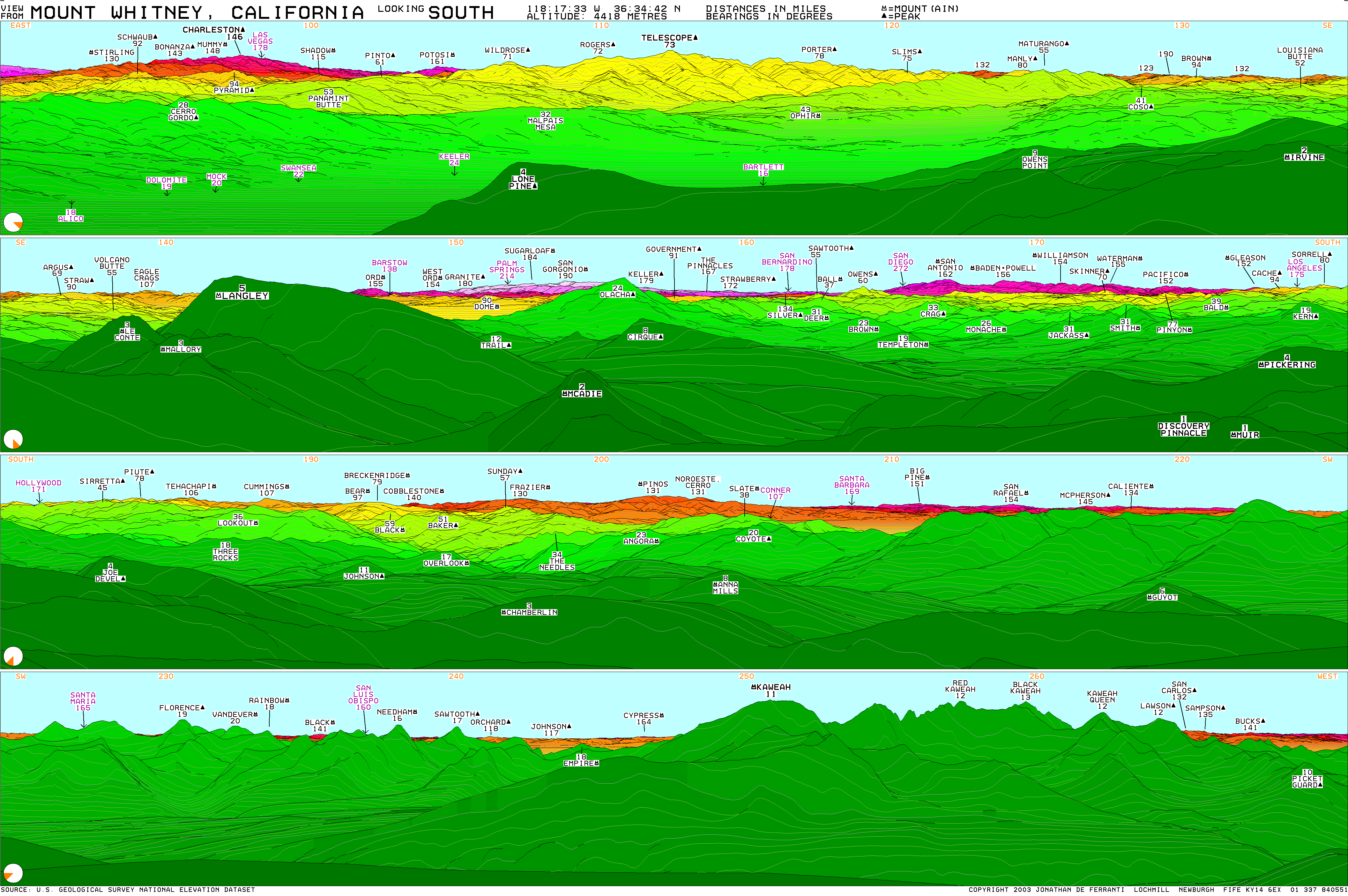
Day Hiker wrote:Reno is actually just a bit farther west than Santa Barbara.
That's even more impressive!

Day Hiker wrote:Reno is actually just a bit farther west than Santa Barbara.

TacoDelRio wrote:Nice programming! I can only program stupid tax programs at the moment, nothing cool. Is it easy to translate the terrain information into Excel?
Guyzo wrote:Luciano136 wrote:Day Hiker wrote:Reno is actually just a bit farther west than Santa Barbara.
That's even more impressive!
You win...
Try that in a bar..... "shit every body knows Reno is EAST of us dummby"

Dingus Milktoast wrote:Another good start a fight bar bet... ask how many West coast NFL football teams there are...
(don't forget Tampa Bay!!111)
DMT
ksolem wrote:
By the way, my "fancy software" is just Microsoft Excel, and I did all the math and wrote all the Visual Basic code for this myself. I spent a lot of time but no money.
Day Hiker wrote:If you start in Jacksonville, Florida (part of North America and near the Atlantic Ocean), and you travel due south, what is the NEXT continent you reach?
Dingus Milktoast wrote:Oh... prolly Antarctica? ( you did say next eh?)

Day Hiker wrote:Luciano136 wrote:Wow, nice man. I hope you work in this field, if not, you should seriously think about it
Actually, I'm one of Nevada's 20%-or-so unemployed. I suppose Vegas may be the wrong place to live for someone who wants to find a job that actually uses one's intelligence.
I want to live here, so I'll settle for something less. But it has to be steady and permanent -- the kind of thing one needs to make monthly house payments and raise a DayHikerJr. Part time is completely fine; it just has to be stable.
Users browsing this forum: No registered users and 0 guests

