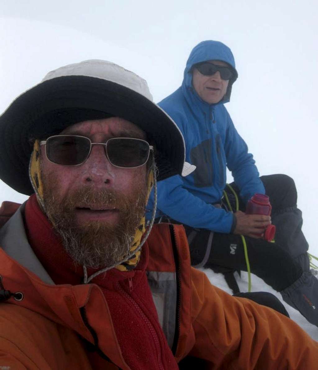
Pierre and me (with a three month beard) in a whiteout on top of Uruashraju (5722m)
Uruashraju is rarely climbed, so there was no trail. If anything but the top part had been in clouds, route finding would have been very difficult indeed, and we would have had no other option than to abandon our attempt.
Fortunately, apart from the summit whiteout, the weather was actually relatively good. No wind at all, clear blue skies when we started and temperatures just below zero, but with the strong sun it didn't feel cold at all.
We had made our high camp just north of the west ridge of Uruashraju Norte, and the ridge blocked any views to Uruashraju itself. But as soon as we had made our way on the ridge, we got fabulous views of our objective.
Te clouds only started to cover the upper reaches of the mountain a few hours later, and by that time we were already pretty high up. Occasionally, it almost seemed like the sun might be breaking through, so the clouds weren't thick. Still, visibility was poor. We discussed whether we should continue or not, but I'm optimistic and wanted to continue as long as we could still see a way up. I was hoping for the clouds to lift so we would have a view again.
Fortunately, while we encountered some technical difficulties - a big bergshrund with a sketchy snow bridge and a steep icy pitch, to name just a few - route finding wasn't one of them. Most of the time, the terrain simply didn't offer much choice, so we continued along the only obvious line, hoping that we wouldn't find any insurmountable problems higher up.
When the clouds moved in, we had decided on 11.00 as our turn around time. However, by that time my altimeter already read 5705m. If that was correct, we would be very close, so we continued a little bit further. It wasn't steep anymore now. We walked on a ridge for just a few more minutes until we couldn't go any higher.
The summit wasn't a big one. At first, we weren't even sure if it was the true summit. There might be a slightly higher one nearby, just beyond where we could see, hidden in the clouds, so we waited quite a while, hoping they would dissolve. Sometimes the direction of the sun could be seen through the clouds. At one point, visibility improved enough to see a good part of the SSW ridge, from where we had come, the last few minutes anyway. To the north, we couldn't see quite as far, but the ridge clearly went down. And either side of the ridge the drop off was quite steep. If you click on the coordinates and zoom in with Google terrain view, you'll see what I mean.
Later that day, some 500m below on the glacial plateau northwest of the mountain, we got a clear view of the summit again. No clouds on top anymore.
19 July 2011.


