
-
 12177 Hits
-
 80.19% Score
-
 13 Votes
|
|
Area/Range |
|---|---|
|
|
42.71050°N / 0.41050°E |
|
|
Hiking, Mountaineering, Trad Climbing, Sport Climbing, Mixed, Scrambling |
|
|
Spring, Summer, Fall, Winter |
|
|
10423 ft / 3177 m |
|
|
Overview
Bielsa is the denomination of the area around this village but really is not a valley, it's three valleys named Chistau, Bielsa and Esera with a set of differents little massif of individualized mountains between the big areas of Ordesa and Benasque. The highest and most important peak of the area is Bachimala in the north.-Valley of Chistau:
In the north, border with France, it has the highest and more important mountains. This area is also trailhead to the neighbor massif of Posets-Eristes at East.
-Some villages: Chistau, Plan, San Juan de Plan, Sin, Señés, Saravillo.
-Trailheads: Refuge Tabernés (free hut), Refuge Biadós (private, reservation).
-Mountains: massifs of Culfreda-Lustou and Bachimala.
-Valley of Bielsa:
The valley of Bielsa is an important area near of road of the tunnel under Pyrenees between France and Spain.
-Villages: Bielsa, Parzán, Javierre, Tella, Ceresa, Puértolas, Escuáin.
-Trailheads: track of Ordiceto (Suelza), Monastery San Victoriano (Montañesa)
-Mountains: little ranges of Punta Suelza and Peña Montañesa.
-Valley of Esera
The little valley around the river Esera.
-Villages: Barbaruens, Campo
-Mountains: Cotiella (really the massif is between 2 valleys, Bielsa and Esera).
Massif of Culfreda-Lustou
 Cullfredas
 Lustou
The first range from the west is joined across the Puerto de la Pez with the massif of Bachimala. This 2 massifs have the same trailhead in area of Tabernés-Biadós (east) but it's possible to begin the route from West and North.
-Mountains: Cauarère (2901m), Culfreda or Batoua (3034m, 3028m and 3032m), Balinet or Niscoude (2963m), Guerreys or Bacou (2867m), Lustou (3023m), Parraouis (2863m). The peak Lustou is located in France not in Bielsa but it's the same massifs.
-Trailheads:
-Spanish trailheads: Tabernés (1750m), Biados (1745m)
-French trailheads: Hospice of Riomajou (1560m).
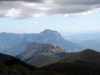
Massif of Bachimala
 Massifs Culfreda-Bachimala
 Bachimala
The great peak of Bachimala is located in the north surrounded with some peaks over 3000 meters. Really had 2 massifs separates in the Puerto de la Pez, the massif Cullfreda-Lustou and the massif of Bachimala
 Punta Ledourmeur
-Mountains: Pico del Puerto de la Pez (3018m), La Pez (3024m), L'Abeille (3029m), Marcos Feliú (3057m), Pequeño Bachimala (3068m), Punta del Ibón (3052m), Punta Ledourmeur (3120m), Bachimala (3177m), Punta del Sabre (3139m).
-Trailheads: Tabernés (1750m), Biados (1745m).
Punta Suelza
 Punta Suelza & Punta Fulsa
 P.Suelza
This forgotten and high mountain is far of the normal routes of the area but the image of the peak is really nice. The forest track of Ordiceto is not always opened and without it the route is long. The forest track is really bad to the cars.
-Mountains: Punta Suelza (2973m), Punta Fulsa (2865m), Ordiceto (2597m), L'Orbar (2422m).
-Trailheads: Central de Ordiceto (1950m), Campamento Virgen Blanca (1555m).
Massif of Cotiella
 Cotiella and Raimond d'Espouy
 Cotiella
Cotiella is an important peak of this area in the special circo de Armeña, but really it's a great massif with highest mountains.
-Mountains: Punta Llerga (2269m), Mobisón (2605m), Punta Litás (2623m), Peña de la Una (2721m), Cotiella (2912m), Raimond d’Espouy (2823m), Peña del Mediodía (2465m), Peña de las Once (2660m), Pico Llosa (2712m), Punta Alta (2740m).
-Trailheads: Pista de Barbaruens (1400m), Collado Sta Isabel (1542m).
Peña Montañesa
 P.Montañesa
In the southwest of Cotiella is the little range Peña Montañesa.
-Mountains: Peña Montañesa (2291m), La Tuca (2267m), Pimpinos (2080m), Peña Madrid (1982m), La Forquiella (2170m).
-Trailheads: Oncins-Monastery San Victorian (south), Ceresa-La Collada (north).
visentin - Jan 19, 2011 9:16 am - Voted 10/10
region nameHi Rafa ! I was in my Google maps to correct a couple of things, and I thought that the name given to this region was perhaps not the most intuitive. Most of the mountains near Monte Perdido are attached to the Ordesa region, which is logic. But Bielsa is perhaps not appropriated as it suggests the whole Bielsa valley (Cinca, which means Anisclo, Escuain, Pineta...), including the hillsides of Perdido, which becommes redundant. I thought about Sobrarbe, but the problem is the same. Perhaps "Chistau-Esera" ? or eventually "Chistau-Cinca" ? What do you think ? Have a nice day ! Eric
Rafa Bartolome - Jan 19, 2011 11:05 am - Hasn't voted
Re: region nameI used the list of maps of 1:25.000 of sua editorial (Miguel Angulo) about the Spanish side of Pyrenees. It's very popular the name "Bielsa" for the map between Ordesa and Benasque but it's true that it's not a perfect name. The name is not very important. I think it's not necessary to change,... all the people can buy a map call Bielsa in all the spanish shops of the area. I will think about it.
visentin - Jan 20, 2011 2:25 am - Voted 10/10
Re: region nameYou know better spanish maps than me, so you're probably right :) Yes, difficult to find a significant name for this area. I also thought about Bachimala-Cotiella, but it doesn't sound very practical either. Have you seen my last updates on the general map of the Pyrenees ? What about including it in the main page ? (Yesterday I corrected a couple of things..)
ojo - Oct 14, 2011 6:36 am - Voted 10/10
A Route page....Hi there. I've done a route page for the Bielsa area if you'd like to attach it to this one? 6 Puertos. Just a bit of senderismo. Si tengas un idea por un titulo/nombre mejor.....?¿
Rafa Bartolome - Oct 14, 2011 8:54 am - Hasn't voted
Re: A Route page..It's the kind of routes for an area. Congratulation for this great route.