
|
|
Mountain/Rock |
|---|---|
|
|
46.26896°N / 9.06999°E |
|
|
Hiking, Skiing |
|
|
Spring, Summer, Fall, Winter |
|
|
7507 ft / 2288 m |
|
|
Overview
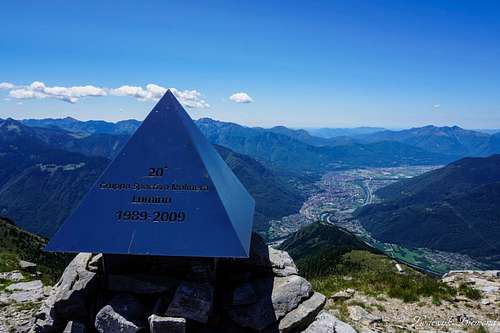
Piz de Molinera Summit and Pizzo di Claro (2727m)
Piz de Molinera (also: Pizzo de Molinera) is located in the heart of one of the most beautiful places of Switzerland: Ticino. Above the ancient city of Bellinzona towers an impressive peak more then 2000 meters above the valley floor: It is Piz de Molinera. Located where the Moesa and Ticino rivers find each other, as well as where the Calanca and Leventina valleys meet, is the home of Piz de Molinera.
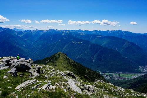
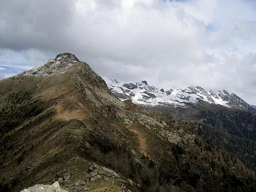
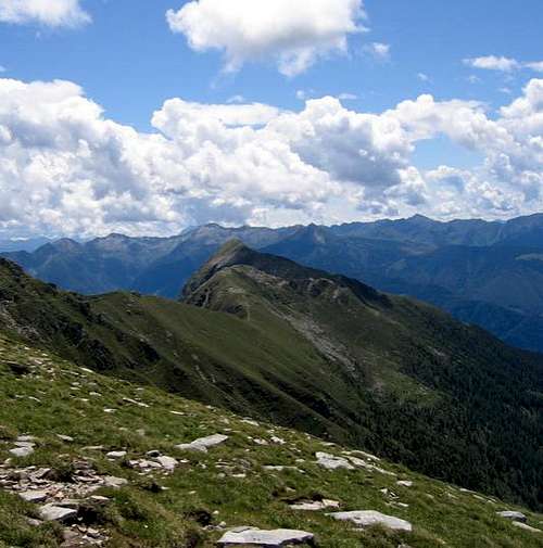
Although Piz de Molinera isn't as famous as it's higher neighbour Pizzo di Claro (2727m), it is a great destination for a single or even multiple day climb. Molinera is the southernmost peak of the Leventina East ridge and the summit offers great views in all directions. Looking south will let you watch over the ancient city of Bellinzona and you can spot the northern tip of the grand Lago Maggiore. To the east and north you are able to see many Graubundener mountains and also Monte Disgrazia is within sight. Towards the north Pizzo di Claro is the main eyecatcher, together with Torrone Rosso, Mottone and Torrone Alto further away. Last but not least, looking towards the west offers great views of the Monte Rosa and Mischabel Groups.
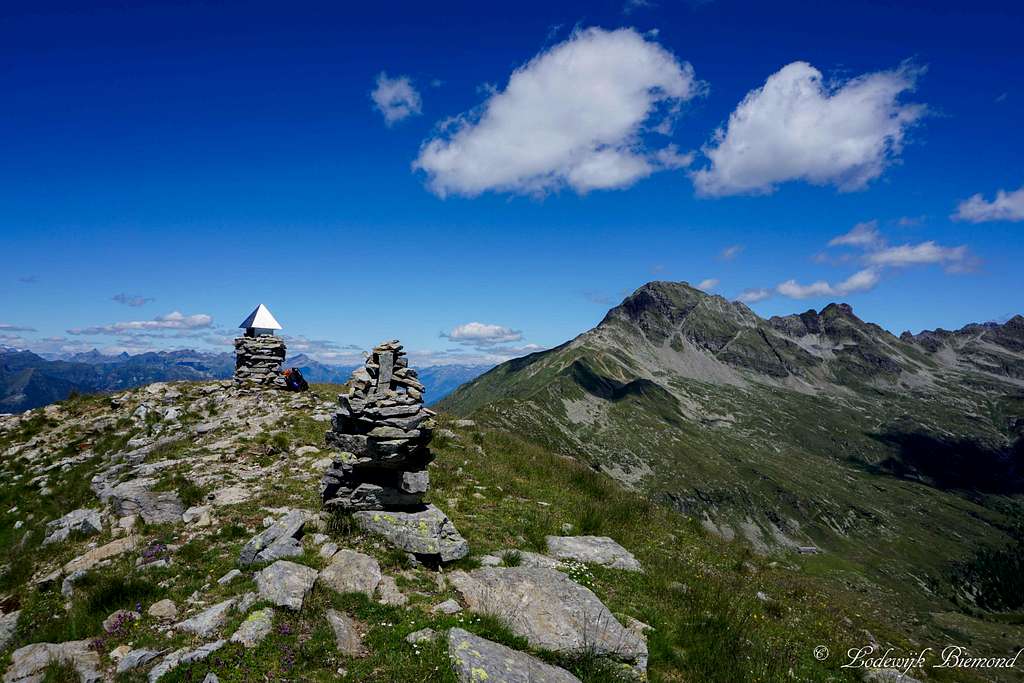
 Summit view towards the South | 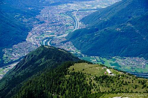 Bellinzona and Capanna Brogoldone from Piz de Molinera |
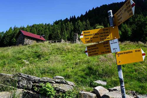
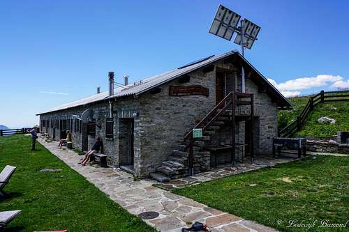
The climb of Piz de Molinera is quite straightforward. A marked trail leads all the way up to the summit. The final part includes a walk over the ridge that seperates the Leventina and Calanca valleys. The route is graded T3 and is marked very well. In the shadow of Molinera lies the Brogoldone mountain hut. It is located at a perfect spot for climbing Piz de Molinera. The hut is guraded during the summer season but also accessible in winter (winterraum) Spending the night here is a great experience seeing the many lights of Ticino's capital from above: Bellinzona by night.
 Piz de Molinera summit | 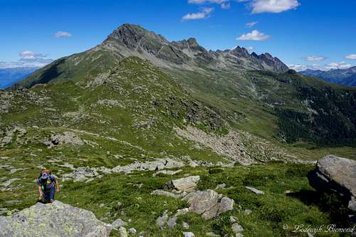 View towards Pizzo di Claro and Torrone Rosso |
Route Description

Alpe Domas
Upper part of the Trail
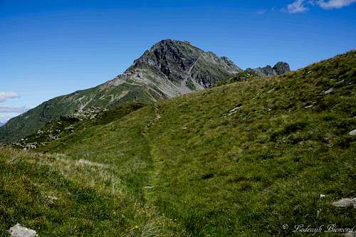
From Capanna Brogoldone a marked trail leads up towards the summit. It is marked by red-white-red painted lines along the path. You will first find your way up to the ridge that connects Piz de Molinera with Pizzo di Claro and that seperates the Ticino and Graubundener Kantons (Provinces). Walking on this ridge offers great views into both the Leventina (west) and Calanca (east) valleys. You will follow the ridge to the southeast where you eventually will reach the summit of Pizzo di Molinera. The route is graded T3.
When to Climb
Piz de Molinrera SW-Face
How to get There
Piz de Molinera North Face
A route (Google Maps) planner to Lumino (valley station of the Funivia/cableway) can be found HERE.
Capanna Brogoldone
Maps
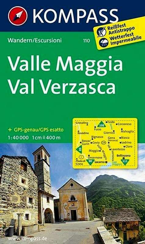 | Kompass map No. 110 Verzasca - Maggia Scale: 1:50.000 ISBN/EAN: 9783850269100 |
External Links
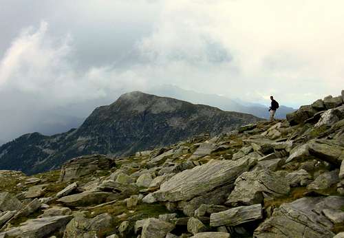
Piz de Molinera from Torrone Rosso descent
Webcam Piz de Molinera & Pizzo di Claro from Bellinzona
Piz de Molinera Weather Forecast by Mountain Forecast
Piz de Molinera Tour description on Hikr.org (in English)
Camping al Censo - a beautiful campsite in nearby Claro