Page Type Page Type: Trip Report
Location Lat/Lon: 36.78925°N / 118.34736°W
Date Date Climbed/Hiked: Jul 4, 1986
Activities Activities: Mountaineering
Seasons Season: Summer

'B' Ginning

It was July 4th weekend and I needed a destination that would be both interesting and obscure enough to be off the radar of most of the 5 trillion or so people that would be heading out to the mountains for the holiday weekend. Given that, I thought that an attempt on Mount Keith near Shepherd Pass would be fun and challenging. It was the highest peak in that area that I hadn't yet climbed and I was pretty sure that the arduous Shepherd Pass trail would not be the first choice for most people standing in line with me for Wilderness Permits.

Indeed, this turned out to be a good choice. Over and over I heard the permit issuing ranger cautiously explain to disappointed and unhappy backpackers that the quotas for the Whitney Trail or the Kearsarge Pass Trail were full. There was relief on his face and in his tone when I asked for a permit for Shepherd Pass. I walked out of there with that great feeling of having a permit in hand! Now all I had to do is get to the trailhead and start hiking. Except...

I was only about 1 or 2 miles from the trailhead when I came upon a small stream crossing the dirt road.  How deep was it? Will my S-10 make it across? Probably, but I decided to stop and check it out anyway. The water was only about six inches at the deepest part. No problem as long as I don't foolishly stop midstream and get stuck. I paused to gaze up at the eastern Sierra towering above me and fully illuminated by the morning sun. Normally an inspiring sight, but this time something else happened.
 
Suddenly, unexpectedly, my enthusiasm drained out of me like the air out of a bounce house at the end of a kid's birthday party. It wasn't that I didn't want to be up there, I just didn't want to do the work needed to get up there. The thought of carrying a heavy backpack up that long steep Shepherd Pass Trail made me feel very... weary. Maybe it was just too soon after my previous trip or maybe it was fatigue from the 450 mile overnight drive from San Jose. All I know is that, I needed something a little less ambitious.

Looking around, I began to consider other nearby options. My eyes focused on the Onion Valley region a short distance to the northwest. There were several easily accessible peaks up there. But, it was Fourth of July weekend at one of the most popular trailheads in the Sierra. Wouldn't it be a madhouse up there? Yes, for backpackers, but maybe not for day hikers. I turned my truck around and began heading back to the Onion Valley Road.

The more I thought about my spontaneous plan, the more I liked it. That first day, I decided to try Kearsarge Peak- a relatively easy, but isolated peak that sits well east of the Sierra Crest. Tomorrow, after a good rest and some acclimatization, I could try something a bit harder like University or Dragon Peaks. I was pretty excited about doing just a few simple day hikes and eschewing the hassles of backpacking and camping. I could spend tonight and tomorrow night car camping at one of my favorite desert spots eating fresh food and drinking cold beer. If there was a down side, I couldn't see it.

As predicted, the overnight lots in Onion Valley were full, but there were plenty of open spaces in the day lot. A sign on a pole in front of my truck warned of the consequences of parking overnight in that lot. No problem.

I transferred some essentials from my backpack to my daypack and then I was on my way. It was probably almost mid-morning by the time I found the actual trailhead and began to hike up the trail that led to Golden Trout Lake. The freedom that my daypack afforded me in lieu of my backpack was much appreciated and enjoyed.

 
From Onion Valley
Start of my trip. Kearsarge Peak is up on the right.

Near Onion Valley
The waterfall near the start of the trail. The crags in the background are on Kearsarge Peak.

 
University Peak
University Peak
 
Independence Peak
Independence Peak 

Kearsarge Peak from SW
Buttress on SW side of Kearsarge Peak

The scenery was fantastic as the trail climbed past a beautiful waterfall at the southwestern foot of Kearsarge Peak. I expected more people on the trail, but there were only a couple other parties. Maybe this was due to the unusually high amount of residual snow that lingered in the high country from the previous winter which had been much wetter than average. As I'd been discovering all that spring and summer, there was a lot of evidence of what were probably climax avalanches that had come down during the previous winter. This evidence was in the form of some large old freshly shattered trees that littered various trails and canyons that I'd been through on several previous trips. 

Avalanche Debris
Remnants of a possible climax avalanche near Onion Valley

Avalanche Debris Near Onion Valley
Overview of avalanche debris from the Previous Winter

Avalanche Debris Near Onion Valley
Still more debris. Owens Valley is in distance.

Up Toward Dragon Peak (Not Visible).
Avalanche debris near Golden Trout Lake trail junction.

By the time I reached the junction with the trail to Golden Trout Lake, I was feeling very sleepy. Unfortunately, this is not unusual for me. You see, I was on the swing shift at work, so I usually clocked out at midnight or so. It was perfect for going on trips, because on a Friday night, I could drive overnight to the mountains and usually arrive at a trailhead (or ranger station for my permit) by sunrise. Then, at the end of the trip, I could spend Sunday night leisurely driving home without the traffic and arrive back in San Jose by very early morning and still have enough time for a full 'night's' sleep before reporting to work at 3 or 4 pm Monday afternoon.

The downside was missing all that sleep  Friday night. Usually fatigue would start to manifest itself shortly after leaving a trailhead on a Saturday morning. I would often literally doze off while in the act of hiking. I used to think of it as 'slumberin' and stumblin'.'  The stumblin' part would cause a sudden burst of adrenaline that would keep me going for another ten minutes or so before the cycle would start again. It was pretty annoying.

Over the years I tried strong coffee, chewing gum, NoDoz, etc. A friend at work once even offered me some meth, but... naw. I didn't want to be higher than the mountains that I was attempting to climb. The only solution that seemed to work was a short 'cat nap'.  Usually if I could just shut my eyes for 20 or 30 minutes, I would be good to go for another several hours.

So that is what I did just after leaving the trail to begin the cross country portion of my climb. It took several tries before I could find a spot that was relatively free from those giant black Sierra ants. The spot I finally found was probably a little too comfortable because I ended up sleeping for about an hour- probably more. Actually, it may have been a lot more. Oops. So much for my simple 'cat nap'. At least I felt pretty refreshed, but now I had to hurry.

Dragon Peak
Dragon Peak from near the southern base of Lilley Pass. Dragon Tooth is on the far right.

Lilley Pass from the South
Lilley Pass (left of center) from the south.

Crags Near Lilley Pass
From partway up the south side of Lilley Pass.

Up Lilley Pass
Looking up the south chute below Lilley Pass.

'B' Lated

I quickly began to hike up the steep talus of Lilley Pass. (It was, in fact, many years later that I learned that this windswept saddle just west of Kearsarge Peak even had a name.) It was easier than it looked and soon I reached the saddle.

Down Lilley Pass
Looking down from the top of Lilley Pass.

 
Northeast From Lilley Pass
Looking northeast from the top of Lilley Pass.

From the pass, I could see my intended route up Kearsarge Peak's west ridge. My plan was to follow that ridge to the top and continue down the east side to an old mining road/trail that is shown on the topo map. I would then follow the trail back down to Onion Valley Road and then back up to my truck in the day lot in Onion Valley. A nice loop- interesting and easy.

But, I happened to notice an easy looking peak to the northwest. I checked the topo map and saw that it was unnamed and the closed contour circle around the summit had it designated as Peak 12,720+.  Since it was somewhat higher than Kearsarge Peak and it appeared pretty easy to climb, I decided that it would be worth a quick visit. So, with only a slight amount of concern about the lateness of the day, I began to hike up the sand and talus slopes toward its summit.

Dragon Jaw Peak
Southeast slopes of Peak 12,720+ from Lilley Pass.

Below the Summit Rocks
Below the summit rocks of Peak 12,720+.

A short time later, I reached the summit rocks, but the highest rock caused me to hesitate for a second. It didn't seem that difficult, but it was perched in such a way that it seemed to hang out over the northwest side of the peak. Was it stable?


Summit Rocks
High point is on the right.
Summit of Dragon Jaw Peak
The summit block.
 

They say that to claim a successful ascent, one needs to either stand on, sit on, or at least lay on the highest point of rock. (Exceptions, of course, are dangerous cornices and unstable snow.) I planted a foot partway up the highest boulder and very gently pushed upward while I transferred my weight to my outstretched hands so I was laying across the highest point. There! I could see straight down into the deep canyon to the north at the foot of Black Mountain. After a brief moment, I reversed my moves. (Yikes! Did it just wobble?! Maybe my imagination.)

I found a small container just inside a gap beneath one of the summit rocks. I remember very little about the register inside except that someone who made the first entry had named the peak, “Dragon Jaw Peak”. I shrugged and scratched my head. Okay... It was sometime later that I got the connection. The name was inspired by its proximity to Dragon Peak. Duh!

Mount Gould from Lilley Pass
Mount Gould from Lilley Pass.

University Peak from Lilley Pass
Left to Right: Mount Keith, University Peak, and Mount Stanford.

Getting back down to Lilley Pass was a breeze. As I started up the west ridge of Kearsarge, I was becoming more and more aware of  the lateness of the day. Long shadows were being cast by the peaks to the west.  In spite of my tired muscles, I continued to hurry on up.

Kearsarge Peak from Lilley Pass
Looking up the west slopes of Kearsarge Peak from Lilley Pass.

Lilley Pass from Kearsarge Peak
Lilley Pass, resembling a funnel, from high on Kearsarge Peak.

 
Onion Valley From Kearsarge Peak
Looking down at the trailhead in Onion Valley from high on Kearsarge Peak.
 
West Ridge of Kearsarge Peak
The west ridge of Kearsarge Peak.

By the time I reached the summit of Kearsarge Peak, much of the east slope of the Sierra was in the shadows. This was new for me. I'd never before been so high up on a mountain top so late in the day. It was kind of exciting. Maybe a little too exciting? It probably would have been safer to simply retrace my ascent route back to the car, but how boring would that be? No, I remained pretty confident about finding that old mining road to the east. Once on that, it should be fairly quick and easy to follow it all the way back down to Onion Valley Road. Even if I had to do it by headlamp.

Summit Ridge of Kearsarge Peak
Summit ridge from the west.

Dragon Peak from Kearsarge Peak
Looking west to Dragon Peak from Kearsarge Peak

Mount Brewer and (right) North Guard
Zoom to Mount Brewer and North Guard from Kearsarge Peak

Owens Valley from Kearsarge Peak
Northeast to Owens Valley from the summit of Kearsarge Peak.

Independence From Kearsarge Peak
Looking far below to the town of Independence (center) from the summit of Kearsarge Peak

East Ridge of Kearsarge Peak
East Ridge from the summit.

The views were incredible especially since Kearsarge Peak is situated well east of the main crest of the Sierra. From that perspective, the views of the abrupt eastern escarpment of the Sierra Nevada- dropping precipitously thousands of feet into the desert of the Owens Valley- is unforgettable. I took several pictures from the summit and perused the register while I ate a quick early evening snack of cashews and peanut butter crackers.

100 Degree Panorama South and West From Kearsarge Peak Summit

Before long it was time to leave. All downhill from here! That is, until I reached OV Road again. Then there would be some uphill back to the parking lot where I left my truck. I was pretty sure that, by then, my sore feet and joints would be ready for some uphill.

Northwest Slope of Kearsarge Peak
Northeast Slope plunging steeply down into the deep shadows of Sardine Canyon.

I continued east from the summit and followed the easy ridge to where it starts to drop steeply down the east slope of the peak. By the time I was a short distance down the slope, the jagged shadow line of the Sierra was already about halfway across the floor of the Owens Valley. Uh, oh. Where's that road?

South from the East Slope of Kearsarge Peak
Looking south toward Mount Williamson from the east face of Kearsarge Peak.

Mountain Shadows in Owens Valley
Jagged line of shadows quickly crossing the Owens Valley.

 
Northeast Ridge of Kearsarge Peak
Northeast Ridge plunging down into the shadows.
 
North From East Slope of Kearsarge Peak
Looking north from east face of Kearsarge toward Indian Rock (left of center).

A short time later I found it. Not much of a road in most places- just a crude track carved out of the talus slopes. It made long sweeps north and south as it switched back down the upper east slope of Kearsarge Peak. I was tempted to leave the road and travel straight down the mountain side, but I was afraid that if I lost the track, I would never get it back in the gathering dusk.

Owens Valley and Inyo Mountains from Kearsarge Peak
Looking east across Owens Valley to the Inyo Mountains.

Snow on East Slope of Kearsarge Peak
Last source of water for the day.

Eventually, I came to some snow fields and I realized that I'd better stop and fill up. I was down to barely an inch of water in only one of my two Nalgene bottles. The last running stream that I'd been to was near the foot of Lilley Pass many hours earlier. I had to scrape down several inches of dirty surface snow with my ice ax to find snow that was acceptably clean to put in my bottles.

Owens Valley Dusk
Dusk in the Owens Valley from high on Kearsarge Peak.

North Owens Valley at Dusk from Kearsarge Peak
Looking at the northern Owens Valley at dusk.

By the time I was done with that chore, the sun had fully set and darkness was closing in fast. I put on my wool shirt and wind breaker when I arrived at the first scrub pines of timberline. In one pocket of my windbreaker, I put my gloves- in the other pocket I put my headlamp. I hoped that there would be no more reasons to make any stops until I reached Onion Valley Road.

In some places, the trail did become almost 'road-like' as it traversed steeply down through the gnarled and weathered trees. It was easy to follow and, for a short time,  there was just enough light to make my headlamp unnecessary. The road/track was heading toward the top of a large steep chute that I could just make out in the dim light. The topo map shows that the trail goes straight down this chute in the coarse of dozens of very short switchbacks. It looked like someone had traced the teeth of a handsaw to draw in the switchbacks.

'B' Nighted

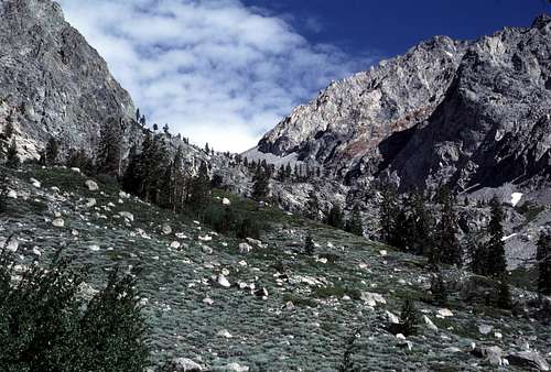
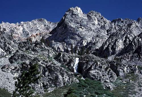
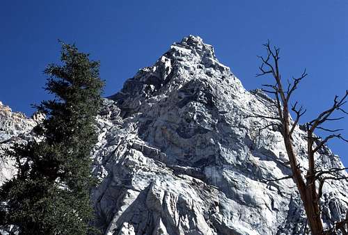
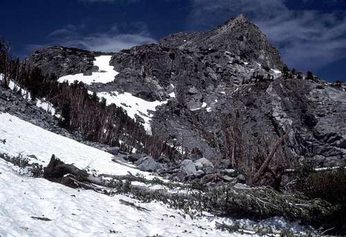
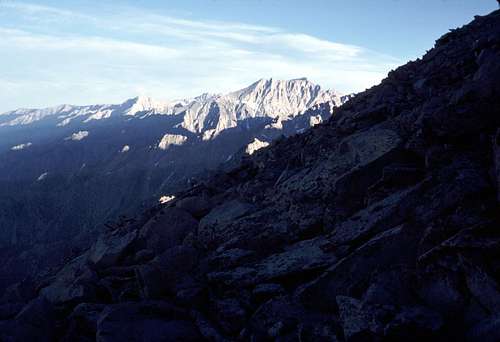
It was full on dark by the time I reached the brink of this steep chute and tried to peer down into the abyss beyond the intervening brush and scrub pines. All I saw was inky blackness hemmed in to the east and west by steep barely perceptible slopes coming down from the adjacent ridges. “This should be interesting,” I said to myself.

A short time later I came to a junction where another trail branched off to the east. This was not on the map (the 1953 edition of the 15' Mount Pinchot quad).  Didn't matter. I stuck with what I perceived as the main trail and continued on down.

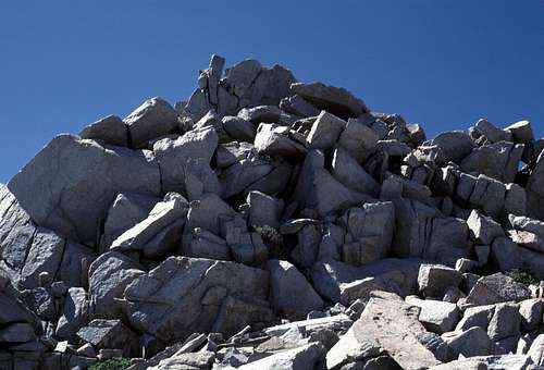
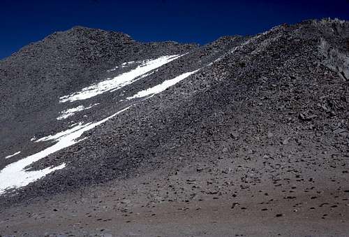
After a couple of quick switchbacks, the trail came to an abrupt end at the edge of a steep smooth slab. The upper part may have been do-able, but the steepness increased as it went further down. I couldn't get close enough to see what was at the bottom about 50 or so feet below. It was coated with a slick layer of sand and I decided that it might be a bit too risky to venture down too far.

I wondered if decades of winter avalanches had stripped away this part of the trail. Maybe the other trail that I'd passed earlier was a newer bypass to this area? Reluctantly, I turned and went back up the trail to the junction I'd passed.

As I hiked back up, I saw a flash of light out of the corner of my eye. Great! Just what I needed. A thunderstorm. The flash had been very faint, so I knew it must have been a long way off. I had noticed thick discontinuous layers of clouds to the south and to the east before the sun had set. Maybe it was in one of those directions. I looked up and saw stars in my vicinity, but to the south, there was mostly just blackness. Hopefully I would have time to get off the mountain before the storms started popping up.

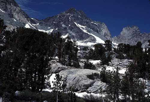
I got back to the trail junction and started following the other trail. This trail was heading in an easterly direction toward a huge rocky ridge that defines the eastern side of the chute that I wanted to descend. I hoped that eventually it would turn west and contour back down into my chute.

As I hiked I continued to see those occasional flashes of light out of the corner of my eye. They definitely seemed to be coming from the east. I scanned the horizon, hoping to see distant lightning- perhaps deep in Nevada, but I saw nothing but blackness out there.

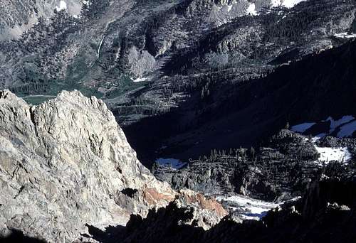
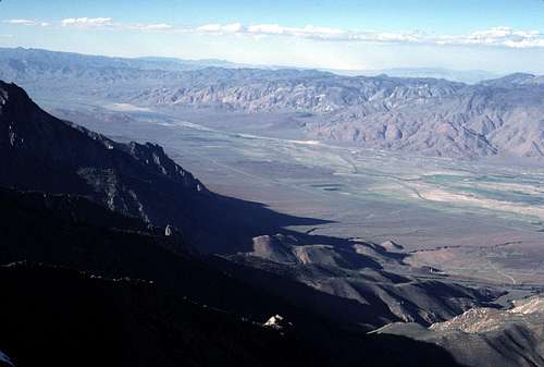
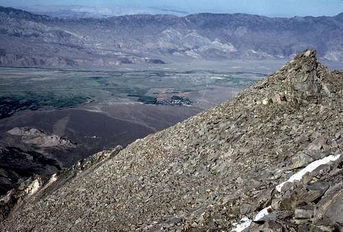
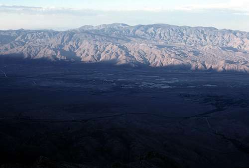
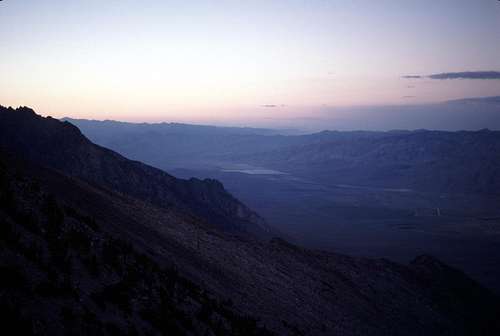
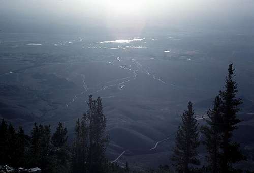
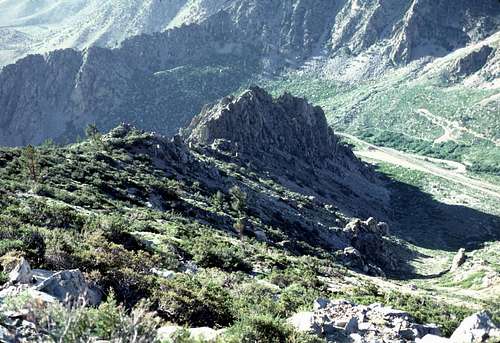
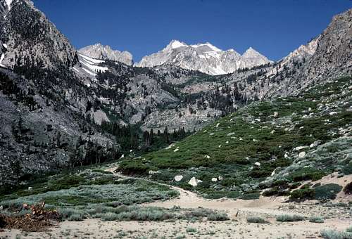
At last the trail reached the crest of the upper part of the ridge and I had an unobstructed view of Owens Valley. Even at night, it was a magnificent sight. The lights of the two towns within view, Lone Pine and Independence,  reminded me of colorful star clusters in outer space. (Yeah, okay. I probably watch too much Star Trek.) Tiny slow moving headlights could be seen plying north and south along the main artery of the valley- US395. I saw an occasional vehicle negotiating the twisting switchbacks of Onion Valley Road far below- seemingly at my feet.

There was another flash from the corner of my eye- then still more. This time, after a significant delay, I could hear popping sounds. Were they associated with the light flashes? I realized that they were coming from down below in the valley somewhere... Then I saw a bright flash just north of Independence. It was followed by several more and seemed to be coming from a open field just north of the town. (The airport maybe?)  They were different colors- Red, white, bl... Of course!!

“Today's the Fourth of July!” I exclaimed aloud.

I stood and watched the distant show for a short time. Kind of a unique experience- watching a fireworks show from above. I was surprised at how seemingly low the shells were bursting and how small the resulting explosions seemed to be. From the perspective of someone down below them, they seem so big and burst so high. 

I thought about the hot dogs, burgers and cold beer being served at the celebration down there and my stomach growled. It was time to get moving. I hoped that there would still be someplace that was open to buy some food and beer later that night.

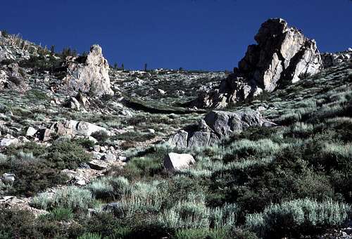
I followed the trail down the ridge and soon some large rock outcroppings loomed up ahead in the dark. The trail started to traverse around on the east side of them and then, unfortunately, made a switchback back to the north. Just as I'd feared, the trail seemed to be heading down the vast eastern slope of Kearsarge Peak. It was likely built to access the mining areas down below in that direction. I could only guess, but it probably continued down past those mines and back to the Onion Valley Road at a point where it traversed across the lower east slope of the mountain- much further downhill than I wanted to go. It would add several unwanted hours to what had already become an excessively long day hike. I backtracked up the trail to where it had left the crest of the ridge.

With my headlamp, I spotted what seemed to be a use trail heading to the west into the chaparral. Maybe it would lead across to the floor of the chute that I needed to descend. I followed it down and it didn't take long to discover that it was in fact just a game trail for what must have been very small game. I continued to push and shove my way through the brush hoping to pop out of it and find a clear path back to a continuation of the trail that had ended high above.

The going got rougher and rougher. There were places where crawling was necessary and more than once a rigid branch tore my headlamp right off my head. Shit! I finally reached a spot where I was encircled by thick brush- with cliffs below and rock outcroppings above. I don't know how this would be in daylight, but at least I would have been able to spot weaknesses in the brush and perhaps thrash my way to easier ground. At night, this was crazy as well as futile. I gave up and retraced my route back up to the trail in defeat.

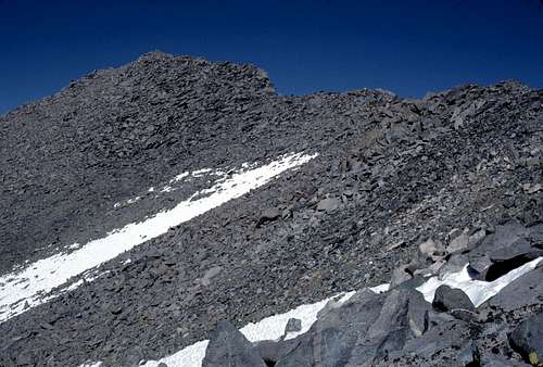
Once again on the trail, I began the long weary slog back up to the junction- the one that was not shown on the map. I decided to check out that other trail branch once again- the one that seemed to agree with what the map showed. Maybe I missed an important section. Maybe that sandy slab wasn't so steep as I thought and I should try to descend it. This time I would take it slowly (in my exhausted state did I have a choice?) and really thoroughly search around with my headlamp.

By the time I returned to the trail junction, the fireworks show was over and all was quiet and normal in the world once again. Once more, I slowly followed the western branch of the trail down into the chute. I held the headlamp in my hand and flashed it around looking for any sign of a hidden trail. But there was nothing. I once again came to the top of the steep sandy slope. I took a tentative step and realized that it was just too slippery. A sprained ankle or worse would be unacceptable up here. Using my headlamp, I didn't see any way to bypass it. Drat!

Reluctantly, I turned and began slowly hiking back up the trail to the junction. I didn't carry a watch on my trips back then so I didn't know precisely what time it was. My internal clock said that it was probably sometime past 10pm. I knew what I had to do. For the first and only time in my mountain 'career', I was going to have to bivouac.
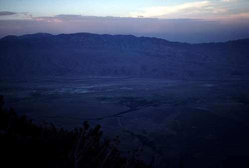
'B' Numbed

I went up past the trail junction to where I remembered that there were some flattish areas peppered with plenty of scrub pine. I found a spot that had a nice view of Independence and the Owens Valley and sat down on a rock. In spite of my situation, it felt good to finally stop hiking for the day. I pulled out my altimeter and noted that I was at about 10,600 feet above sea level. 

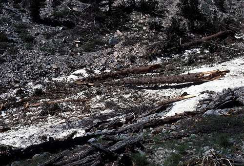
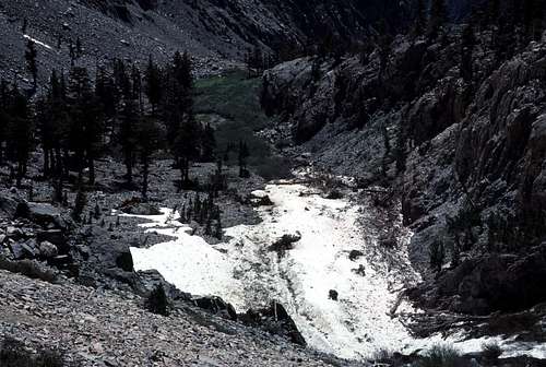
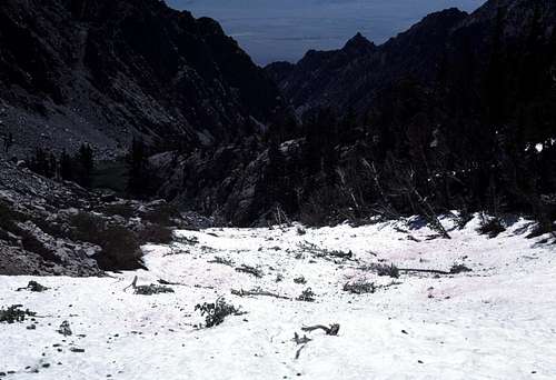
But... what now? I've never had to bivouac before. Time to take inventory. I took off my day pack. My back was damp with sweat and I felt a chill. My food supply was barely adequate: A few pepperoni sticks, a hand full of 'gorp' and a small bag of cashews. My water supply was cause for concern: maybe about two inches in only one of my Nalgene bottles. The snow I'd packed into them earlier had melted into only a small amount of actual liquid. The two hours or so of searching for the correct route up and down the mountain had created a great amount of dehydration and thirst so I drank up a lot of water thinking that I was only a couple hours or so from the car. Oops. The snow fields that I'd passed earlier were a good thousand feet or so back up the mountain. Shit! This small amount of food and water was just going to have to last until I got back to the car tomorrow.

What else did I have? A rain poncho, a wool button down shirt (which I was already wearing), a windbreaker, wool leather palmed gloves, and (thank goodness!!) a down jacket with a down hood. I also had a wool balaclava which I put on immediately in lieu of my broad rimmed hat. For equipment, I had a fire starting kit of matches and some chemically treated sticks. A small camp shovel, a Swiss Army Knife, and my headlamp.

I realized that maybe I deserved some credit. I was actually fairly well prepared for this and I even found myself kind of looking forward to it- an unplanned bivouac in the High Sierra. Funny, only a week or so earlier I'd been lamenting to Dave (my climbing partner) that most of our trips for the last few years have been kind of routine and mundane. There didn't seem to be much adventure to them anymore. Well, as they say, be careful of what you wish for...

I chose a medium sized scrub pine to serve as a rudimentary shelter and  spread my poncho out in the slightly cramped space beneath it as a ground cloth. After putting on my extra clothing, I ate a 'dinner' of 1 pepperoni stick and the 'gorp' while I watched the slow moving traffic on US395 far below.

I felt a small thrill (or maybe it was a chill) in knowing that nobody in the world knew where I was at the moment. Remember that I'd changed my plans from the Shepherd Pass trail to Kearsarge Peak at the last minute and didn't really have a convenient mechanism for informing my people at home. Oh, well. I won't be overdue until Monday. If something terrible happens to me, I'm sure it would be easy to find my truck in the parking lot in Onion Valley... 

Shit! I just remembered my truck down in the day parking lot. Oh crap. There was probably already a citation tucked under the windshield wiper. But, what if it gets towed? Was that a possibility?  I didn't want to think about it until morning.

The temperature seemed typical for my elevation in the Sierra at night in the summer. Probably in the low to mid 40s. There was only a slight breeze coming from the west or southwest.  No moon. Skies were mostly clear. This could have been a lot worse.

I enjoyed the night time views for a short time before crawling under the tree to my makeshift bed. I drank one good sized swallow of water before I laid down to attempt sleeping. I used my empty rolled up daypack as a crude pillow.

As tired as I was, it quickly became apparent that sleep would not come so easily. The ground was very hard and rocky without my sleeping pad. My down jacket alone was not enough to prevent my body heat from escaping into the cold ground. I curled up into a fetal position and closed my eyes. Eventually, I reached a state of semi consciousness similar to sleep. I stayed this way for perhaps several hours. My own personal 'Twilight Zone'.

It was while I was in this 'zone' of semi sleep that I slowly became aware that I was not alone. Others had silently arrived and seemed to have encircled the scrub tree where I lay. They were saying something I couldn't quite understand. They seemed pretty determined for me to understand  their message, but I wasn't quite getting it. I just wanted to sleep. They weren't going to let me. Why don't they leave? Who were they and why were they up here on the southeast side of Kearsarge Peak?

Wake up! Get out of there!
Yeah, right! Leave me alone!
Get up and move. Dance!
Dance?! Who were these people. Were they lost up here too??
No! You are! Now, GET THE F**K UP!!

I opened my eyes and my mind reacquired the cold reality of the real world.

“I'm alone!” I said aloud. “...and I'm cold.” Very cold. Shivering, I crawled out from under the scrub pine and stood up in the cold darkness. It had all been in my own mind! I had been trying to wake myself up to move around in an effort to warm up. But, the 'others' had seemed so real! This was not the first time I've had an experience like this. Usually it's brought on by extreme fatigue. How weird is the human mind! (Okay, okay. Maybe just my mind.)

I started pacing up and down around my bivvy site. I warmed up a little, but I needed to dance. I'd read recently about how... was it Norman Clyde? Or John Muir? Maybe it was Clarence King. Anyway one or all of them used to dance like Indians at night to ward off the cold. Now it was my turn. I bounced, hopped, twirled squatted and jumped. I continued to do this for several minutes- even singing like an Indian as well. I was glad no one was there to watch or listen.

After about 15 minutes, I stopped. I was warmer, but I was getting tired and, also, I didn't want to raise a sweat. I sat and felt the heat that I'd generated slowly drain away.

I realized that I would need to make a fire. I didn't have enough water to douse it if something went wrong, so I decided to make it very small. I made a fire ring only about 8 inches in diameter and used just small pieces of dead-fall which was very abundant around my bivvy site.

The dry wood lit very easily and after being in darkness all night, the brightness actually hurt my eyes. I suddenly worried that maybe someone down in the valley might see it and mistakenly think that it was a distress signal. Oh well. Whatever. Even with its small size, it was surprisingly warm and comforting.

I sat for quite a while in front of the fire occasionally getting up to gather an armload of small wood pieces. If only I had more food and water- I might actually have enjoyed myself despite the discomfort of spending the night in the open without camping gear.

I looked up and saw that the sky to the east was beginning to brighten. Was it my imagination or just wishful thinking? Nope. It was definitely getting brighter. The long night was finally coming to an end. I spread my poncho out on the ground next to my fire and laid down. As I let the fire die, I fell asleep absorbing the warmth of the rising sun. I think I slept for about an hour. When I finally woke up, it was full on day time.

'B' Dazed


My mouth was very dry and I needed to get going. Packing up my gear was a snap and in a few minutes, I was ready. Before starting out, I destroyed all the evidence of my fire and put things back the way I found them. I ate my last pepperoni stick and drank the rest of my water knowing (hoping) that I was probably only an hour or two from my car.


Morning From Bivvy on Kearsarge Peak
Morning sun from my bivvy on Kearsarge Peak.

University Peak
University Peak from near my bivvy on Kearsarge Peak.

Independence Peak
Independence Peak from near my Kearsarge Peak bivouac site.

I went down past the junction and followed the trail that I'd tried to descend the night before and easily found a bypass for the steep sandy section that had stopped me. The bypass had been mostly hidden by an overgrown section of brush, and it was pretty obvious in the daylight. Doh!

Down the Chute East of Kearsarge Peak
Here's the chute I needed to descend. Rock outcroppings that I'd descended to the night before are in the center. Straight down to the right is the steep sandy slab I couldn't descend.

My Descent Route East of Kearsarge Peak
Another view looking down my descent route. Looks easy in the daylight.

The path descended steeply along the bottom of the ravine and it was easy to travel down the dozens of switchbacks in the sand. (Would hate to ascend this route!)  To the east, I think I picked out  the brushy section that had stopped me the night before when I'd tried to take the alternate route down along the eastern ridge of the chute. Probably if I'd gone a little further, I would have popped out of the difficulties and found this trail. Oh well.

Looking Back Up My Descent Chute
Here's the chute from below- maybe about 2/3rds of the way down. My bivouac site was beyond the upper right.

Chute on East Side of Kearsarge Peak
Another view looking up from further down. My bivouac was beyond the center skyline.

Perhaps less than an hour after leaving my bivvy, I reached the bottom of the chute and found some overgrown dirt roads to follow up toward Onion Valley and my truck. I'm guessing that these old roads may have at one time been an older version of Onion Valley Road before the newer road was built and paved.

At last I reached Onion Valley Road itself and hiked up on the shoulder next to the pavement. Jeez, I hoped my truck was still up there and not sitting in an impound lot down in Independence.
 
Approaching Onion Valley
My approach to Onion Valley after my exhausting 'day' trip. Nameless Pyramid is on the right.

The backpacker lot was full as I quickly passed through. I climbed a short grade and went around a bend in the road  and... There it was!!! My truck!!  There wasn't even a citation on the windshield. Really?! If I'd seen any rangers around I might have been tempted to go and shake their hands. I threw my pack into the back of the truck and got in.

I could tell by the length and angle of the shadows that it was just about exactly this time yesterday that I'd started this hike- about 24 hours earlier. I suppose that means it still qualifies as a day hike.

I don't know... Given the circumstances, maybe I should have just stuck with Plan 'A' and Mount Keith.

'B' Gone

Thanks for reading! :-)

Comments

Post a Comment
Viewing: 1-10 of 10
MarkDidier

MarkDidier - May 2, 2013 5:41 pm - Voted 10/10

Very Entertaining!

Really enjoyed your writing style in this. Great TR! Glad it all worked out safely for you. And oh yeah...the scenery isn't too bad either! Thanks for posting... Mark

boyblue

boyblue - May 2, 2013 6:20 pm - Hasn't voted

Re: Very Entertaining!

Thanks for the comments, Mark! I glad you enjoyed the report.
I realize that I was lucky this occurred on a nice 'warm' peak in California. ;-)
-Gordon

wyopeakMike

wyopeakMike - May 5, 2013 11:24 pm - Voted 10/10

A great read

I really enjoy your writing style, I read the whole story with much interest. That was from all the way back in 86. Makes me want to be in the Sierra. I have had many spontaneous plan changes, sometimes you just go with what feels good for the day. I was once returning in the dark with a friend in the Tetons when there were large booms and flashes and we thought the Jackson Hole airport was under attack. Turned out to be the ski movie guys, Teton Gravity Research were have a big premiere in Teton Village complete with fireworks, we could not figure out for a while what was happening. I know the feeling you had when you realize its just a party you missed because we are up in the mountains trying to get back to the truck. I hope you share more about some of your adventures. Great photos too.

boyblue

boyblue - May 6, 2013 1:49 am - Hasn't voted

Re: A great read

Thank you for the kind comments and I'm really glad you enjoyed the report.

I've wondered if other mountain adventurers have had similar experiences involving pyrotechnics while in the wilderness. The southern Owens Valley is the setting for many Hollywood films such as Iron Man that use (or appear to use) a lot of explosives. I imagine that it could be quite alarming for someone on the Whitney Trail if one didn't know what was going on.
-Gordon

PrinceOfNorway

PrinceOfNorway - May 6, 2013 3:28 pm - Voted 10/10

Better than a Cookie Dough Blizzard

Thank you for the story and the great photos. You have inspired me to go on another adventure very soon.

Also, as one who has done his own style of Indian Dance, I can attest to this method of warming indeed does work. Chanting is a plus. Well done.
-Anders

boyblue

boyblue - May 6, 2013 3:49 pm - Hasn't voted

Re: Better than a Cookie Dough Blizzard

I greatly appreciate your comments, Anders.

Dancing is an excellent way to warm up if one has the energy, but beware: According to nearly every pre-1970's cartoon and sitcom about Native Americans that I've ever seen, that kind of dancing could also trigger a very unwelcome downpour of rain. ;-)

Happy climbing!
-Gordon

bechtt

bechtt - May 6, 2013 11:06 pm - Voted 10/10

Too bad

you didn't find the miners cabin at the east end of the peak. Good story!

boyblue

boyblue - May 6, 2013 11:53 pm - Hasn't voted

Re: Too bad

Thanks, Bechtt!

I never saw that cabin! If it had a working wood stove, then that would have been luxury indeed!
-Gordon

rgg

rgg - May 8, 2013 2:31 pm - Voted 10/10

A well written adventure

So far I've been fortunate enough that I never had to bivvy unplanned, without much gear, food or water, but there have been a few occasions where I found myself high up a mountain far too late. I can relate to how you must have felt: reading your report brings back a few memories of having to find a way down in unfamiliar terrain, just like you were doing. The only difference is that, although I considered bivvying, my attempts to find a way out always worked. But I realize that it could have been different, I just lucked out.

I remember one particular occasion where I descended a mountain by a different route than I had climbed it, and since the descent was much harder than I had expected, it got dark before I reached easy ground. Even though the terrain was not nearly as difficult as when I could still see where I was going, the almost total darkness made route finding very complicated. Like you, I was in unfamiliar terrain, and had an old map.
At one point, I was following an old overgrown dirt road. Unexpectedly, it just simply ended at a small abandoned mine. I looked hard to see if there was any kind of trail on which to continue, but couldn't find it, so I retraced my steps. Although the dirt road didn't match what I saw on my map, I still had a pretty good idea of where I actually was and decided to go cross country towards where I thought the main road would be. To get there, I had to hike and scramble up the slopes to the crest of a ridge, all the way hoping the terrain wouldn't be too forbidding. It was above the tree line, and the few shrubs were no problem, but I couldn't see far ahead so I didn't know if perhaps it would get too steep higher up. In the end I needed my hands, but I managed. As I reached the crest, I was happy to see the road nearby below me - more to the point, I saw the floodlights of the large mining plant that I had known would be down there. The workers were more than a little bit surprised to see my head light coming down the steep slope towards them, but were kind enough to put me up for the night. Otherwise I would have had to walk at least two hours more to get back to the village down in the valley where I had started.

By the way, there's no way to watch too much Star Trek!

boyblue

boyblue - May 8, 2013 6:09 pm - Hasn't voted

Re: A well written adventure

Thanks for your comments and the interesting story, Rob!

I remember one time I got a warning from an NPS ranger in the Giant Forest parking lot. He'd seen me sitting in my car eating a fruit cup at about 11pm and told me that there was no overnight camping allowed. What he didn't know was that I'd just arrived from being lost in the dark in that maze of trails between Panther Gap and Crescent Meadows while trying to use an outdated map to find the trailhead and my car. I explained and he left me to my 'meal'. I don't know if it was my words, my appearance, or my aroma that convinced him. (I'd been in the mountains for about 13 days.)

On Kearsarge, I'm pretty sure that if I'd had more incentive- such as an imminent storm or even high winds- I would've just said, "Screw it!" and somehow thrashed my way down in the dark. In fact, if there had been lightning, there's no way I would have stayed up there. But, as I implied in the TR, I was kind of up for a bivvy. The weather was mild and even though it was rather uncomfortable, I never felt as though I was in any real danger. And, almost 30 years later, it gives me something to write about. :-)

Live long and prosper!
-Gordon

Viewing: 1-10 of 10

Parents 

Parents

Parents refers to a larger category under which an object falls. For example, theAconcagua mountain page has the 'Aconcagua Group' and the 'Seven Summits' asparents and is a parent itself to many routes, photos, and Trip Reports.

 
Kearsarge PeakTrip Reports