Toggle navigation
Mountains
Routes
Images
Trip Reports
Forum
What's New
People
Areas & Ranges
Articles
Trailheads
Canyons
Huts & Campgrounds
Albums
Logistical Centers
Fact Sheets
Lists
Custom Objects
Gear
Plans & Partners
WELCOME TO SUMMITPOST
SIGN IN
REGISTER
Photo of the Hour
Additional Parents
Image
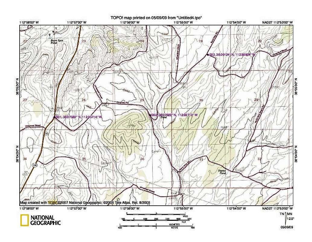
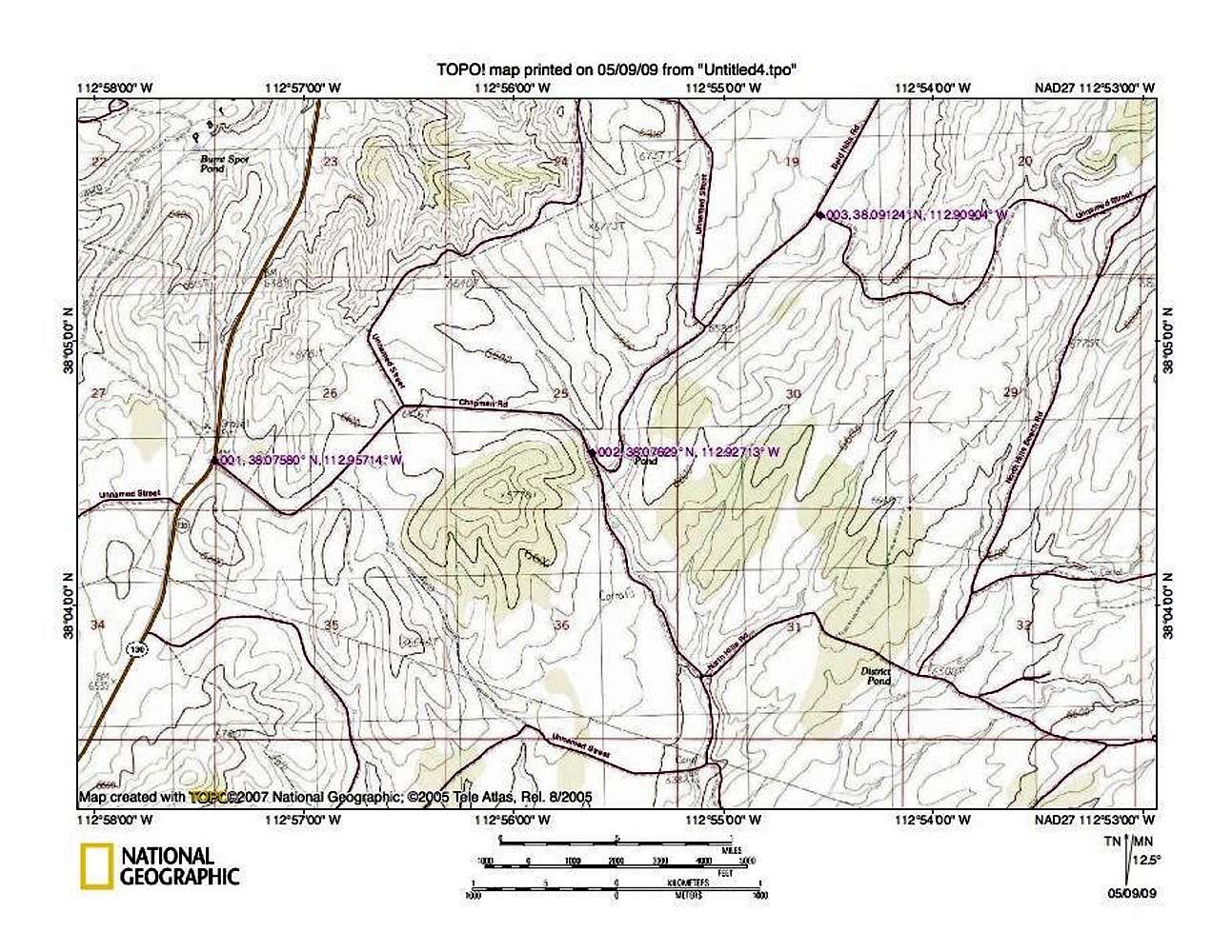
Poorman map one
View High-Resolution Image
Poorman map one
Highway 130 goes north to Minersville and south to Cedar City to hook into I-15. Take the dirt road at waypoint 001 and follow it to each waypoint. 001 38.0758 -112.95714 002 38.07629 -112.92713 003 38.09124 -112.90904 lat/long nad 27
« PREV
NEXT »
Dean
on
May 9, 2009 9:13 am
Comments & voting
Other parents
Image ID:
512488
1838 Hits
75.81
% Score
6
Votes
Log in to vote
Comments
No comments posted yet.
to post!
Don't have an account?
Photo of the Hour
(Album)
« PREV
Viewing
#16902 of 35941
GALLERY
NEXT »
Dean's Image Gallery
« PREV
Viewing
#3975 of 7927
GALLERY
NEXT »
Poorman BM (UT)
(Mountain/Rock)
Loading....
×
You need to login in order to vote!
User Name
Password
Remember me
Forgot your password?
Log me out when I close my browser.
Keep me logged in all the time.
sign in as a user
Don't have an account?
Register now for FREE
Rating available
Suggested routes for you
People who climb the same things as you
Comments Available
Create Albums
Register Here


