
|
|
Route |
|---|---|
|
|
45.83799°N / 10.79822°E |
|
|
Hiking, Scrambling |
|
|
Spring, Summer, Fall |
|
|
Most of a day |
|
|
EE |
|
|
Overview
Pregasina Ridges loop
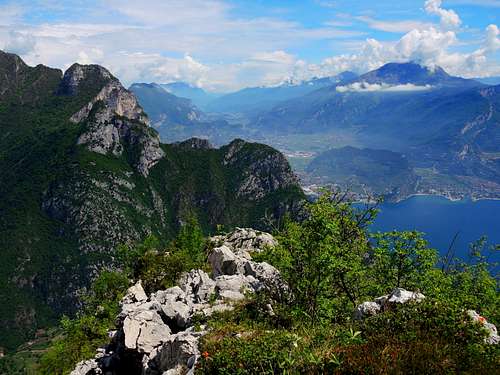
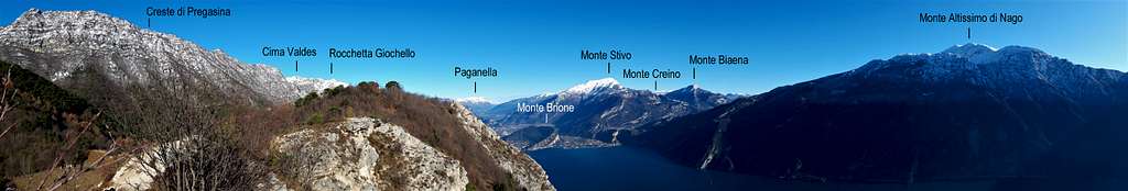
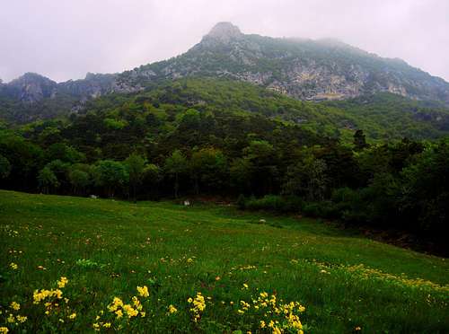
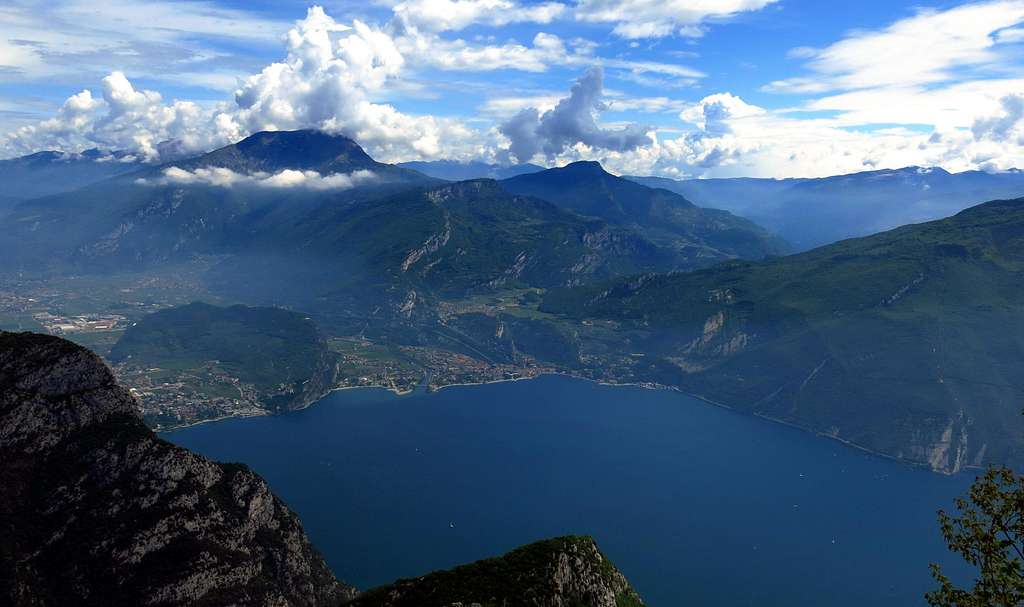
Along the Western shore of Lago di Garda it's located a series of rocky peaks dominating the water mirror and offering great views over the lake and the surrounding mountains. All these peaks are connected by a charming route along old mule tracks and trails built during the First World War, a loop route departing from the small village of Pregasina and rising to keep a succession of ridges, reaching the summit of three lined up peaks, Cima Al Bal, Cima Nara and Monte Guil, then returning to Pregasina along an alternative route. It's a beautiful trail for rather experienced hikers - in fact along the high ridges there are some easy climbing moves - in a secluded and wild environment, where you can also walk in late fall, when still it has not fallen the snow on the peaks along the ridge.
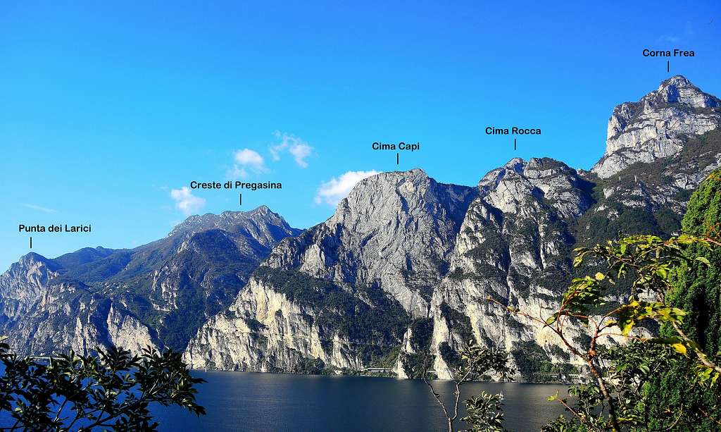
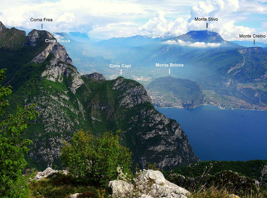
The backbone connecting Bocca di Lè with Passo Guil shows some sections a bit exposed, inadvisable in presence of snow or ice. During the WWI the whole area has been affected by the conflict, there are especially numerous works and fortifications along the ridge. The trail runs through the Italian lines, which faced the nearby Cima Capi, where there were located the Austro Hungarian troups.
Getting There
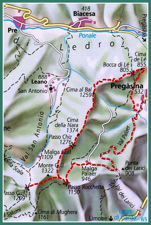
Access: from the Brennero autoroute exit Rovereto Sud and take the road to Arco and Riva del Garda, through the villages of Loppio and Nago. Once getting to the entrance of Riva del Garda, turn to right taking the road to Val di Ledro, which is reached through two long tunnels. Immediately after the second one, you find on the left the narrow but paved road leading to the small village of Pregasina 535 m. Leave the car in the small parking lot below the church.
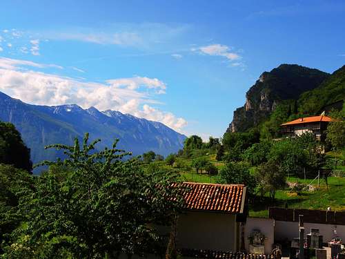
Pregasina |
Rocchetta Giochello and Cima Rocca |
Getting to Cima al Bal |
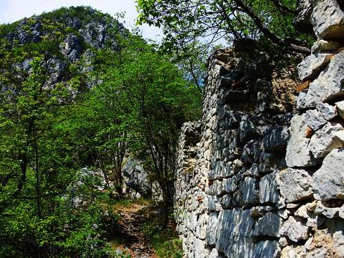
Remains of WWI military citadel |
Monte Baldo seen from Cima Al Bal |
Lago di Ledro from Cima Al Bal |
Route Description
Pregasina Ridges round trail
Summit quote: 1376 (Cima Nara)
Difficulty: EE
Difference in level: 850 m from Pregasina, longer develope
Exposition: North, East
Time required: 6-7 hours round trip
Starting point: Pregasina m 535
Route description
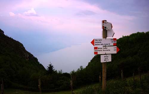
From the church of St. George in Pregasina we take the forest road towards Malga Palaer, paths n. 422 and 422B, getting soon to the crossroad where the two paths diverge. At this junction we turn to right, walking briefly on a concrete ramp, getting quickly to another crossroad, where we always must keep the right, following the path n. 429. At the third crossroad (signpost "Scala Santa, Cima Nodice") we take the detour from the path 429 - if we wish to climb also Cima Nodice - that leads us to the "Scala Santa", it will pass through a crack in the rock, then on a staircase carved into the rock, climbing up to Cima Nodice with its observatory. We continue on a ledge connecting to the path that descends on the West side, getting to the small cemetery of Alpini. Go ahead and follow the signposts to Bocca di Lé 806 m. Alternatively at the third crossroad it's possible to omit the detour to Cima Nodice and follow directly the signposts to Bocca di Lè.
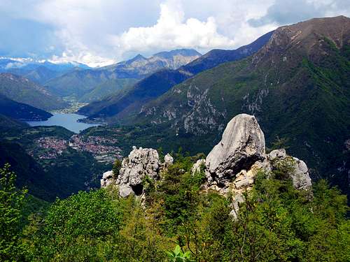
Here the route follows the path 430 in the direction of Cima Nara, we continue along the trenches, then along a steep path we reach a sharp left turn and climb a stretch along the side of the mountain, then along the NE ridge, where we find some step of easy rock, up to a plateau with a clearing. Here there's the intersection of the path 430 and 430 EE variant (a scramble up some easy rocks). We take the variant which after a short scramble up some easy rocks quickly leads us on the main ridge and near an Italian military village joins the main 430 path. Now the main path leads us towards Cima al Bal 1270 m, starting to follow the summit ridge.
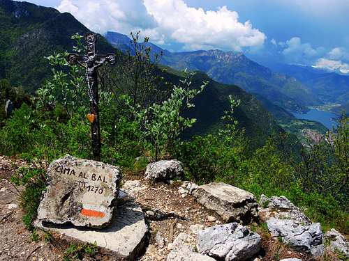
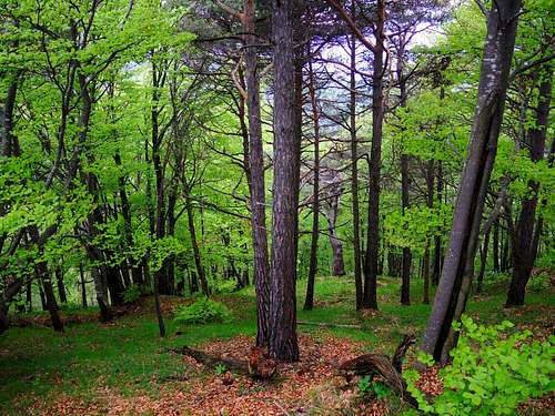
From Cima Bal small summit cross the trail always follows the ridge along one of the most spectacular stretches of the route, with several ups and downs. In front of us we can already see the next peak, Cima Nara, the highest point of the crossing. The path 430 bypasses the peak on the Eastern side (towards the Garda Lake), but we will not let miss the highest peak and getting to a small crossroads marked by a wooden stake we turn sharply to the right, leaving the main trail 430 and climbing through some easy rocks we reach the summit of Cima Nara 1376 m also called Col Coi, marked by a small signpost. From the summit with some up and down the route joins the path 430 which descends decisively passing on the West side and crossing a beautiful forest, getting to the marked saddle of Passo Chiz.
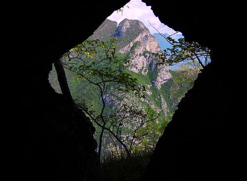
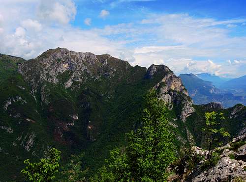
Cima Rocca seen through a WWI cave |
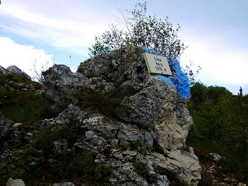
Cima Nara signpost |
Wood between Cima Nara and Monte Guil |
Soft light over Prati di Guil |
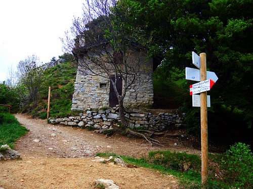
Old shelter on Passo Rocchetta |
Pregasina ridges seen from Malga Palaer |
The last climb leads to the summit of Monte Guil (no indication), the last summit. A brief descent gets the beautiful meadow saddle of Prati di Guil. With a sharp left turn, the route takes the path 422 towards Passo Rocchetta, traversing under the Western slopes of Mounte Guil (Garda Lake side), getting the fascinating and characteristic large saddle of Passo Rocchetta. From Passo Rocchetta we can chose amongst three paths, all running to Pregasina: the path 130 Creste di Reamol to the right, a path that goes down right away in the middle and another path on the left. We follow the middle trail, running down inside the forest to reach the wonderful glade of Malga Palaer. From the shelter we proceed along the forest road to the right, following the signs to Bocca Larici. Once reaching Bocca Larici 881 m we continue westwards (to the right) towards the promontory of Punta Larici and, after passing through the settlement of Malga Larici, we reach the summit of Punta Larici, excellent panoramic point over the entire Garda Lake. From Punta Larici we take the crests trail, in the first section traversing with breathtaking view over the lake, then, after a steep descent, joining the forest road. Following this latter rightward we come back to Pregasina.
Bocca Larici
Essential Gear
Normal equipment for trekking: hiking boots, backpack, sunglasses, gloves, cap, supplies, spare clothing.
Red Tape
No permits, no fees required
When to Climb
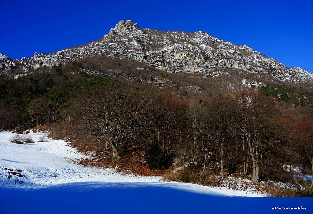
All year round, in fact also the winter can be a good period, but exclusively in the absence of snow and ice. On the contrary summer months may be sometimes too hot.
Accomodation
Several possibilities of accomodation in Riva del Garda and Val di Ledro
Bibliography
Maps:
KOMPASS sheeet 071 – Alpi di Ledro Valli Giudicarie 1:50.000
LAGIRALPINA sheet 016 - Alpi di Ledro - Tremalzo 1:25.000